A short spur trail heads over to a beautiful spot on Clear Pond. A fire ring, row boats and easy water access make this a must see spot.
After checking out the clearing on the pond, I headed back to the trail junction, where a left hand turn brought me back onto the yellow trail towards John Pond. This part of the trail heads south, closely following the west shore of Clear Pond, where occasional openings provide nice water views.
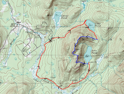
As the trail nears the south end of the pond it turns away from the water and climbs into a hardwood forest. About 2/10 of a mile after leaving the shoreline, I headed off trail into the woods, ascending an open forest. A steady 300 foot climb got me up onto the north end of John Pond Ridge, where a large expanse of open rock provided great views towards John Pond and Bullhead Mountain beyond.
SW views towards Chimney Mountain.
The ridge is actually broken into three separate summits, spread out over 3/4 of a mile. The bushwhacking is very pleasant up high through grassy clearings and open hardwoods. This hike was all about the views and not elevation, as the high point on the ridge is just over 2300 feet.
From the middle summit, I tried to get a glimpse north to the high peaks, but storm clouds were quickly moving in up there.
On my way to the third and southern most summit, the dark clouds were really moving in, threatening overhead.
The southern most summit provides a really good view of John Pond and its odd, off-green like color.
Bullhead Mountain, one of the Adirondack hundred highest peaks, looms impressively to the south. Storm clouds behind it kept me from lingering long.
The southern end of the ridge is filled with much more spruce, but a carpet of white moss makes for a nice walk.
I dropped off the southern end of the ridge, heading east towards John Pond. Once off the cliffs, it was a very easy hike down through more hardwoods. The dark clouds above really took away from the pictures of the pond.
Nearing the lean to, I found an open area with good views of the pond.
The southern ridge above John Pond is easily visible from a spot near the lean to.
Arriving back at the trail, I quickly stumbled upon the lean to.
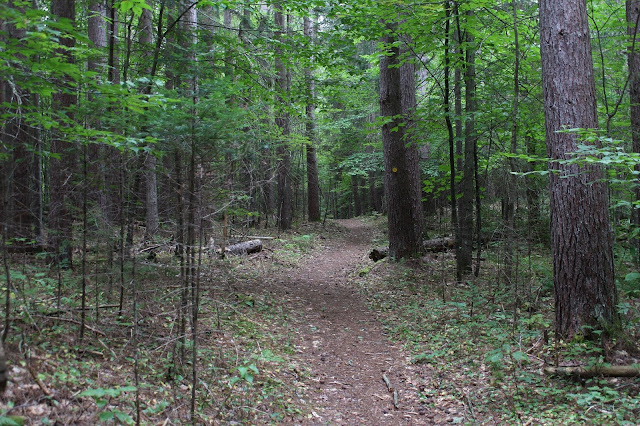
Fearing that the skies would open up any minute and knowing I had over 2.6 miles left to hike, I fervently made my way on the yellow marked trail, which was actually an old road.
A short side trail, blazed in red, breaks off from the main trail momentarily leading to a sad 19th century grave site.
Back on the main yellow marked trail, the hike is fairly benign, with the exception of a small foot path down to a large wetland. This is part of John's Pond Brook and provides glimpses of the surrounding mountains from the extensive wetlands.
After an uneventful 2.4 miles, I arrived at the John Pond trailhead, where a short road walk brought me back to Wilderness Lane. From there it was another short road walk to the car to complete the half day loop. Hiked about 5.5 miles RT, with a little over 1000 feet of ascent for the day.
Red=Trail Blue=Bushwhack


No comments:
Post a Comment