I headed north-northwest towards the edge of state land, where Halsey Brook flows down out of the mountains.
The woods quickly transition back to deciduous trees, with a sea of fallen leaves on the ground. I stayed on the east side of Halsey Brook, continuing north near the state land boundary, where I actually saw a red blazed trail on the private property side.
Elevation gain is slow at first, but near the south end of the ridge at about 2900 feet it becomes quite steep. With the leaves off the trees, Black Dome's ridge can clearly be made out to the northeast.
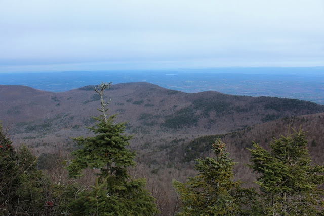
The ridge thins out as it gains elevation, passing through several large plateau like areas on the way. At about 3400 feet I came to this screened view of the valley to the south, at the headwaters of a drainage.
From between 3500 feet and 3700 feet, there are a series of small clearings, each with decent(and some very good) views. The first set of sandstone ledges is also the most impressive from below.
Poked around the clearings and view points, which face both south/ southeast and south/ southwest. Here is a view due south towards the Devils Path peaks with Onteora Mountain just in front of them.
To the west along Thomas Cole's ridge one can easily pick out The Caudel and Camels Hump.
SW views down over the East Kill valley of Route 23C in Jewett, with the East Jewett Range rising above.
A lone spruce tree atop Camel's Hump.
Black Dome's southern ridge, with Dutcher Notch, Stoppel Point(and West Stoppel Point) just beyond. Lake capra and Colgate Lake clearly visible as well.
Perched atop a wide open east facing ledge is this impressive view of neighboring Black Dome Mountain(with Blackhead poking out beyond).
Sprawling SE views down towards Lake Capra and Colgate Lake from my lunch spot.
Much of this section of the ridge took on the appearance of this low brush meadow.
West views from a small clearing.
Mountain Ash Berries.
At about 3700 feet, the open meadows quickly ended and transitioned back to a dark, hemlock forest. The hemlock's do a great job of locking up the cool air, and wintry conditions were witnessed for the first time all day.
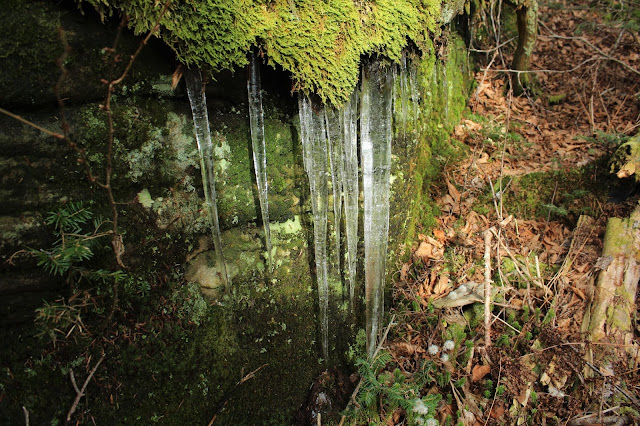
Just below the summit, one more steep push found me passing by a large area of icicles. Yet another indication that winter is well on its way to these mountains.
Once atop the summit ridge, I hit the red blazed DEC trail, but quickly left it in search of a true high point. I had a hard time finding one particular spot as my GPS and my eyes both disagreed. I settled on this nondescript spot as the true 3940 foot summit.
After hitting the high point I hopped back onto the trail and followed it off Thomas Cole, heading east over to Black Dome.
Passed over the wooded summit(which I've been to a couple of times previously)and continued on down to the east view point towards Blackhead.
I almost forgot how good these views are from these ledges. Breathtaking views NE over the escarpment wall towards the Hudson Valley.
I continued beyond the views, dropping down the trail to Lockwood Gap, the saddle between Black Dome and Blackhead. From there, I left the trail and bushwhacked south back down towards Colgate Lake. The slopes were steep but no ledges or difficult spots to descend. Down around 2800 feet, I came to the washed out slopes from one of the mountain;s drainages, with Blackhead's ridge towering above.
Continuing south, I came to another washed out slope from the drainage. Mother nature can be quite impressive.
Eventually picked up a good woods road, that headed south right towards Colgate Lake. I stayed on it for a while, before finally heading more SW to the car.
Just prior to arriving back at my car, I came to a pretty tributary stream, flowing swiftly down through a beautiful hemlock forest. Splashed some of the cool water in my face and then headed out to the car.
A fun bushwhack/ trailed hike, with over 2300 feet of ascent and 8 miles RT.
Today's route. Red=Ascent Blue=Descent


Fabulous hike - I'm putting it on my list.
ReplyDeleteGlad to hear! Think you'll enjoy it...in my opinion, sometimes the unconventional route is the best way to go
DeleteOh, in the Fall of 2020, i wacked Black Dome from Colgate Lake, took the trail out to Thomas Cole and then to Blackhead, where i descended the ridge back to Colgage. It was a fantastic hike. The only significant ledge was at 3800' descending Blackhead, but a narrow chute allowed for a safe passage.
DeleteHow long did this hike take, how many hours. Its on my bucket list to hike to the Black Dome.
ReplyDeleteAre you referencing this specific hike or just a route to Black Dome? The trailed hike to Black Dome is very popular and you can find many trip reports/ travel time online. This route was a tough bushwhack hike up(no trail). Don't remember the exact time but probably 5 hours round trip
DeleteThis comment has been removed by the author.
ReplyDeleteBy the way, melamime is one of the chemicals found to be the cause of the March 2007 pet food recall. And there is one more concern with grains - aflatoxin. hiring a professional dog walker
ReplyDeleteWill a subsidy make it affordable or not affordable is really subject to debate at this point in time. We're going to have to actually see what the rates look like for these plans. goitrogens in foods
ReplyDeleteThey're produced by the very best degree developers who will be distinguished for your polo dress creating. You'll find polo Ron Lauren inside exclusive array which include particular classes for men, women. wood fire pit
ReplyDelete