Search This Blog

Tuesday, April 28, 2020

Little Cathead Mountain(Silver Lake Wilderness-Adirondacks)

Finally had a nice weather day matched up with a day off so decided to head north to bushwhack Little Cathead Mountain, a small peak in the Silver Lake Wilderness with reputed good views.  I parked at the trailhead for the Northville Placid Trail on Benson Road(Hamilton County Route 125)and crossed the road heading north on the red blazed Woods Lake Trail.  Elevation to start was 1360 feet and there were no other people there when I arrived.  A mere 3/10 of a mile into the hike I arrived at the quiet shoreline of Woods Lake, with a perfect view north at Little Cathead Mountain, my intended target peak.
I quickly left the trail, following the edge of the water on rough herd paths and several campsites.  From the SE edge of the lake, looking NW across the beautiful blue water towards Three Ponds Mountain and Wallace Mountain.
Once across the wetter than usual inlet area I began a straightforward bushwhack up the steep, snow covered slopes.  At first there wasn't much more than a dusting but, as I gained elevation...
..the snow got a bit deeper..and the slopes got a bit steeper.  Couple that with rising temps up towards 50 degrees and I was making slow progress ascending through melting snow.
In the SW corner of the steep slopes below the summit is a wide open ledge with spectacular views.  Woods Lake can be seen spreading out in the foreground with the peaks of the Shaker Mountian Wild Forest filling the horizon.
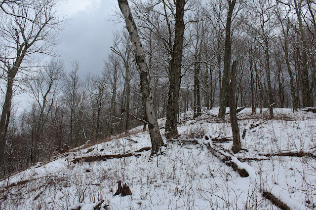
Arriving at the mostly wooded 2090 foot summit of Little Cathead Mountain, where there were still about 5 or 6 inches of quickly melting snow on the ground.
2235 foot "Middle"Cathead and 2431 foot Cathead Mountain rise impressively from this vantage point to the east.
A zoom view towards Cathead Mountain's fire tower, which remains private and off limits.
An open view to the SE towards what I think might be a corner of Woodward Lake.
 
Wandering just below the summit area, I made my way over to a wide open rock slab. 
SE views from the open rock, with the many peaks surrounding Mud Lake covered in white.
A nice and easy descent brought me down the rapidly melting snow covered slopes.  Once back down below 1500 feet, most of the snow was gone and the drainages were running fast and hard.
A perfect little (mostly)off trail adventure in a quiet corner of the Adirondacks.  3.6 miles RT with 900 feet of total ascent on an absolutely beautiful spring day.   Red=Ascent   Blue=Descent

Saturday, April 25, 2020

Chestnut Woods State Forest(White Creek, Washington County)

Decided to pay a visit to the 802 acre Chestnut Woods State Forest, located along the New York State/ Vermont border in rural Washington County.  I had heard of this place but couldn't find too much information on it, so figured I'd give it a look.  There are no marked trails in the forest and it is well off the beaten path...a perfect recipe for solitude.  I parked in the small pull off(beneath a state forest sign) on Chestnut Hill Road, elevation 875 feet.  Just beyond a metal gate, I picked up a very good woods road heading east.
Passing beneath a gorgeous pine plantation.  From here an informal path bypasses some blowdown before rejoining the woods road.
 Near the border of private property, a pretty stream drains down along the woods road, compete with many tiny cascades.
 The woods road continues onto private property, so I began to bushwhack straight up towards the ridge.  The slopes were fairly steep but very open and easy to negotiate.  The screened views were good, but the bugs were worse!  Ugh!!  Finally a nice day and the bugs were out in full force.  This is a look directly west at the ridge across Chestnut Hill Road.
Temps in the 60's and full sun brought out the spring beauties .
A final steep push up towards the ridge, provided more filtered views of rolling farmland of White Creek and North Hoosic stretching to the south.
The first high point on the ridge, elevation 1640 feet was very open and pretty, with a carpet of green underfoot.
 The state land heads north from the first summit bump, but does not stay on the ridge, instead dropping down to the steep east slopes just below the ridge.  This was a bit frustrating but just as the state land began to open back up onto the ridge, a steep climb up brought me to this great view east over Shaftsbury Hollow.  West Mountain and its multiple summits make up the ridge just beyond. 
A zoom view towards Shaftsbury Hollow.  This spot was literally right at the corner of state land and private land, and is clearly man made.
Continuing north up towards the next summit bump, elevation 1790 feet.  The small grouping of rocks, barley noticeable in the photo, was indeed a feeble attempt at a rock cairn.
High up on the ridge, well above 1800 feet, a found a sturdy old stone wall.  It always amazes me how past generations truly utilized all the land around them.
The woods were remarkably wide open and nearly 100 percent hardwoods. 
After hitting the furthest bump north on state land(elevation 1950 feet), I began my descent  with more screened views all around.  Instead of bushwhacking back over all of the summit bumps on the ridge, I decided to descend west back towards the north parking area on a rough 4 wheel drive road.
Once back down low, an easy mile and a half road walk got me back to the car in no time.  Hiked about 6 miles total for the day with 1600 feet of ascent.

Monday, April 20, 2020

White Lily Pond(Grafton Lakes State Park, Rensselaer County)

Did a short late afternoon hike with Kalli today in a quiet little corner of Grafton Lakes State Park.  Parked in the unmarked parking area off Babcock Lake Road and followed a wide old cart path downhill less than 2/10 of a mile to the shores of White Lily Pond.  There is an open, grassy area complete with a fire pit that provides easy access to the water.  I decided to circle the fringe of the pond to get different views.
 Looking south across White Lily Pond near the border with private property.
From the pond we picked up the purple White Lily trail, which meanders north passing by stone walls, vestiges of the past farming community on the plateau. 
The White Lily Trail comes to a junction with the red blazed Conklin Pass Trail, which we followed south back to the car.  Although the sun was shining bright, there was a cool nip in the air, with temps holding in the upper 40's at this elevation.
Less than 2 miles of peaceful woods wandering on a pleasant spring day.

Saturday, April 18, 2020

Berlin State Forest-Mattison Hollow(Rensselaer County, NY-Taconics)

After visiting Cowdry Hollow in the northern part of the 678 acre Berlin State Forest earlier this week, I decided to check out the southern section of the State Forest in Mattison Hollow, just west of the Massachusetts state line.  To start my bushwhack, I parked at the very end of Mattison Hollow Road on the shoulder of the road in a small area of state land beside a pretty brook.  Elevation to start the hike was just a touch over 1300 feet and there was a chill in the air, with temperatures hovering in the upper 30's. 
An easy rock hop across the brook brought me up into a wide open hardwood forest, heading north.  Through the trees to the south, the southern ridge above Mattison Hollow could be seen, in a coating of white.
The woods were remarkably wide open, as I made an easy ascent up through hardwoods.  As I climbed up over 1700 feet, a solid coating of snow covered the ground.
Once I hit the ridge above 1800 feet, the ascent eased up and it was pleasant hiking through about an inch of snow.
While I enjoyed some filtered views to the north and west, the view south back down over Mattison Hollow was even better, although still just a tease.
South view towards some of the multiple east ridges that come off Misery Mountain.
As I continued east, gradually gaining elevation on the ridge, I made my way towards both sides of the ridge.  The slopes looked steep and open on the north side, so I decided to check it out.  This proved to be a good move, as I found my first unimpeded view through a small window of downed trees.
NW view over Browns Hollow and the Rensselaer Plateau west of Route 22 in Berlin.
The north side of the ridge was almost park like, through an open meadow, covered in snow.
As I continued my ascent, the snow got a bit deeper, clinging to all the trees as well.  I hugged the steeps on both sides in hope of a good view, with about 3 inches of snow underfoot.
North view through a small window towards Berlin Mountain and its ridges.
Suddenly, almost out of nowhere, the sun emerged and the woods lit up.
A framed view north towards Misery Mountain's long ridge and multiple summits.
Clearing skies and 3 to 4 inches of snow gave the appearance of mid February instead of mid April.
A large, open meadow sits just off the top of a 2250 foot high point on the ridge.
Hugging the north/ NW facing slopes I managed to find a few breaks in the trees, where seasons seem to clash.  Green in the valley and snow up high.
Skies only continued to clear as I continued along, with many views such as this, facing north.
While I didn't find any wide open, 180 degree views, I found many decent views like this.
NW views up SE Hollow and Comstock Hollow. 
Easy bushwhacking along the ridge heading east to the next high point.  This is one of the multiple west ridges that come off Misery Mountain.
Filtered valley views down into Southeast Hollow in Berlin.  Houses along SE Hollow Road can clearly be made out from here, over 1000 feet below.
The view north towards the Taconic Ridge near the 2360 foot highest point on the ridge walk.
After hitting the nondescript high spot, I headed directly south down off the ridge, losing elevation quickly.  Back down at the bottom I found a good woods road, that headed west through a dark hemlock forest.
Crossing over beautiful Kronk Brook on my way back to the car.
Picked up an old extension of Mattison Hollow Road west, which follows a thin sliver of state land near Kronk Brook back to the car.  A total of 5.5 miles RT, with 1700 feet of ascent.