The trail quickly comes to the shore of pretty Iron Mine Pond, circling around the west and north end. Informal paths lead around the pond to provide easier access.
Once beyond the pond, the trail begins to climb an old woods road, which is wide and very easy to follow.
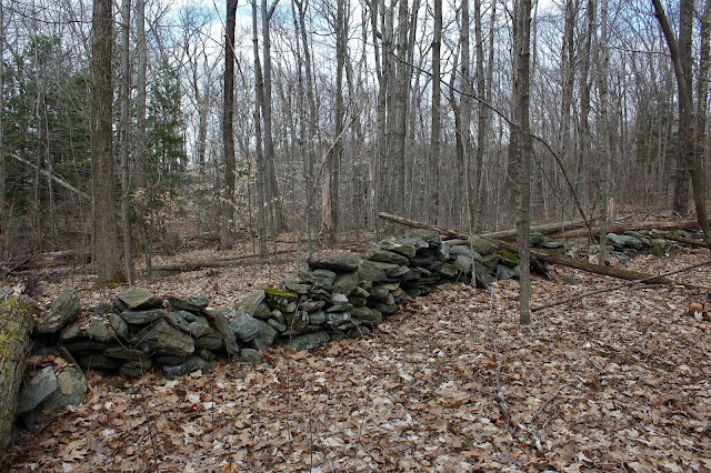
I spotted a myriad of old stone walls scattered throughout these woods. Some appear to be in much better shape than others.
High above Rudd Pond, I opted to leave the trail to bushhwack up to an open ridge. The woods are very open and easy to negotiate.
The open ridge NE above Rudd Pond provides some pretty nice long distant views. This is a shot SW over Rudd Pond(barely visible through the trees) and into rural Dutchess County.
A short bushwhack brought me back to the trail and to the next viewpoint, an overlook NW over the Harlem Valley of Columbia County.
From nearly the same vantage point(just a few yards away) there is a nice view east towards the Riga Plateau(Thorpe Mountain).
The trail descends from the view point, dropping slightly to the east towards the state line, circling above a cirque. Through the woods, about 20 yards off trail, I spotted an old hunting cabin, looking pretty rough these days.
After heading east for a short bit, the trail turns back north, staying on the west side of the state line and the steep slopes of Thorpe Mountain. The trail crosses over several drainages, but one in particular offers up a spectacular waterfall view just above the trail at a rock hop crossing. The falls are about 12 feet high and very picturesque.
A short distance beyond the falls, the trail drops down to a dirt road crossing(Kaye Road Detour) before re-climbing to another area of open views. From here, the views up the Route 22 corridor to the north stretch for many miles.
The open rock offers up several good view points here, including this view west towards Round Ball Mountain and Fox Hill as well as a large wetland of Webatuck Creek.
The Catskill Mountains can be seen rising impressively to the west, forming an amazing horizon.
The trail meanders its way, heading generally north through mostly open hardwoods. At one point, I was alarmed to stumble upon a large vernal pond deep in the woods.
A bit further along, a stream crossing, easily rock hopped.
Nearing the far north end of my day's hike, on the ridge just south of South Brace Mountain, the very best views of the day can be found. I found these views just off trail from an area of steep, open west facing slopes. Rural Columbia County and the long ridge of Fox Hill, with the Catskills beyond form a gorgeous view.
From the same off trail spot, a spectacular SW view.
Back on the trail, just a short distance further, the views are amazing. The woods seemingly drop off around you, leaving an open area of grasses and low bushes with endless views.
North facing views with the slopes of Brace and South Brace Mountain to the right. The trailhead for Brace Mountain along Quarry Hill Road is nearly directly below here, near the red house.
The views of South Brace Mountain are nothing short of spectacular from here, standing nearly 400 feet above and less than a mile away. I continued on to the last open views before the trail begins a steady descent. Nearly 6 miles in, I decided that this would be my turn around point.
A quiet, peaceful 5.6 mile return hike to the south brought me back to the car. As I neared the car, clouds and a light drizzle began to break out. Great timing and a great hike. Nearly 11.5 miles total(including bushwhack) with over 3000 feet of total ascent. A fun day for sure and only took about 5 hours, including stops. The amazing scenery certainly makes up for the ups and downs and many miles. Stay safe everyone. Only saw one other hiker all day and never came close to them.


Hello Walking Man, I was interested to read your comment that Slide Mt. despite being the highest Catskill peak, cannot be seen from the surrounding area because it is nestled in among other high peaks. I thought you would be interested to know that we can see Slide from a viewpoint in our backyard at the northern edge of the Town of Rosendale. The coordinates are approx. 41°53'59''N 74°03'04''W looking northwest. We are located just where the Shawangunk Ridge dies into Kingston, NY.
ReplyDeleteVery cool! Thanks for the info. Slide has always fascinated me in that it being the tallest it doesn't always necessarily jump out at you from other places. Kudos to you for having such a good view from your own backyard!
Delete