A few years ago NY state acquired thousands of acres of former Cowee woodland covering a large swath of the Rensselaer Plateau, as well as land in Washington County and Vermont. Sitting in one of the southern sections of that acquisition in the town of Stephentown is Turner Mountain and parts of its five plus summits. I had previously hiked the named summit and its two sub summits but wanted to hike to the other peaks as well. One of the issues with exploring here is a lack of formal access, but I was able to find some areas where it was possible.
I have attached a map with the five summits, simply labeled 1-5 for simplicity.Having previously hit Peaks #1 and 5, my goal today was to hit the three middle peaks(2-4). For ease of access, I decided to start this hike from the Rensselaer Plateau Alliance's Chensut Hill Preserve off of Brainard Road(Elevation 1370 feet). To get to the new state land I headed east on the Preserve's trails until I picked up the discontinued section of Brainard Road, which is rough and rutted but easy for foot travel.
More filtered views towards Taplin Pond to the south.
From Peak #2, it was an easy bushwhack NE towards summit #3, where I picked up logging roads that meander their way throughout these woods. This is logging road that crosses over a drainage between Peak's Two and Three.
Near the south nose of Peak #3, not far below the summit ridge, I found the best view of the day. This is the view south into the rolling hills of Columbia County.
From the same clearing, a view back west to Peak #2, the summit I had just been on.
Bushhwacking up with spring blossoms and Peak #2 behind me.
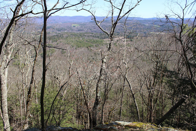
I closely hugged the very steep east slopes below the summit area, finding some decent views out over eastern Rensselaer County and towards the Taconics.
SE views from the steep slopes.
The open, nondescript 1605 foot summit of Peak #3.
Continuing north towards Peak #3, there is a sharp drop off to the east down into the Roaring Brook Valley. I carefully weaved my way above the steep terrain, finding filtered views throughout much of the way. This is one of the decent views I found east towards Peak #5.
Peak #4 sits over a mile north from Peak #3 and unfortunately comes very close to private land along Tinley Road. I was careful to stay on public land, hitting the 1677 foot high spot, which sits in a pole stand clearing.
From there, the main goal for my hike back to the car was to try to remain on public land, which I believe I was able to do. Covered about 5.4 miles RT and nearly 800 feet of ascent.


No comments:
Post a Comment