Hadn't hiked up in Vermont in a little while, so headed out that way to bag a couple of peaks. First went over to Wilmington and the Molly Park State Park to hike Mount Olga. It is a relatively short hike at 2.0 miles RT(have to hike in from Route 9 in the winter) of steady climbing to a fire tower at the 2415 foot summit.
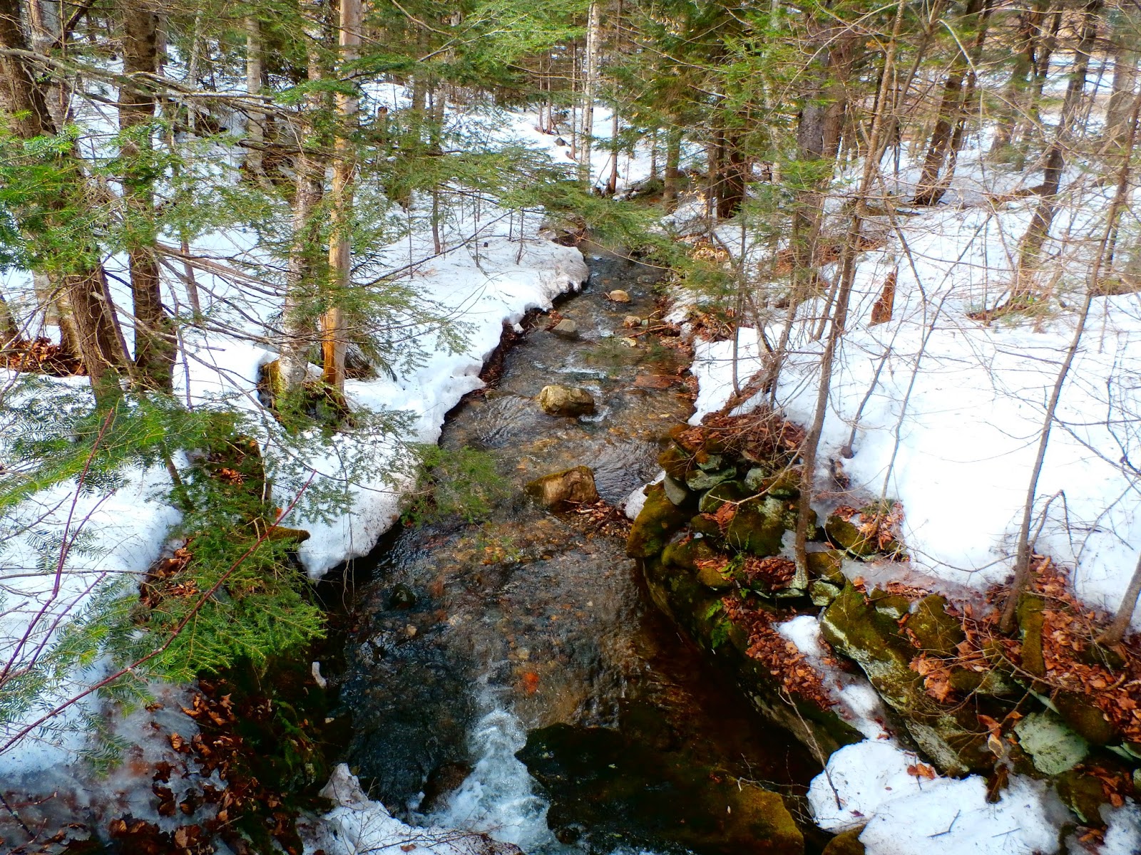
Along the access road to the park is a stream that is flowing pretty strong due to snow melt. It is actually a tributary of Beaver Brook.
The hike passes through mostly spruce forest with some deciduous trees. There is still about a foot of snow in the woods up here.
There is a sign pointing you in the right direction at an intersection about .1 mile from the fire tower.
Looking up at the fire tower. Without it there are no views to be had at the wooded summit.
Superb 360 degree views await you at the top of the fire tower. Here is an amazing view to the west towards Haystack Mountain and Mont Snow.
A view to the south offers sweeping views all the way down into Massachusetts.
Distant views are abundant beyond the tree tops.
A lone house nestled amongst the trees to the north.
A tremendous view to the northwest with Mt Snow's ski slopes to the left and Stratton Mountain's ski trails straight ahead.
Winds were brutal on the fire tower and made it pretty uncomfortable but the blue skies, puffy cumulus clouds and dramatic views made me want to linger anyway.
Looking out over the tops of the spruce trees.
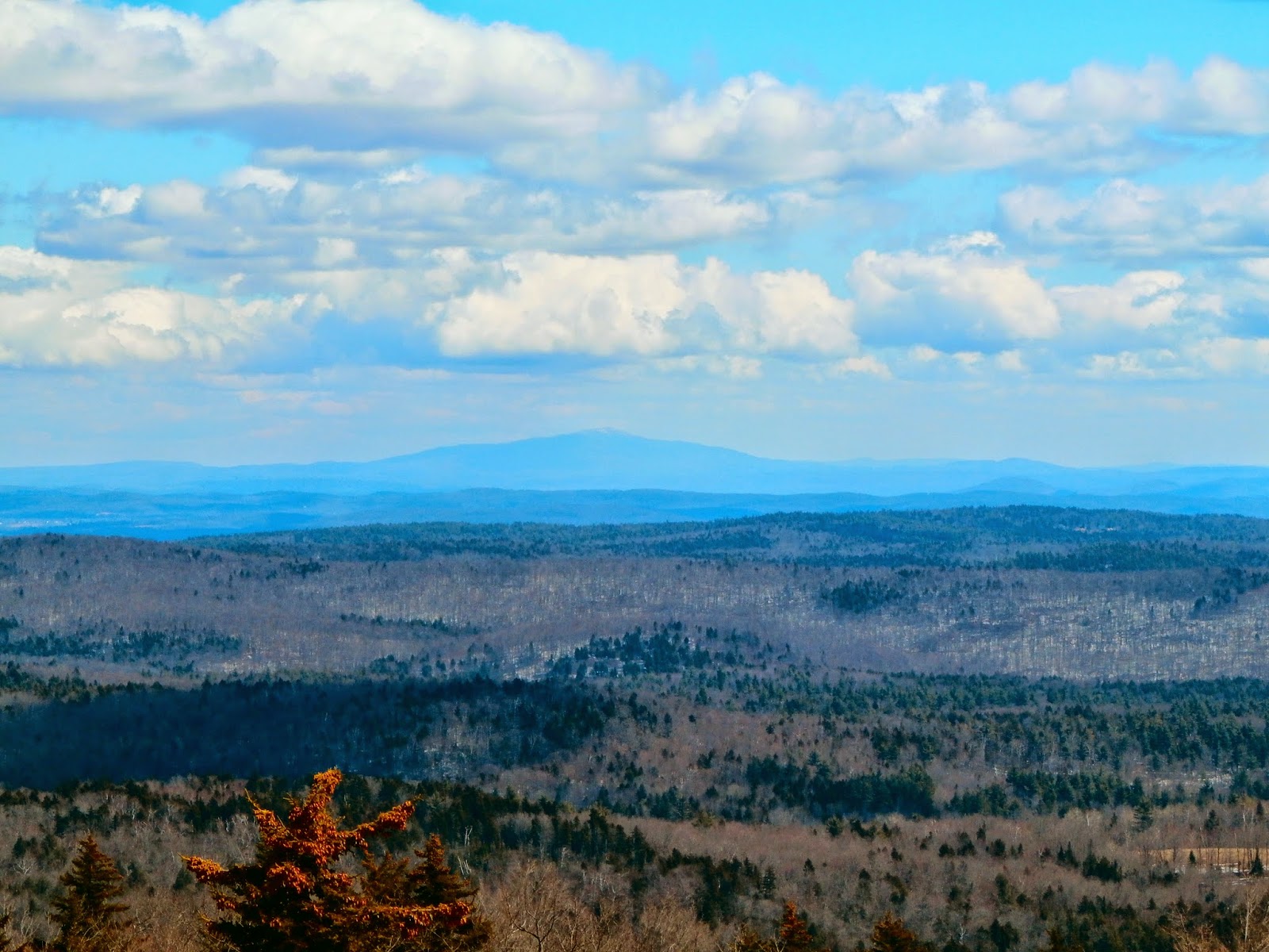
Mount Monadnock can be seen rising high above the surrounding peaks to the east in New Hampshire.
A view to the south and east towards southern Vermont and northern Massachusetts.
After finishing my hike of Mt Olga I headed back to Bennington to grab some lunch before driving over to the Appalachian Trail/ Long Trail parking area in Woodford. Just to the north of the parking area the trail crosses City Stream with a very well built foot bridge.
My hike was to the south along the AT/ LT to Harmon Hill. To access the trail you must cross the busy highway before climbing an extremely steep hillside.
Good footing is a must along this rocky cliff area. Especially with snow or ice on the trail as was the case today, which is exactly why I brought my micro spikes along.
This very steep section lasts for about .6 mile but seems longer due to the effort exerted to get up it.
Near the top of this climb are broken views back over the Hollow and towards nearby peaks to the northwest.
The trail levels out considerably after the initial climb with much of the elevation gain behind you. Unfortunately much of the trail was very wet as is usually the case in the early spring. Here a puncheon(wooden plank walkway) crosses a normal wet area.
Here is a puncheon that is partially under water. A giant leap got me over it.
Several streams were seen flowing swiftly down the hillside and across the trail. A couple of areas were completely washed out and even under nearly a foot of water. Had to go completely around these sections of trail to keep my feet (somewhat) dry.
After 1.7 miles, the trail comes to a large clearing. The National Forest workers keep this area cleared by regularly controlled burns.
Beautiful views to the west over the city of Bennington can be had from the 2325 foot summit.
Bennington with Mount Anthony rising prominently above.
A closer look at the city of Bennington with Mount Anthony's northern slope and distant Taconic Mountains beyond.
Looking back up towards the summit through the burn area.
This is a popular spot along the AT/ LT as well as a popular day hike. A fire pit can be found in the clearing and probably sees a lot of use during the summer.
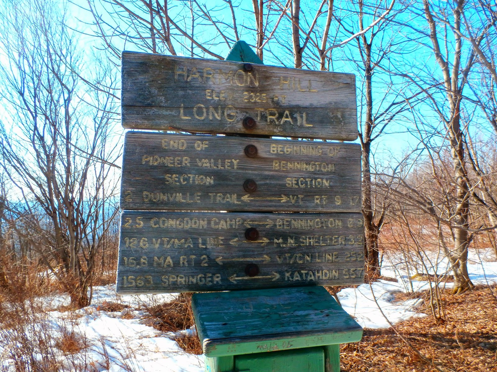
An AT/ LT trail sign with distances both north and south.
Heading back through the mushy snow towards the final steep descent.

Here is what the rock steps look like climbing the steep part of the trail. Much of the upper 2/3 of the hillside was covered in snow and ice making it even more difficult of a climb. The descent is especially hard on the knees and will make you work.
The trail is 3.4 miles RT, but the steep ascent and steep descent will make it feel like a much longer hike. Overall, I did 5.0 miles of hiking in Vermont and about 1.5 miles on my sunrise hike for a nice total of 6.5 miles for the day.


No comments:
Post a Comment