Immediately after passing the trail sign, a ladder drops you down to a stream crossing over Shepard Brook....which would normally not be an issue...
...but the wet spring meant we had to ford the creek. What better way to start an all day hike than by getting your feet wet right away?
Once across the creek, the Hedgehog Brook Trail ascends steadily to the west up through a hardwood forest.
Nearing the top of the Hedgehog Brook Trail, the trail steepens quite a bit..with help from a couple of ladders on the way up.
We turned right(north) and followed the Long Trail towards Burnt Rock's summit. The climb up from here was quite steep, but a lot of fun.
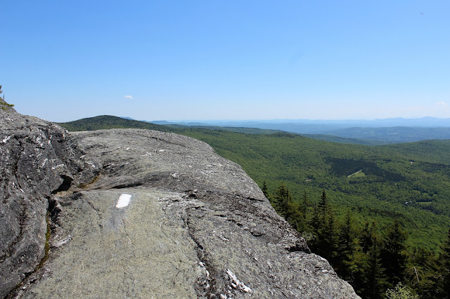
Emerging atop open rock ledges.
Did I mention that the trail gets steep near the summit? Looking back down at a steep push up towards Burnt Rock.
Many open rock ledges provide outstanding views.
From the 3168 foot summit of Burnt Rock Mountain, we found a terrific view north towards our next three peaks for the day. Mount Ira Allen's 3506 foot summit bump in the front, Ethan Allen's 3688 foot summit to its right, and Camel Hump's 4083 foot summit peeking out in the distance. Over 2000 feet elevation gain from the trailhead.
Continuing beyond Burnt Rock Mountain, we continued north soon dropping down to Ladder Ravine. This is a tricky spot where good footing is essential. There is about 8 feet of very slippery, wet rock on the way to the ladder, where a false step could drop you down about 12 feet.
The climb up and over both Mount Ira Allen(the trail doesn't cross the summit) and Mount Ethan Allen was pretty nondescript, passing through a fragrant balsalm forest near Mount Ethan Allen. Unfortunately, it was on this section of the hike that the black flies really seemed to pick up in intensity. Out came our head nets.
Mount Ethan Allen's north peak sign, where a man made clearing provides a view.
The view from Mount Ethan Allen.
The descent off Mount Ethan Allen was steady all the way down to about 2750 feet elevation. Soo enough, we arrived at the Montclair Glen Lodge. These Long Trail shelters are very nice, many with caretakers and fully enclosed.
As we climbed up a series of three steep, rocky "stairs" a great view of Mount Ethan Allen(which we had just hiked off of) opens up to the south.
From the open rock on the "stairs" there are some very, very nice views.
Onto the next "stair", looming directly above.
Some fun rock scrambling to ascend.
After reaching the third "stair", Camel Hump's summit bump can be clearly seen in front of you. It seems much further away than it should.
Although our GPS told us we were just shy of the summit, our elevation was still only a bit over 3200 feet. This meant that we had nearly 900 feet to climb up a rugged, rocky trail.
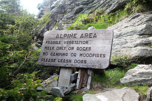
Emerging into an Alpine Area, just under the imposing summit bump of Camels Hump.
The last quarter mile of the hike is truly special. Be mindful to watch white paint blazes on the open rock.
A thru-hiker on the Long Trail just ahead of us.
Heading up the steep pitches nearing the summit.
Emerging at a large area of open rock and small trees. This was the final push to the summit.
The views from the summit are jaw dropping. 360 degree views will leave you breathless. Here is a great view west towards Lake Champlain and the Adirondacks of New York.
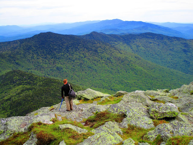
A look way down below into the valley, some 3000 feet below.
We arrived back at the car, quite exhausted, but also fulfilled. A great 13 mile, 4 peak hike. Elevation gain was nearly 4800 feet for the day. The only drawback was the amount of black flies, which really got annoying.


No comments:
Post a Comment