Grafton Lakes State Park is a rather large state park at over 2500 acres, but few people realize that there is a large southern section containing many miles of trails and the 98 acre Martin-Dunham Reservoir. I parked in the small parking lot along the south side of Route 2, across from the main entrance to the State Park, with the plan of hiking all of the southern trails in the park. To begin, the Gartler Trail leaves busy Route 2 and heads south through a wide open field.
At the bottom of the field, the trail becomes more defined, crossing a small drainage and following some sort of woods road up to a blueberry meadow.
The woods road is very obvious, but is also extremely muddy.
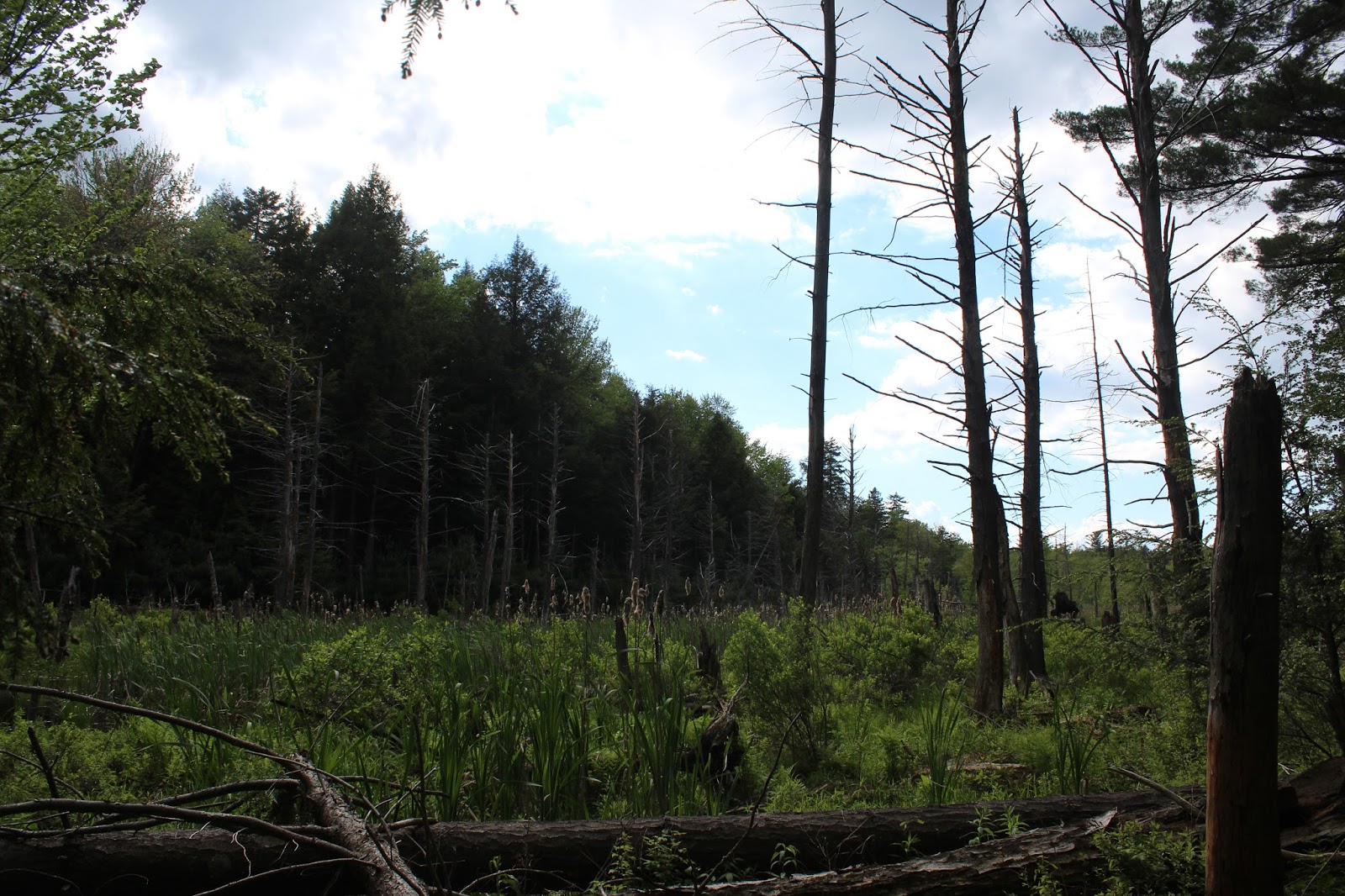
The trail soon enters a predominantly conifer forest, and suddenly the sounds of traffic and civilization seem to disappear all at once.
This trail also doubles as a snowmobile trail, and soon it passes over a bridge wide enough for a sled to cross, beside a large beaver swamp.
After about 1.3 miles, the Gartler Trail begins to drop out of the conifers and arrives at the quiet, calm section of the Quacken Kill. A couple of benches and fire pit would suggest that this is a popular place to relax and perhaps do some fishing.
Such a peaceful, calm area of the Quacken Kill.
The trail skirts the Quacken Kill and offers several different spots to throw in a fishing line.
Just beyond the Quacken Kill, and 1.5 miles from Route 2, the Gartler Trail ends at seasonal Johnson Road. This gravel road offers plenty of access to the Dunham Reservoir, which sits on the south side of the road.
I walked a very short distance west along Johnson Road until I came to a pull off area and trail sign for the Double Bit Path.
The Double Bit Path runs south for just over 1.6 miles along the west side of the Reservoir.
After meandering through the woods and in and out of the coves for about a mile, the trail comes to a small brook crossing. The recent wet weather meant that this normally easy stream crossing was quite difficult. Luckily, I found a snowmobile bridge just downstream a short distance.
The tricky stream crossing, which is usually easily crossed by rock hopping.
About a hundred yards past the stream crossing, I came to the Reservoir's spillway.
I climbed up to get a fine perspective of the rushing water dropping out of the Reservoir.
Just below the spillway, the water comes crashing down as the reformation of the Quacken Kill.
The water below the spillway was running extremely high and was quite dangerous to cross. I had to follow the creek downstream quite a way, before I could find a safe crossing. Once across the creek, I continued south in search of the trail. I couldn't find it, so I just continued on to Dunham Reservoir Road at the south end of the Reservoir. There are a few pull offs along the road, each with fine views and small picnic spots. Here's a view back at the earthen dam and pump house.
A fantastic view across the placid waters.
The South Dunham Trail can be quite tricky to find, as it located about .2 of a mile uphill on the road and is not well marked. I found a trail marker in the woods and was on my way north, high above the east side of the Reservoir. This trail also follows an old road, which was very muddy. Here's a spot where a stream drains down off the hillside, crossing right over the trail.
Typical stretch of the South Dunham Trail, which stays far up into the woods away from the water much of the way.
Eventually, the South Dunham Trail drops down to the east side of the water, where dark clouds had quickly rolled in.
A quick moving system moved in and out within 15 minutes, providing a much different Reservoir view than just an hour before. After about 1.85 miles, the trail comes to gravel Johnson Road at the north end of the Reservoir.
I walked along Johnson Road the short distance back to the Gartler Trail and retraced my steps back north towards the car.
As I continued along, the sun began to break out again. As nice as it was to have the sun out, the thick mud did nothing to help the mood.
Got back to the car under blue skies and the sounds of rushing traffic along Route 2. Hiked just shy of 7 miles Round Trip.


Dear Walking Man,
ReplyDeleteCan Grafton Lakes State Park use some of your photos for interpretative panels we are developing for the new Welcome Center? We are in the process of editing panels now and your Gartler field shot would be particularly useful! Please email elizabeth.wagner@parks.ny.gov and let me know. Thanks so much! Liz