We followed an old woods road up for a while, then swung around to follow a tributary of the Panther Kill up.
The climb up from the valley is quite steep in spots, but there was no snow or ice down low so footing was good.
Jim and John heading up to a series of rock ledges below the ridge line.
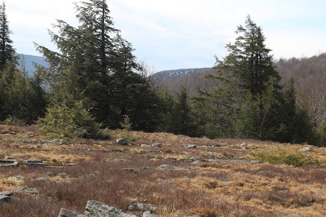
Once on the ridge, it was a fairly uneventful hike up to 2700 feet, where we came across the first of two remarkable high elevation clearings.
A rock cairn reminds us that there have been others here before us.
Exploring the clearing, which likely serves a summertime campsite.
On our way toward the second clearing, we passed by this HUGE burl on a tree.
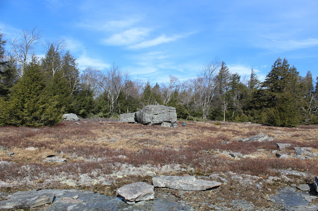
As nice as the first clearing is, the second clearing is quite simply even better. The up close view of Panther's summit ridge, nearly 900 feet above is certainly a highlight.
The second clearing is much more sizable and provides great views south to Witt, Cornell and Slide. Slide is easily recognizable in the center of the picture.
Witt and Cornell stand side by side just to the left of Slide.
I wandered across the meadow to capture this great shot of the slide on Slide's north face.
Enjoyed this unique view to Giant Ledge.
Clearing skies provided a fantastic backdrop for our lunch break.
Jim and John(and John's two collies) exploring the wonderful, open clearing with Panther looming above. John and his dogs turned back here, heading back down to their car. Jim and I continued on.
As we headed up the steep ridge just east of Panther's summit we finally encountered ice and snow. A closer inspection revealed ice pellets were melting and dropping from the trees, littering the ground beneath our feet.
At about 3100 feet, we decided to don the microspikes and with good reason. The conditions turned much more wintry on our way up to the summit.
Just before hitting the summit, we emerged onto the DEC trail over Panther. We stopped to enjoy the views, which are very nice. One of Panther's long east ridges, extending down towards Muddy Brook, looks to have some nice rock ledges way up high.
Our GPS showed the second view point as the true summit, my second time here and first in the winter. I only have a winter ascent of Balsalm Mountain left to meet my requirements to become a 3500 club member.
From the last view point on the summit ridge, we found a great view back down to the clearing we had just been on. Some refer to this spot as the "Panther Flats" down at 2848 feet.
The view directly down into the Panther Kill valley, with some of the homes further up the road visible below.
After about .7 of a mile on the trail, we finally and thankfully left the trail to begin our bushwhack west. Soon after leaving the trail we also took off the spikes. The woods are mostly very open and deciduous but we had a hard time finding views. This view towards Balsalm and Belleayre through the trees was the best we had.
The ridge just northwest of the summit is very long and mostly easy bushwhacking. We did hit some areas of thick prickers which were no problem today.
The ridge was seemingly never ending, as the afternoon shadows grew longer and longer. Here was a a small vernal pond we found high up on the 2384 foot bump just east of Oliveria Road(CR 47).
The descent off the 2384 foot bump was quite steep, making for slow going.
Just prior to arriving back at the first spotted car, the Esopus Creek and McKenley Hollow Road came into view through the trees. It was very nice to see the valley floor after a long day in the woods.
Hiked about 10 miles total(9.25 bushwhack) with over 2600 feet elevation gain.


I read with much interest about your hike around and over Panther, notably the clearings on Panther's Eastern shoulder. In the past I had both day-hiked and back-packed that site, and it is beautiful, especially in the warmer months. Very rare and unusual that it sits in that bowl of surrounding mountains and has great views and star-viewing. I originally sighted the larger open area from Giant Ledge years before I got there, and had a friend who had a house down in the Pantherkill Valley near the old Pathworks Ctr. (now Menla Retreat) and could start my trips there. That area is called 'Beech Flats', at least per Michael Kudish in his book, "The Catskill Forest, A History". You can Google Beech Flat. I know a very few people get up there, but it isn't common. Thank you for the pics and memories. Best, David Terrell dterrel1@optonline.net
ReplyDeleteThanks for the info David!! I always appreciate the background history of an area. The area referred to as "Beech Flats" is completely fascinating to me. An amazing little spot that, as you mentioned, very few folks seem to know about. I will have to dig into this a bit more. Thanks again!
DeleteVery interesting read! I was just up on Panther Sunday and noticed the flat area below, which got me curious and led me to this article. I am looking at exploring a trip back there for some camping. Is the parking along Pantherkill Rd well marked / suitable for an overnight?
ReplyDeleteHi! Yeah-really cool area to check out but no trails or formal parking-but there is room(possibly not in the winter)to get a couple of cars off the shoulder of the road for state access.
Delete