PLEASE NOTE-THESE PEAKS ARE PRIVATE! WE SECURED CONSENT WITH LANDOWNER BEFORE HIKING
In my ongoing quest to hike all of the Catskill hundred highest peaks(as well as my buddy Jim's attempt to do all of them in the winter), we met up to hike a couple more on a cold mid winter day. A sunny and clear morning drive quickly turned to heavy lake effect snow showers as we hit rural Delaware County. We began our hike of 3140 foot White Man Mountain from DEP land just east of Roxbury village in a heavy band of falling snow.
DEP(Department of Environmental Protection) protects land in the NYC watershed and provides plenty of outdoor recreational opportunities, especially in the Catskills. Although not always owning the entire mountain, they often times provide a connector to state land or access to a beautiful part of a mountain that was previously private. Ascending through open fields, we caught a nice glimpse to the west, where nearby peaks were obscured through a veil of snow.
A view southwest towards Hubbell Hill, barely visible through the squalls.
We followed DEP land through several fluffy inches of snow.
A gorgeous spruce stand.
We used several logging roads, which criss-cross the slopes of the moutain.
Nearly as quickly as it had started snowing, it quickly stopped, giving way to picture perfect blue skies and freshly fallen snow.
2870 foot Cator Roundtop can be seen just beyond the shoulder of nearby Vega Mountain.
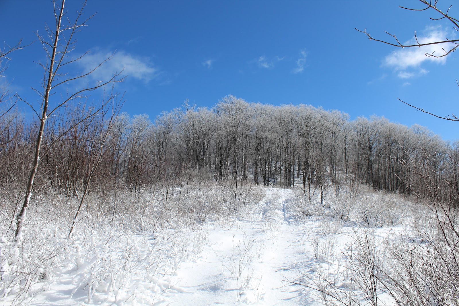
As we continued to gain elevation, the scene became dream like, a true wintry wonderland.
The bare winter trees offered up nice glimpses towards Old Clump and Narrow Notch Mountain to the northwest.
A steeper push, which was made a bit more challenging, snowshoeing through deepening snow.
Screened orthwest views through the trees.
Few people realize how high up the mountain that public access goes, with some very nice filtered views.
Another view of Cator Roundtop, from a higher perspective.
White Man Mountain is also known as Hack Flats, for its long, flat area just below the summit.
The final push up to the summit bump.
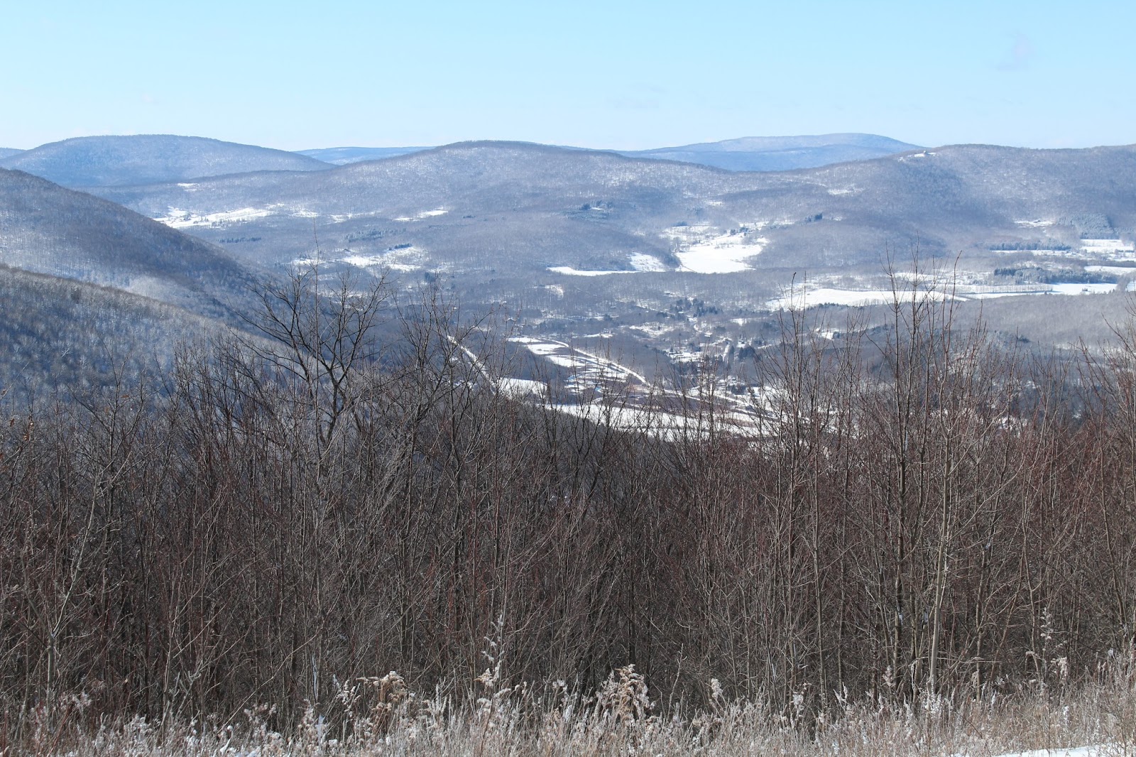
Several outstanding views can be found near the summit. Here is a look at Shultice Mountain, which sits directly north of White Man.
More views.
Looking down into Roxbury.
Plattekill's ski slopes stand out to the northwest.
The last quarter mile to the summit lead us through a field of prickers, which were actually quite picturesque under a fresh snowfall.
The 3140 foot wooded summit, my 82nd hundred highest peak.
Snowy trees against cobalt blue skies.
We quickly descended off the summit, with some steeper sections back down to DEP land, where we enjoyed more fantastic views to the west across open meadows.
3010 foot Old Clump rising directly above to the northwest.
As we arrived back at our starting point, we took a glimpse back at the far western ridge of White Man Mountain, which had been nearly completely obscured by snow showers only a couple hours earlier.
We got back into the car and drove a short distance north of Roxbury to start our ascent of 3280 foot Shultice Mountain. On the way, we paused for a moment to take in the mass of White Man Mountain, which we had just got finished climbing to the south.
DEP land on Teichman Road would be our access for Shultice today.
We ascended via a good woods road through an airy hardwood forest.
Open slopes of Shultice, which we had both previously climbed.
A small opening in the forest canopy provided a great look northwest towards the impressive Moresville Range.
Our main goal in climbing Shultice this time was to check out this enormous, open field directly below the summit.
From just over 3220 feet, we look up at the snow covered summit bump, which sits less than a .1 of a mile in front of us.
On our descent, we enjoyed amazing views to the west.
The lengthening days of February provide us with just enough extra daylight to fully enjoy these winter days.
The sun setting on another terrific day in the Catskills. Jim leading the way down the woods road we had climbed up, under the fleeting late afternoon sun.
Total for the day was 8.8 miles with 3000 feet of elevation gain. All snowshoe and all bushwhack conditions made those numbers that much more impressive.


I love this blog!! Don't ever stop...
ReplyDeleteThank you so much! It is certainly a labor of love! There is just so much to see and explore out there..wish I had more time to do it all.
Delete