PLEASE NOTE-THIS PEAK IS PRIVATE! WE SECURED CONSENT WITH LANDOWNER BEFORE HIKING. Started at around 2100 feet in elevation and headed up through a hardwood forest, passing by gorgeous stone walls under mostly blue skies.
A few inches of fresh snow blanketed the landscape, but we bare booted it the entire day and were fine. We enjoyed some excellent views towards 2922 foot West Settlement Mountain, the informal name given to the ridge just east of Red Kill Ridge.
We were quite surprised that the sun was shining and skies remained blue as we continued our ascent.
Several logging roads wind their way up the peak, with decent views northeast towards South Bearpen.
A fine view of South Bearpen's slopes with the long ridge of Bearpen just beyond.
A great view of the south ridge of South Bearpen.
After only about 1 mile of bushwhacking, but 1000 feet of ascent, we hit the wooded 3100 foot summit.
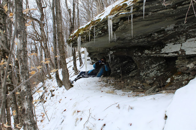
We dropped south off the summit cone, where the contours of the mountain are the steepest. Jim climbed under this overhanging rock shelter to capture his shot. He's always willing to go the extra mile for just the right angle.
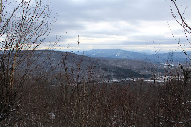
We managed to find a nice ledge with fantastic views towards Belleayre Mountain's ski slopes. The tiny hamlet of Bedell can be seen at the south foot of West Settlement.
A zoom view of Belleayre, with Graham and Doubletop looming beyond.
Once back in our car, we headed east a little ways to hike 3410 foot South Bearpen Mountain from DEP land. We enjoyed some amazing views back to Sleeping Lion and Halcott from the valley floor.
Starting again from about 2100 feet in elevation, we climbed up a good woods road with a nice look at one of South Beapren's neighboring ridge lines.
As was the case with Red Kill Ridge, the mileage wasn't long for South Bearpen, but the ascent was quite steady and steep.
Near the ridgeline, the slopes got very steep, but this provided us with some nice vistas south towards Halcott and Belleayre.
The valley of Halcott Center along County Route 3. To the east lie South Vly, Sleeping Lion and Halcott.
A final steep push got us up to the wooded 3410 foot summit. My 85th Catskill Hundred Highest.
Just off the summit, we stumbled upon a neat little clearing with gnarled trees and what looks to be a fern glade.
As we turned back to retrace our steps off the mountain, the leading edge of the rain moved in. Warming temps through the 30s and light rain began to turn the snow a bit mushy for the descent.
Got back to the car just in time before the steady rain moved in. Hiked just over 5 miles total(all bushwhack) with about 2400 feet elevation gain. Two more peaks closer to my goal!!


No comments:
Post a Comment