Hasn't been a very nice week in the weather department around here, but with a forecast for clearing afternoon skies today, I thought I'd do a small after work hike and hope for the best. Headed down to the northern fringes of the Catskills to hike NE Richmond Mtn, Richtymer Peak, and Mount Pisgah, all peaks that I had climbed before but with a slightly different twist. I approached the mountains from the south, heading up Mount Pisgah Road before then turning onto a unmarked DEC service road which becomes quite rough as it climbs quite high up the slopes between Richtmyer and Pisgah. There are two areas to potentially start this hike, making it a full loop. I chose not to drive all the way up to the high lot, with sits at over 2700 feet, due to my uncertainty about the road conditions. Instead I parked on the shoulder of the service road near the spot where an old carriage road(unmarked) comes down off Pisgah's slopes. From this spot, elevation 2450 feet, I walked the rest of the road heading generally west before hitting the upper lot. At the upper circular parking area, an almost unnoticeable yellow blazed trail heads into a hardwood forest, climbing steadily on an old woods road.
3120 foot NE Richmond's view spot...where a nice little view can be had....just not today.
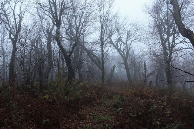
From NE Richmond I followed the Long Path heading NE through increasingly foggy conditions. Seemed almost fitting that this close to Halloween, I'd encounter these "haunting" woods.
In a low spot between NE Richmond and Richtmyer, I hit a woods road that was in pretty good condition. This is a look through the eerie woods, where the woods road continues north.
Just a short climb up from the low spot, I hit the wooded, nondescript high spot on Richtmyer Peak, which sits just off trail.
Dropping down into the col between Richtmyer and Pisgah, where some green still clung to the ferns in this protected area between the peaks.
From the col, I continued east on the trail, soon hitting the ominous, conifer forest near Pisgah's summit.
A steep ascent through the dark conifers leads straight up towards the summit.
Arriving at the 2912 foot summit of Pisgah, where a benchmark can be found at a bend in the trail. From the summit benchmark, the Long Path continues east and an unmarked trail stays right, heading south. This unmarked trail is actually an old carriage road, and that is the way I was heading.
Although it's hard to tell just by looking, there is a lot of history on this mountain. A summit hotel graced these woods back in the 1880's and a carriage road made the top of the mountain accessible to guests. Very little remains from the old hotel, which burned down only ten years after opening, but there are stone foundations and an old spring that provided water to the guests and horses at the hotel. Another neat little spot is Inscribed Rock, located almost directly across from the spring. Hotel guests, as well as many others through the years have carved their initials into this rock.
After enjoying the summit area, I began a steady descent down the old carriage road, which heads south, then west, back towards the service road and my waiting car. Suddenly, almost like turning a light switch on, the sun fully emerged as I descended down the old unmarked carriage road. Too little too late at that point, but the fog actually enhanced the experience for me anyway.
Hiked just under 4 miles total, with 1050 feet of ascent along the way.
As I headed home, I took a moment to stop on Cunningham Road to enjoy a great view back at Mount Pisgah to the west, and a tidy little Catskill farm at its foot.


Very nice, Shawn. Looks like I had nicer weather a week ago. Did the same, parked at the bottom of the Carriage Road, walked to the upper trailhead then whack NE Richmond.
ReplyDeleteThanks Alan! I basically went off your suggested route in DogHiker. Such an beautiful, underrated area.
DeleteA foggy hike offers no distant views but the immediate surroundings make up for it, puts you in another world.
ReplyDeleteNed, the foggy conditions gave the woods a completely eerie, almost creepy vibe. I couldn't have love it more to be honest!
Delete