I have hiked many of the numerous mountains that surround Lake George over the years, but one that has been on my radar for a while now is 1982 foot Spruce Mountain on the east side of the lake. The peak is located on private land but the public is welcome. To find the trails, head north on Route 22, just beyond the road for Huletts Landing to North Road on the left. Follow North Road to a T in the road, then bear right, passing by Military Road and to a snowplow turnaround, which was where I parked the car. I hiked up an extension of the road, which is a rough but driveable road. Elevation is just above 1100 feet to start.
Thankfully the land owner has granted permission to the public to hike the trails here. If you're reading this and plan to hike here, please be respectful.
After a short distance, I came upon orange discs in the woods, marking the start of the trails. I caught this nice glimpse of the south shoulder of Spruce.
The trails are a bit rugged, winding along heading basically north. I easily rock hopped this pretty little drainage.
The trail hugs the west side of the ridge, leading to numerous ledges.
One of the first view points to the south, with Sugarloaf and Black Mountain in the distance.
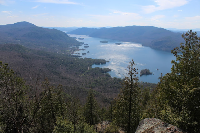
A gorgeous view of Lake George down towards Huletts Landing.
West views with Agnes Island(center-right) towards Sabbath Day Point on the far shore. Deer Leap(L) and Bloomer Mountain(R) can be seen straight across the lake.
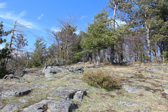
Heading up and over the pretty meadow atop the false summit.
After passing over the false summit, the trail drops steeply down. Incredibly this sheltered area held a block of ice, reminding us that winter is not that far in the rear view mirror.
After the steep descent, a quick climb leads back up towards the summit. A ledge on the way up provides spectacular views of Lake George.
The southern ridge of Spruce, Hogback and Black Mountain are clearly seen to the south. Sugarloaf is the small bump to the east of Black.
Continuing the climb up the open rocks below the summit.
This was a fun climb up.
The wide open meadow just below the summit makes the perfect spot to stop for lunch and soak in the views.
The breathtaking vista of Lake George from the meadow is the money spot. For my money, this is one of the most incredible views of Lake George that I have seen.
West views across the lake, where Route 9N can be seen winding between Deer Leap and Bloomer Mountains.
The meadow and viewpoint.
Another rock ledge facing south.
Headed up a few yards above the viewpoint to the true summit, where old airway beacon parts remain.
A gorgeous spring day with incredible Lake George views.
A zoom view down to Huletts Landing.
West views with Bluff Head on the near shoreline.
After soaking in the numerous vistas, I finally headed back down retracing my steps to a trail junction. I opted to take the yellow marked trail to change things up. This trail proved to be extremely steep and rocky.
After enjoying one more open ledge view of the lake, a steep descent brought me to another trail towards North Road. A small blue trail leads past an old, red schoolhouse along North Road. I hiked out the rest of the distance from here on North Road, back to the car.
Hiked about 4.5 miles RT with over 1500 feet elevation gain.


My father enjoyed the cherry blossom boat tours. Lake George is an amazing place. I recommend my father you go there and enjoy the best time there.
ReplyDelete