I did a quick loop on one of the Greylock Glen trails which offered up a spectacular view of Greylock's east face from an open field.
Almost immediately upon hitting the Thunderbolt Trail, I left it, heading straight up the steep slopes of Ragged Mountain. The rock formations were absolutely incredible in some sections.
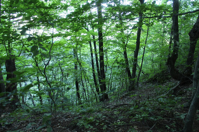
A typical stretch of buswhack through open hardwoods. I startled a black bear out of a tree at one point, as he leaped down in front of me, quickly darting away into the forest. This was quite a rush.
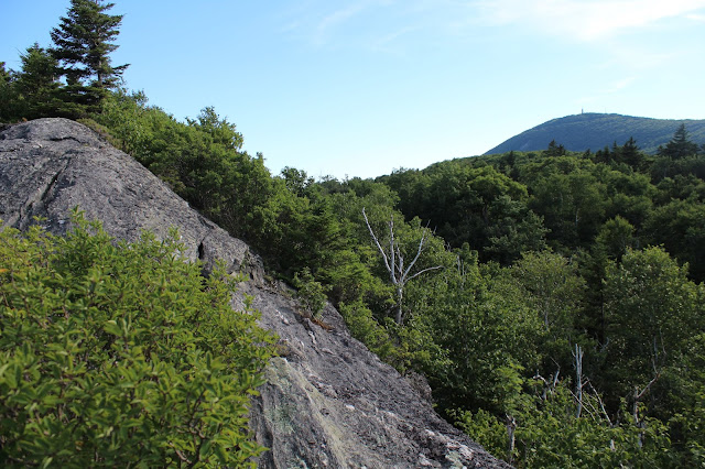
My bushwhack was steadily steep, gaining over 1350 feet in about 1.3 miles. Once hitting the summit cone, I ran smack dab into the trail, which brought me to a nice vista of Mount Greylock, nearly 1000 feet above.
Upon leaving the summit area, I picked up the unmarked herd path which heads northeast towards an area known as Raven Rocks. The herd path is very well defined and easy to follow most of the way, but does seem to fade away to nothing in a couple of spots. I easily found my way, anyway, over to the rock ledges that make up Raven Rocks.
Raven Rocks, where the views to the east begin to unfold.
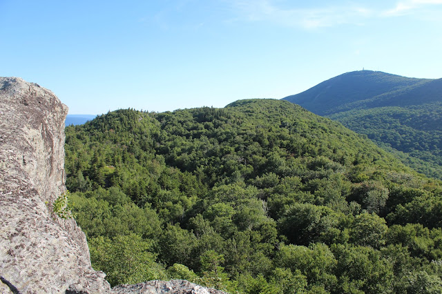
From this vantage point, Greylock's summit is still visible, but a bit further away, and somewhat hidden by Ragged's summit bump.
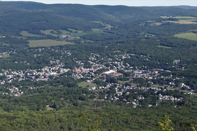
The views to the east towards the town of Adams are outstanding from here. Although over 1000 feet lower than Greylock, they are nearly every bit as good as the views from the top.
The huge quarry at Specialty Minerals stands out, as does the Hoosac Range further to the east. The power line cuts up the range heading into the Savoy State Forest area.
A zoom view towards the ponds at Greylock Glen.
The north view towards the large mass of East Mountain.
A look back towards Greylock, with Mount Fitch to the north now becoming much more visible.
The open rock on the second small summit bump on Ragged beckoned me.
A look at some of the rock ledges along the way.
A good herd path continued up to the second summit bump, where the open rock on top was the best yet.
I was completely floored with the wide open area to explore as well as the incredible views.
From the open rock, the views east began to open up again.
The jaw dropping rock ledges on Ragged's second summit bump. To say I was surprised would be an understatement. Mount Williams can be seen in the distance.
Ragged Mountain and Raven Rocks from the second summit bump.
Mount Williams sitting just to the northwest across a deep valley. Pine Cobble and some smaller peaks in Vermont can be seen on the horizon.
Soaking in the views from a lower ledge. This is another look south at Ragged's true summit, and Greylock beyond.
A closer look at Mount Greylock's summit.
I decided to continue on to a third summit bump, but found no herd paths anymore. I had to swing around a couple of steep cliff bands, but had no issues making my way through the mostly open woods.
The third summit bump to the north, provided even better views over Mount Williams shoulder to the northwest, with Pine Cobble rising beyond.
The sprawling vista from the third summit, with a shoulder of Mount Williams(L), East Mountain(center), and yet another summit bump on Ragged(R).
As much as I would've loved to continue exploring Ragged's magical summit ridges, I unfortunately had to turn back. The late start and growing shadows were beginning to catch up to me. Instead of ascending and descending all of Ragged's ridgeline bumps, I opted to bushwhack straight down, heading southeast. It was a very steep drop.
Luckily, about halfway down the mountain, I picked up a good herd path which was heading in the direction I wanted to go, so I followed it.
Once off the steep parts of the mountain, I once again left the herd path, crossing through a magical woodland on my back towards Thiel Road.
Arrived back at the car, with about a half hour of daylight to spare. A fun day in the woods, with about 6.5 miles RT and over 1700 feet elevation gain.









Cool. I remember visiting Ravens Rocks several years ago. I have some of the same pics.
ReplyDeletehttps://get.google.com/albumarchive/110179653839607320851/album/AF1QipOtHTksz6ZF0TvlfkEm6wRpqNh10ib4B2s3G0Ms?source=pwa
A real fun area to explore!
ReplyDeleteThere are actually 4 vistas on Ragged Mountain - 1) an official blue blazed trail to the overlook within the Reservation. 2) Raven Rock overlook and 3) the Big Rock with a shallow cave and a firering in the saddle below the overlook. 4) the true Summit of Ragged is the northern most vista - at about 2531 feet. It's not clear whether you actually had time to get there. Mini Mart
ReplyDeleteThanks! Yeah, I was looking at that last little north bump, but it was getting late so had to turn back. What a sweet little area!
DeleteSeems like the Ragged Mt Vista #2 is being called Raven's Rocks. Having been told in the 1970's by a Mt Greylock DEM Mountain Maintenance Man that Raven's Rocks can not be seen from the Town of Adams, best seen from the Greylock summit. The larger vista & cave you call "Big Rock" has been to my understanding since working on Mt Greylock myself, is know by many at The Raven's Rocks having more grandiose than Vista#1 or VIsta#2 . It is confusing for the TOPO maps places "Raven's Rocks" on a much lower elevation which is not located near either location. End of Rant.
ReplyDeleteThanks for the info! Very interesting. Learn something new every day
DeleteThat is not Raven Rocks. Raven Rocks is on the east side about half way up the side. Its a large rock outcrop. What you call RR is known as Fox Pines.
ReplyDeleteAny chance you have a good map of the walk along the ridge past the summit? I found a couple of these views, but that’s where things started getting confusing for me with the map that I had. And I am a bit reluctant to bushwhack too much because of ticks, having Lyme and co already. I did this as part of a loop over the summit of Mount Greylock, So I was a little tired by the time I finished what I was doing here. Because of the trail closure, I plan on using the Bellows pipe Trail again for that but only this time to go up ragged mountain instead of it being a downward part of the loop with ragged a spur off of the course. I got to the second rock Outlook from the summit last time and sort of lost the path. I think I might know where but I would feel better with a good map. But otherwise, I went up the gold and Appalachian Trail to Greylock before coming over here last time. This time I’m just going to focus on ragged. I underestimated both the difficulty and the reward of this mountain before my first time being on this mountain
ReplyDeleteSame anonymous guy who posted last time. I decided to give it a try today and I did get to one summit bump past where you have pictured and trust me. You have to go back. The view is just breathtaking. No lie. Makes the entire journey worth it
ReplyDeleteOnce you get past the last peak, there is another path you can take to avoid having to climb back over all the cliffs, and you can make your way back down to the Bellows pipe Trail
ReplyDeleteYes that is correct. Raven Rocks are half way up on the east side. A large outcrop. The top on the east side is Fox Pines.
ReplyDelete