Decided to head north today to knock off Saddleback Mountain, another Adk Hundred Highest bushwhack peak. This Saddleback, not to be confused with the high peak, rises to 3615 feet and is best known as being the neighbor to popular Jay Mountain. I parked at a small pull off on Jay Mountain Road, almost directly in the south shadow of Frenyea Mountain. Elevation to start was 2275 feet. Immediately leaving the car, I began steeply climbing the slopes of Frenyea. Although the spruce was thick in spots, it was never too bad, and I also spotted an on again off again herd path.
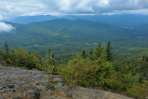
I poked around Frenyea's summit a bit, and did find one decent ledge view to the SW.
After a short descent off Frenyea, I continued north through mostly fairly open woods gaining elevation steadily. There are several areas of thicker spruce, but I always found a way through or around them. From a 2930 foot false summit, I managed to catch a peek towards the true summit, in the clouds, poking out above the next ridge up.
As mentioned, there are spruce covered areas, but there are just as many of these nice, open bushwhacking areas as well.
Emerging at a large clearing at roughly 3200 feet, there is an amazing view directly up at the true summit, which was, unfortunately, almost completely fogged in.
As I made my way up the mostly open slopes, the fog only got thicker the higher I got.
Ascending through a thick fog. This was incredibly frustrating, because the slopes all around me were dropping off, meaning there must have been incredible views...that I was not getting!
Arriving at the wooded 3615 foot summit, marked with a small pile of rocks that I don't even know you can call a cairn.
After hitting the summit, I decided to explore just a bit, hoping that some of the fog would lift. From a wide open set of ledges, I got my wish! The fog cleared just long enough to provide the only good views I had all day. To the SW, the Nun-Do-Ga-O Range and the distant high peaks.
To the west, looking towards Whiteface and the Lake Placid area.
Unfortunately, this view was obscured by the clouds and fog within just a few minutes.
From across one of the "saddles" on Saddleback, looking at the true summit, just over 1/10 of a mile away.
The descent was pretty straightforward, with some slight clearing the lower I got. Here's a neat look down the ridge that was my route out.
From just over 3200 feet, there was just enough clearing to capture this look east towards Lake Champlain.
A last look back up towards the summit area, still engulfed in a thick fog.
After a fairly uneventful return hike, I captured the ledge view from Frenyea yet again, this time with clouds dropping down to the summits.
The final steep descent down to the road.
I came out a mere 2/10 of a mile away from the car, due to some steep ledges I wanted to avoid, so it was a short road walk back from there. Didn't see another soul the entire day.
Hiked about 5.5 miles RT, with 1900 feet of ascent.
Today's Route below. Red=Ascent Blue=Descent


No comments:
Post a Comment