After my earlier hike of Moose Mountain in the Wilcox Lake Wild Forest, I wanted to head further north to see how far advanced the colors were up by Indian Lake. One of the best foliage experiences I've had was from a couple years ago at Ledge Mountain, which sits NW of the hamlet of Indian Lake. Today I wanted to visit part of the ridge that make up the Stark Hills, which are Ledge's northern neighbor. Stark Hills are actually a cluster of peaks with the highest point rising to a modest 2283 feet. The easiest access for Stark Hills is from the Rock River Trail which heads north from its trailhead off of Route 28. Elevation at the trailhead was 1960 feet.
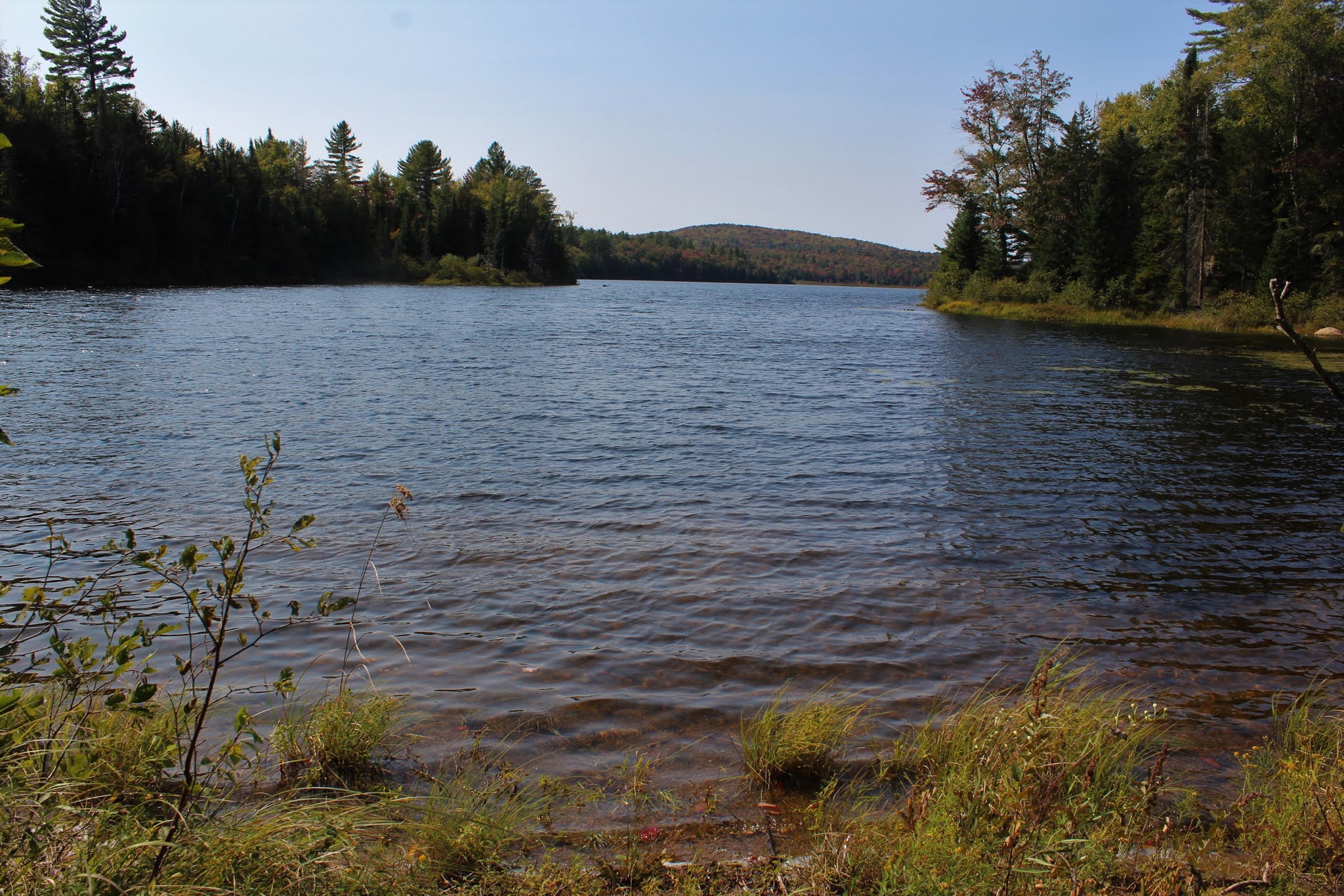
After my early morning bushwhack, it felt good to be on a trail for a bit. I zipped along quite nicely covering ground quickly and before I knew it I was near Rock Lake. A very short off trail excursion brought me down to the lake shore. From this small cove on the east side of the lake, I enjoyed a nice view.
After enjoying the lake view, I headed back towards the trail but crossed over it and began my bushwhack ascent up towards the long ridge of south end of the Stark Hills. At first it was nice and easy, but soon the ascent got quite steep.
From a set of steep ledges, I caught an early view SW towards Blue Ridge Mountain, with a corner of Rock Lake visible to the right.
From the same ledge, looking more south, with the large, sprawling wetland below.
These ledges were no joke. A near vertical drop made good footing a must.
I closely hugged the steep ledges, which were actually quite fun to explore. There were many nooks and crannies to check out, each with halfway decent views.
Although not the high spot of Stark Hills, the high spot on the long south ridge sits at 2273 feet, but is treed in.
While a lot of the hiking was fun, it wasn't all rainbows and butterflies. There were several scratchy sections such as this to contend with.
From the far SE bump on the ridge, I found an open set of ledges, with the best views of all.
West views.
South views from the ledge towards Ledge and Sawyer Mountains. This made a perfect lunch spot, taking in the views and enjoying the serenity.
On the descent, I had to backtrack a bit, dropping down SW carefully on the steep slopes. Once down off the steepest section, I hit the first of two large beaver meadows.
Passing by the second beaver meadow as I continued SW.
Once beyond the two meadows, I had to slowly regain elevation, passing through an open forest on my way out.
Out of nowhere, I hit the trail, almost literally at the trail register. Signed out and got back to the car feeling great. A fantastic, dare I say, perfect start to fall today. Hiked 4 miles with 1300 feet of total elevation gain. The route below.
Red=Ascent Blue=Descent


I was two miles east of you!
ReplyDeleteNice! I saw your blog post! Beautiful area this time of year
DeleteWalking Man and Grog, my two favorite hikers! Those ledges looked awesome, they are always a welcome sight when summiting for an extra adventure of rock hopping and exploring. I was at Balm of Gilead last week and had fun on those ledges!
ReplyDeleteThanks Ned. Yeah, nothing like a good old fun rock scramble!
Delete