Sitting almost directly in the heart of the Catskills is 2543 foot Mount Tobias, a mountain with no trails and that gets very little attention. If you've ever driven Route 212 or any of the roads near Woodstock, chances are you've seen Mount Tobias rising high above the surrounding countryside. It is also visible from several of the surrounding mountains as well. My plan was to hike up the mountain from a DEP parking area along Route 212, which sits almost directly across from Woods Road. When I arrived, however, it quickly became clear that I would not be able to safely(or for that matter comfortably) cross the Beaver Kill, which was running strong.
Within just a few minutes of climbing, I was already able to enjoy views back towards Little Rocky and Olderbark Mountains.
As I climbed, I kept looking back over my shoulder at a fast approaching snow squall, that was quickly obscuring any views to be had.
The snow squall was moving in fast and furiously, accompanied by brisk winds. In the blink of an eye I was enveloped by snow.
Winter is coming.
The slopes on the north face of the mountain are quite steep, but very open woods make for a pleasant climb.
The snow was really coming down, coating the ground in just a few minutes time.
Intense snow band moving through on my ascent.
Almost as if someone hit an "off" button, the snow abruptly came to an end, leaving behind an enchanting coating of white. Around 1900 feet, I began to hit the first patches of conifers.
Within just a few minutes, not only did the snow stop, but the sun broke through the clouds, brightening up the dark woods.
Near 2300 feet, circling around a nice set of cliff bands, bathed in late afternoon sunlight.
High up on the mountain I was able to find some peek a boo views towards Carl Mountain and the peaks just north.
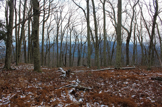
Although I couldn't find any grand views, there are many fine through-the-trees-views towards the neighboring peaks.
Emerging atop the summit ridge, I caught my first glimpses through the bare trees to the mountains south of Tobias, near the Ashokan Reservoir. The ridge is quite flat near the summit and sparsely covered in trees.
One last small push up brought me to the 2543 foot summit, where I found a rock cairn marking the top.
Instead of descending the exact same route I came up, I decided to drop east, then north, exploring a different area of the mountain. The slopes were quite steep in spots, but I was easily able to navigate my way down.
Back down below 2000 feet, I was able to catch broken views down into the valley, where a wall of snow showers had obscured any views earlier.
Enjoyed a nice and easy decent down the lower slopes and back to the car. Hiked 3.5 miles RT with over 1500 feet of ascent. Although lacking any long distant views, this was still an enjoyable little bushwhack and of course I didn't see another soul all day.
Today's route below. Red=Ascent Blue=Descent


Stay safe out there Walking Man, we don't want you to get lost in a snowstorm! Of course us hikers know the difference between snow squalls and a nor'easter; I got caught in a few of those quickie snow squalls that day too, hiking up in Saratoga County. That Beaver Kill photo was beautiful, I love those rocky rivers.
ReplyDeleteThanks Ned! I actually like those quick hitting snow squalls! They make for a fun hike ;-)
Deleteyou can kiss this one goodbye, Shawn. DEC and the Catskill Center are hellbent on cutting a trail from the Center to the summit. A gorgeous peak with no attraction to the Catskill Center tourists. The DEC can't patrol the trails we already have and we're building a trail to a mostly viewless summit.
ReplyDeleteFirst Ticetonyk..now Tobias...good grief
DeleteYour site is awesome, Im always looking at the pics you post and have shared with lots of my friends. Thank you for the pics you post and details about where everything is :) Im in East Greenbush NY :)
ReplyDeleteThanks for the kind words! I really appreciate that. I just love exploring the out of the way, off the beaten path spots. Always glad to share!
Delete