Headed south today to explore one of Panther Mountain's long ridges, and being trail-less, I figured I'd have the woods to myself. This particular ridge has been on my radar for quite some time now, as we spotted some rocky ledges on it from across the valley to the south on another trip. My starting point today was from state land along Muddy Brook Road, where a small pull off provides parking for a couple of cars. Elevation was 1200 feet to start, meaning I'd be climbing 2000 feet to get to the high spot on the ridge.
Immediately after leaving the car, I dropped down to a creek crossing of Muddy Brook. The water was flowing pretty well, but it was still a pretty easy rock hop across.
From the meadow looking back NE. This made a great early spot to catch my breath and down some fluids.
Our recent cold and snow has made it feel a lot like winter recently, so it was very pleasant to see a little colorful beech brighten up the woods.
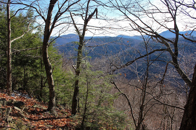
The terrain below the ridge is quite steep, and offers some pretty good glimpses to the nearby mountains. This small window provided a look NE up to wintry Stony Clove Notch. A careful eye can pick out the rocky ledges above the Tanbark Trail in the foreground.
Another framed view east towards Mount Tremper in the distance and Romer Mountain in front.
Once up on the ridge, it was a nice and easy hike west, following the slopes gently up. As I gained elevation, the slopes below me to the south began to drop off very sharply, offering more decent through the trees views.
In typical Catskill fashion, there are several rocky shelves along the ridge, making for a fun climb up or around.
The snow line seemed to be around 2600 feet, but even there it was a bit spotty. Nearing 3000 feet, however, winter conditions really began to take hold.
One of the final steep pushes up towards the summit(high spot on the ridge).
From a small grassy(snowy today) ledge, I found a nice view to the SE.
Watch your step! These ledges weren't all they were "cracked" up to be.
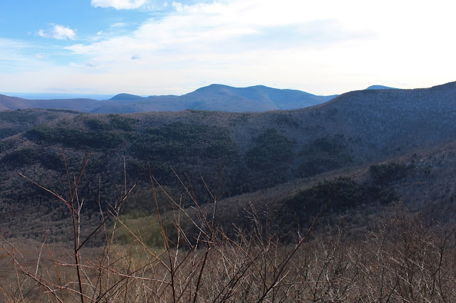
Although I usually hit the summit first, my attention was drawn to a series of ledges just off the summit. From the first vantage point, I enjoyed a spectacular view SE over the Pantherkill Valley far below.
This ledge offered up one of the best view spots that I've seen in the Catskills.
Continuing along the ledges, I found an even more substantial view spot with Panther Mountain's summit rising impressively above.
Wide open views from the ledge, at just under 3200 feet.
I was in awe of this view. Unfortunately, it does look like someone has cut some smaller trees to enhance the view, but it is remarkable.
An incredible south view of Panther's long east ridge, with Witt, Cornell and even Slide poking out just beyond.
The 3200 foot summit(high spot on the ridge) sits back from the ledges and is fully wooded and nondescript. Actually was hard to tell exactly where the highest spot was, but this looked close enough. About 2 or 3 inches of snow covered the ground here, with a biting NW wind keeping me on the move.
Although it was nice to disconnect from the world, I was far from alone up on this mountain. Fresh bear tracks kept me from feeling too relaxed!
Another fun part of bushwhacking is the sense of discovery. This small, partially frozen vernal pond came seemingly out of nowhere on my descent.
The route down was pretty straightforward, following the ridge back east. Here is one of the steep descents down a rocky shelf.
Made great time coming down, zipping along the ridge, basically retracing my route up. I was a bit surprised to see that I had done the whole trip in just over 4 hours, even taking my time. Didn't see another soul the entire day. 6 miles RT(all bushwhack) with 2200 feet of total ascent.
Today's route below. Red=Ascent Blue=Descent


Thank you for sharing such informative content! I'd love to explore that vernal pond/wetland sometime- do you remember what elevation it is at?
ReplyDeleteHi, thanks for the kind words. It's been a while since this hike, but if I remember correctly, it was well up on the ridge(around 3000 feet). Awesome ridge to explore so if you do hike it then enjoy!!
Delete