With snow in the forecast for this afternoon, I decided to head east just over the state line into Massachusetts to check out the Berkshire Natural Resources Council's newly constructed trail from Bosquet Ski Area up to 1889 foot Mahanna Cobble, which is the northern summit of Lenox Mountain. Although hikers have always had access to the explore the ski slopes, they were never allowed during the winter ski season. All of this changed recently when the BNRC partnered with Mill Town to build a hiking trail from the ski area up to the top of the Cobble, with minimal impact to the ski operations.
From the parking area(elevation 1125 feet), head over to "Tube Town", where a trail map and signage will point you in the right direction. Blue markers and signage aide you as the trail crosses over ski slopes as well as woodland areas on its way to BNRC property. I chose to bare boot it because there were only a few inches of snow and it was all very well packed and supportive.
Do I have a witness??
The trail switchbacks a couple of times just below the top of Mahanna Cobble, with more filtered views to the east.
From atop Mahanna Cobble, there are very nice, open views to the south where Kennedy Park and Yokun Ridge make up the most prominent ridges. "George's Bench" makes a perfect spot to stop and rest, while soaking in the views.
From Mahanna Cobble, there some options. You can either hike back on the trail you just came on or continue either north or south along Yokun Ridge. I chose to head north towards the top of Bosquet's ski slopes. This part of trail, while still used, showed much less foot traffic.
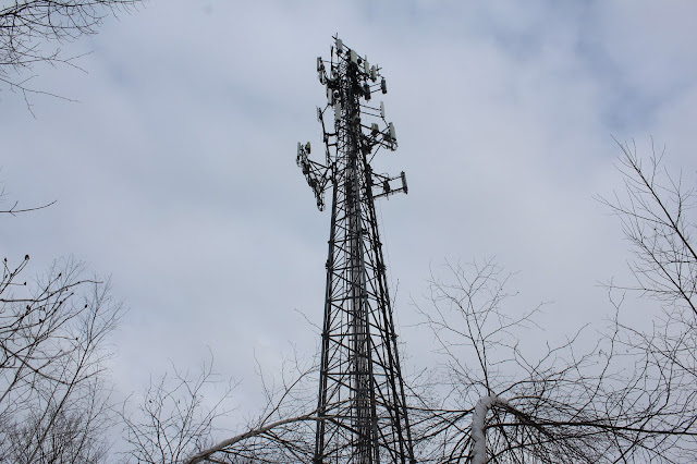
There are a pair of towers atop the ski slopes, set back in the woods a bit. I believe one is a cell tower and the other bring a radio tower.
Just a few yards past the towers, the woods open up to a wide open, sprawling view from atop Bosquet's ski slopes.
The view is pretty remarkable from up here. To the far left is the Taconic ridge, with the Greylock Range front and center. Much of the city of Pittsfield can be seen sprawling in the valley below.
After enjoying the views, I headed back to the "Secret Trail", which briefly lead me through the woods and back to the Mahanna Cobble Trail. It was a nice and easy return route from there. Hiked about 3.2 miles RT with 850 feet of ascent.
This morning's route below. Red=Ascent Blue=return(descent)


No comments:
Post a Comment