Headed north into the Adirondacks to tackle 2067 foot Beech Mountain, a trail-less little peak tucked into the rugged hills east of Brant Lake on a beautiful mid week day. To access this peak, I parked at the north end of seasonal Fly Brook Road, where it meets Route 8(Elevation 1540 feet) and then set out on foot, heading south on Fly Brook Road. The road is used as a snowmobile route in the winter months but there was more mud than snow for my first hike of the spring. Bright sun and crisp air set the mood for a brisk walk past private camps and logging roads.
.JPG)
As I slowly gained elevation, I began to hit some large stretches of snow and ice.
.JPG)
Nearly two miles into my hike(and now on state land) I encountered a sprawling, picturesque beaver pond at the foot of Beech Mountain(out of frame to the right).
.JPG)

Beyond the brook crossing, the road continues south, but I decided to head into the woods here, beginning my true bushwhack up the steep, rocky west slopes of Beech Mountain.

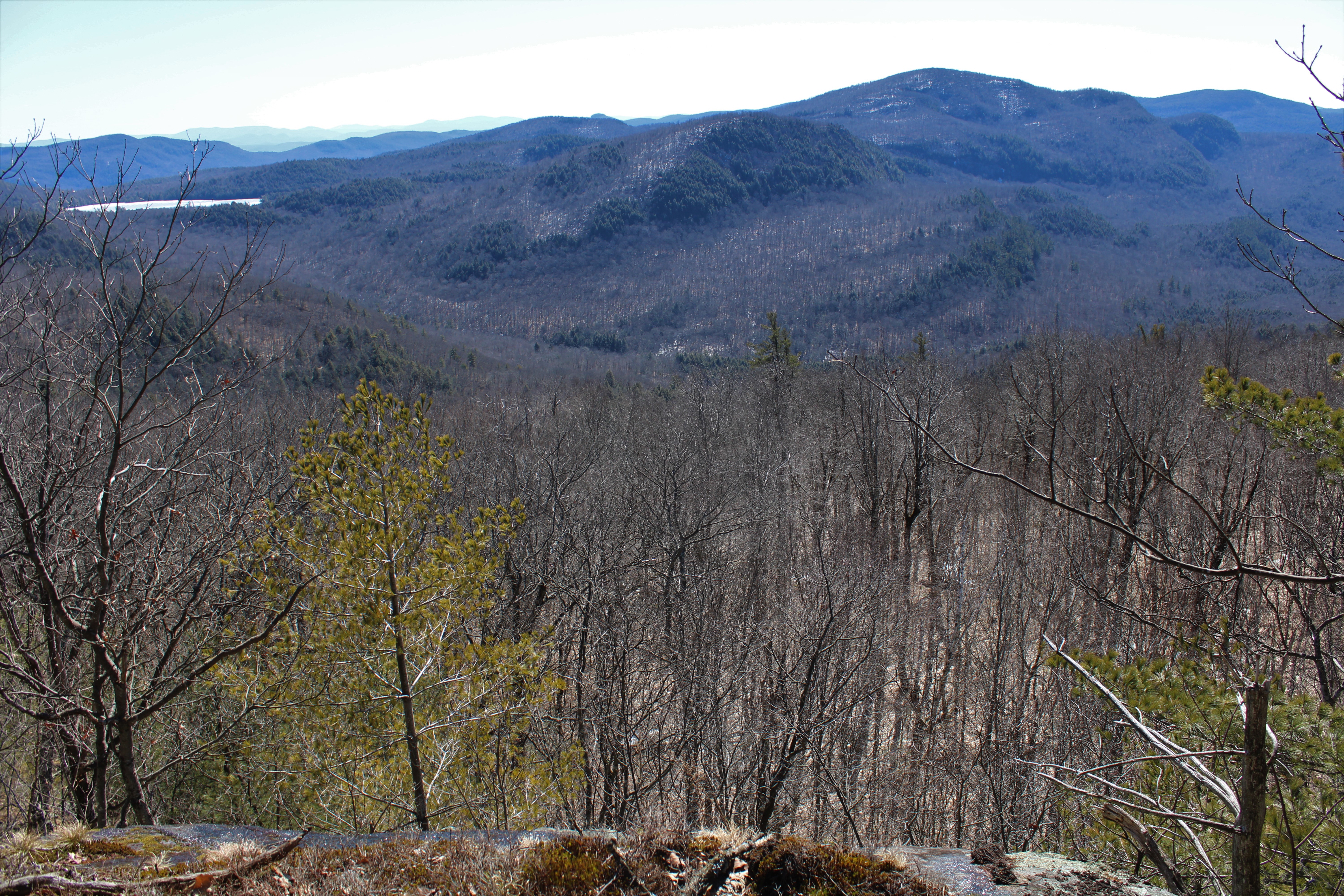
A steep but fairly brief climb brought me up to small area of cliffs near 1800 feet, with decent views to the south and southwest. A small portion of Northwest Bay on Lake George is even visible from here.

After carefully maneuvering my way along the cliffs, I continued my ascent, steering towards the south slopes of the peak, which were much more open and sun bathed.

The south slopes below the summit area are a joy to explore, with some really nice views to be found. Almost immediately I was able to find this nice view south towards Lake George.

The best view of the day was from an open ledge facing south/ southeast towards Jabe Pond(left) and monstrous Catamount Mountain's broad profile.


While the views from the summit are not completely open, they are nice and unique compared to the earlier views, because they face NE, taking in northern Lake George near Ticonderoga and into the peaks of Vermont in the distance.

After enjoying the summit area, I headed down off the mountain, trudging through some deeper areas of snow on the north facing slopes. I carefully weaved my way back down off the steep slopes to another section of Fly Brook Road, which I followed back to my original route and eventually my car. With the leaves still off the trees, I was able to enjoy some nice views of the surrounding peaks along Fly Brook Road.

A nice and easy 6.5 miles RT, with 1400 feet of combined ascent for the day. Didn't see another person all day in a quiet little corner of the Adks.
Map below.
Red X=Open view points to the south

No comments:
Post a Comment