Took advantage of a 70 degree, spring fever type afternoon by heading down to the Catskills to hike a couple of obscure peaks that were sure to provide solitude. I would be utilizing DEP land off of Baker Road in Woodstock to hit 1821 foot Beetree Hill as well as the south slopes of neighboring Roundtop Mountain(not one of the 100 Hundred Highest Roundtops) to where public land meets private land. I parked in a small designated parking area off of Baker Road(Elevation 1080 feet) and headed out, following a very good woods road east, then north up Beetree's slopes.
The woods road eventually peters down to a foot trail that seems well traveled, although not marked. The woods on Beetree were remarkably open and pleasant.
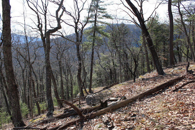
High on the ridge, I began to get filtered views to the east as well as some nice stone work.
After about 1.3 miles, a short bushwhack off the herd path brought me up to the wooded 1821 foot summit of Beetree Hill.
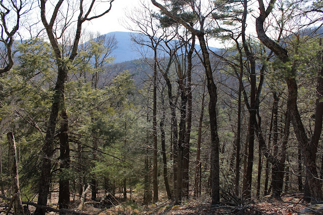
Once I bagged the summit, I turned back, retracing my steps south to about 1500 feet, where I once again left the path and began my bushwhack west towards Roundtop. From near the property line, I enjoyed filtered views south towards Tonshi and Ticetonyck.
Directly west sits Roundtop, my next goal, now easily visible through the trees.
Ticetonyck is truly a giant among the many smaller peaks surrounding it.
Although Beetree and Roundtop are not very big peaks, the terrain is quite steep. From some near vertical ledges on Beetree's west slopes, Roundtop towers above.
The drop off of Beetree Hill is a bit tricky and a little challenging due to steep slopes, slick leaves and staying on DEP land. Down in the draw between the two peaks, there are a couple of stream crossings where properties converge near 1200 feet. This is the trickiest spot of all to stay off of private land, but the water crossings were no issue.
Another rock hop crossing over a drainage.
From the stream crossing, I passed over a couple of good woods roads on my way up to Roundtop's steep woods. I contoured a bit south to where the terrain is a little more forgivable and slowly made my ascent.
I scrambled my way up on the slick leaves and was able to find some nice through the bare tree views to the SE. Just a little further up the steep slopes, the views really, really opened up-but unfortunately they were all on private property-so I had to settle for the screened views.
From the south slopes of Roundtop, I backtracked NE towards Beetree Hill, where I eventually picked up the herd path once again, following it back to the car. Hiked about 4.7 miles RT, with 1600 feet of total ascent on a beautiful late winter afternoon.
Map below. Blue P=parking Red X=Beetree summit Blue X=Roundtop Ledges


No comments:
Post a Comment