We have been stuck in a very persistent cold pattern for the better part of the last couple months, and today-St. Patrick's Day-was no different. Wind chills in the low single digits are certainly letting us know that winter isn't ready to give up yet. Bright blue, sunny skies certainly made it look nicer than it felt though, and I bundled up and headed over to Petersburg Pass to hike the Taconic Crest Trail to Berlin Mountain.
The trail was very compact and made for easy walking due to illegal snowmobile use. This section of trail has a few steeper sections but most is level walking along the ridge line, although there is an extremely sharp drop off just a few feet away.
Only a short distance south of the parking lot, there are screened views west into the Little Hoosic River Valley and the Petersburg countryside. The Taconic ridge can be seen running to the north through the trees.
More views of Petersburg.
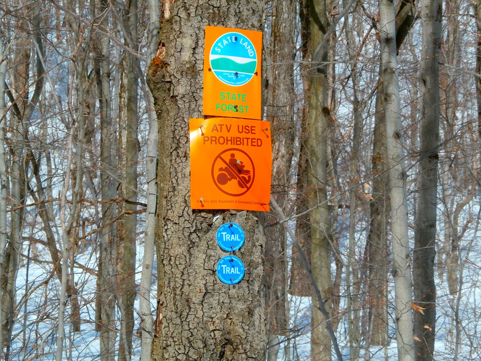
The Taconic Crest Trail runs 2.8 miles from the Petersburg Pass parking area to Berlin Mountain. There is ample signage along the way.
Along with the blue Taconic Crest Trail signs, there are many other signs throughout.
Deep snow in the mixed hardwood forest.
After about 1.25 miles, at a large clearing, the first views of Berlin Mountain open up before you, stretching to the south.
Zoomed in view of Berlin Mountain. If you look closely, you can see that most of the mountain consists of mixed hardwoods, with a small section of spruce just below the summit.
Berlin Mountain, the highest point in Rensselaer County at 2818 feet.
After 1.8 miles you come to Berlin Pass, a saddle between Mount Raimer and Berlin Mountain. A trail to the east leads to the old Williams College Ski Area in Williamstown, Ma, and a trail west heads down into Green Hollow in Berlin.
The clear skies and bright sun made for an enjoyable walk through the open forest.
The strong March sun did its best to warm things up, but the biting north winds and well below average temperatures held the cold firmly in place.
A strange sight along one particular section near Berlin's summit, saw scattered leaves all over the trail. This was the only spot like this the entire way.
After 2.8 miles, the summit comes into view. The summit and west side of the mountain are in New York state, but the east slopes are located in Williamstown, Massachusetts.
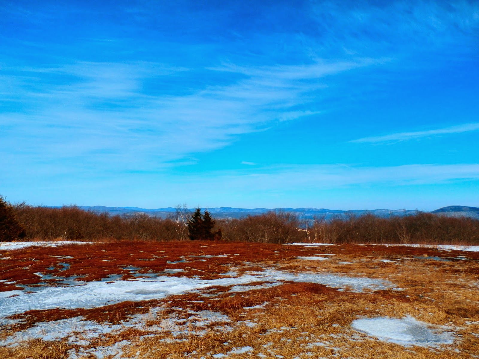
The mountain is well known for its large, grassy clearing at the top, known as a bald summit.
The large, grassy(and muddy) bald summit, is very exposed to the elements and can be quite uncomfortable on cold, windy days.
There are great views from the summit, with the most prominent being the Greylock Range.
The Greylock Range sits majestically to the east.
East Mountain and the southern Green Mountains can be seen rising to the northeast.
The War Memorial Tower high atop Greylock is clearly visible.
A view to the south provides clear views of Jiminy Peak's slopes and nearby Brodie Mountain's wind turbines.
Broken views west into New York state on the return hike.
After hiking for a couple of hours, the cold isn't even an issue anymore. Not sure if I just become numb to it, or if my body warms up from the hike, but it was a very pleasant afternoon hike, despite the cold. Here is the intersection of Berlin Pass, as I made way back.
Looking back at the long shadows cast by the late afternoon sun.
Almost back at the car, an opening in the forest, provides a beautiful scene over the Little Hoosic River valley.
After completing the 5.6 mile RT hike, I began driving back down Route 2 to Petersburg and took this picture of the Route 2 climbing up to Petersburg Pass. You can clearly make out the road making its path up the mountain and ultimately going through the Pass and leading into the Massachusetts.


No comments:
Post a Comment