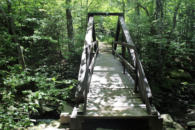
Immediately after heading downhill, the trail crosses the Platte Kill on a replica king post bridge.
After crossing the Platte Kill, the trail continues south through mostly evergreens on the historic Old Overlook Road, which provided access to the multiple bluestone quarries in the area. Crossing over a small tributary stream here.
Just over a mile into the hike, you will pass by a trail junction with the red marked Devils Path. Stay straight and continue on to the Devils Kitchen Lean To.
Took a moment to explore the Lean To.
Just after the lean to, the trail crosses a wooden footbridge over a small creek and bends to the southeast, continuing on the old stony road.
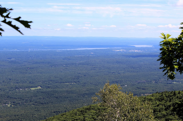
About .7 of a mile past the lean to and 1.9 miles into the hike, a yellow marked spur trail leads to an area known as Codfish Point. From here, there are sweeping views over the Hudson Valley.
Zoomed in a little closer look towards the Hudson River and Saugerties.
Codfish Point is actually part of a large bluestone quarry, where many rocks have been propped up as chairs, benches, tables and more.
Stone work in the quarry.
Retraced my steps back to the original trail and opposite of where the yellow marked Codfish Point trail leaves, an unmarked old quarry road heads west into the woods. This path is very faint and can be hard to find at first.
Once on the unmarked path, it is fairly easy to follow, but you do have to pay attention.
About a half mile along the path, you will arrive at another quarry. This spot offers a tremendous view to the north over Platte Clove and towards Roundtop(L) and Kaaterskill High Peak(R).
Another stone chair, for optimal viewing pleasure.
The unmarked path comes to an end just past this quarry, meaning its about a .3 of a mile bushwhack to the summit from here. Bushwhacking south through fern glades.
The bushwhack is pretty straight forward and pleasant through mostly hardwoods, until you arrive at the summit area. A small stand of conifers makes going a little more difficult.
There is no official marking for the summit, but my GPS seemed to think that this small clearing was the top. I searched all around looking for any sign of rock cairns or other markings but found nothing. Summit elevation is 3100 feet, with about 1270 feet elevation gain.
I had read that there are nice views from a cliff band on the southern slopes of the peak at around 2950 foot elevation. After much searching, I finally did find them and they offered spectacular views. Here is the view southwest towards Woodstock with Overlook Mountain's western slopes in the foreground. Cooper Lake can be seen in the distance.Echo Lake can be spotted far below, with imposing Overlook Mountain towering directly above.
The bushwhack back was fairly easy with only one real rock wall to negotiate.
Retraced my steps back towards the car and stopped by to take a peek at Old Mill Falls on the Platte Kill, right next to the trailhead. These are the first of many falls in Upper Platte Clove.
Hiked a little over 6 miles RT and oddly enough, didn't see any other people in the woods all day.
Drove back, by descending steeply down through Platte Clove towards West Saugerties. I stopped briefly at a bend in the road to capture a glimpse the magnificence of the Clove.


No comments:
Post a Comment