We quickly left the old "Friends" trail and began bushwhacking up through the woods. DEP Land soon merges into state forest preserve.
Typical bushwhacking scene up Roundtop.
Hitting some rock ledges as the hike gained elevation.
A small section of thicker bushwhack.
Nearing the summit, we passed through a wide open conifer forest.
About 2.1 miles into the hike we arrived at the wooded 3440 foot summit of Roundtop Mountain, marked by a small rock cairn.
We went looking for some views back on the southwest side of the mountain and although we didn't find any, I did enjoy this high elevation fern glade, just below the summit.
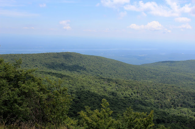
As we began our steep climb off Roundtop, we found this incredible view towards High Peak. This is the very spot that inspired Thomas Cole to pain the famous work "Sunny Morning on the Hudson".
A closer look at our next goal. The imposing 3655 foot Kaaterskill High Peak.
A slight shuffle to the left provided a nice view back over KHP's southern shoulder towards Platte Clove and the Hudson Valley.
After enjoying the view from Roundtop, we began the steep descent down towards the col. We found that the easiest way down was side walking part of the steep slopes.
Dropping into the saddle between the two peaks, at about 3230 feet. We looked around for an old Revolutionary camp(Tory Fort) that is in this area, but couldn't really find too much.
Passing through a beautiful stretch of woods on the way towards High Peak.
The climb up the west side of High Peak is steep, but nothing too bad. About 2 miles from Roundtop's summit, we arrived at High Peak's 3655 foot summit. My 35th high peak in the Catskills. I have now climbed all of the 3500 foot mountains in the Catskills, and only need a winter ascent up both Balsalm and Panther Mountains to become a 3500 club member. A special thank you to Jim's wife Carol, who made me a sign to commemorate this feat.
After leaving the wooded summit, we continued south for about .25 of a mile, soon arriving at a fine vista. Dropping down about 100 feet, brought us out to the large, open ledge known as Hurricane Ledge. The views from here are absolutely stunning. Here is a look at Platte Clove, with Huckleberry Point to the left.
Views east towards the Hudson Valley.
Directly south is a fantastic view across the valley to the Devils Path peaks.
Devils Path peaks to the south. The mountains seen here are(from left to right), Plattekill with Overlook poking out behind it, Indian Head and Twin. An obscured view of Plateau can be had further to the right.
A zoomed in look at Pecoy Notch between Twin Mountain and Sugarloaf Mountain.
We enjoyed lunch, soaking in the amazing views and nice breeze from Hurricane Ledge, before finally descending directly down the south face of High Peak.
Steep descent.
The trail soon levels out and leads to the snowmobile trail, marked by an enormous rock cairn. Jim stopped to pose for this photo, showcasing the sheer size of the cairn.
The hike back was very pleasant beneath the steep walls of High Peak's southern slopes.
Passing through a field of nettles.
Arriving at one of the infamous plane crash sites on High Peak.
Parts of this plane are scattered all about. In doing a little research, I found that this was a fatal crash with three occupants on board, in June of 1987.
A small fire pit and camping location.
We left the snowmobile trail and bushwhacked for a quarter mile, cutting off a couple of miles of unnecessary mileage on the wet and muddy snowmobile trail. We then simply followed the trail out towards Platte Clove, crossing this small stream.
We arrived back at the first car, sweaty but feeling accomplished. We decided to do a short walk down the road towards beautiful Plattekill Falls to wash up. This added another 1.4 miles RT to our hike.
The lovely 70 foot Plattekill Falls.
Hiked a total of 9.4 miles total.


No comments:
Post a Comment