I've been very interested in hiking Mount Tom's incredible cliff top views, located in Central Massachusetts, for quite some time now and decided that today would be the day. 1202 foot Mount Tom is part of the Mount Tom State Reservation and offers over 22 miles of trails as well as unparalleled views in nearly all directions. I opted to hike a section of the Metacomet-Monadnock Trail, which runs 114 miles and the entire length of the state from south to north. The trail is found by taking exit 17 off of I-91 and begins on the north side of Route 141(Easthampton Road), across from an animal shelter at an unmarked pull off. The trail enters the woods here.
There are many paths through these woods(some marked-some unmarked), but they all lead to the same main trail, which climbs steeply through hardwoods for less than a mile towards Mount Tom's cliffs.
After climbing nearly 700 feet, the trail arrives at the first of many cliffs.
The climb was steep, but felt twice as tough, due to the relentless heat.
A short distance from the summit there are a series of dramatic cliff views.
Good footing is essential following the cliff top trail.
If you enjoy open views then this hike is for you. There are countless views nearly the entire time.
I apologize for the amount of cliff top photos I included, but the sheer
drop offs and dramatic views were so incredible I had to include them
all.
Straight down.
The actual summit of Mount Tom is crowded with radio and TV transmission towers, as well as some remnants of an old hotel which stood there.
Unbelievable views.
Unfortunately graffiti scars many of the open rocks.
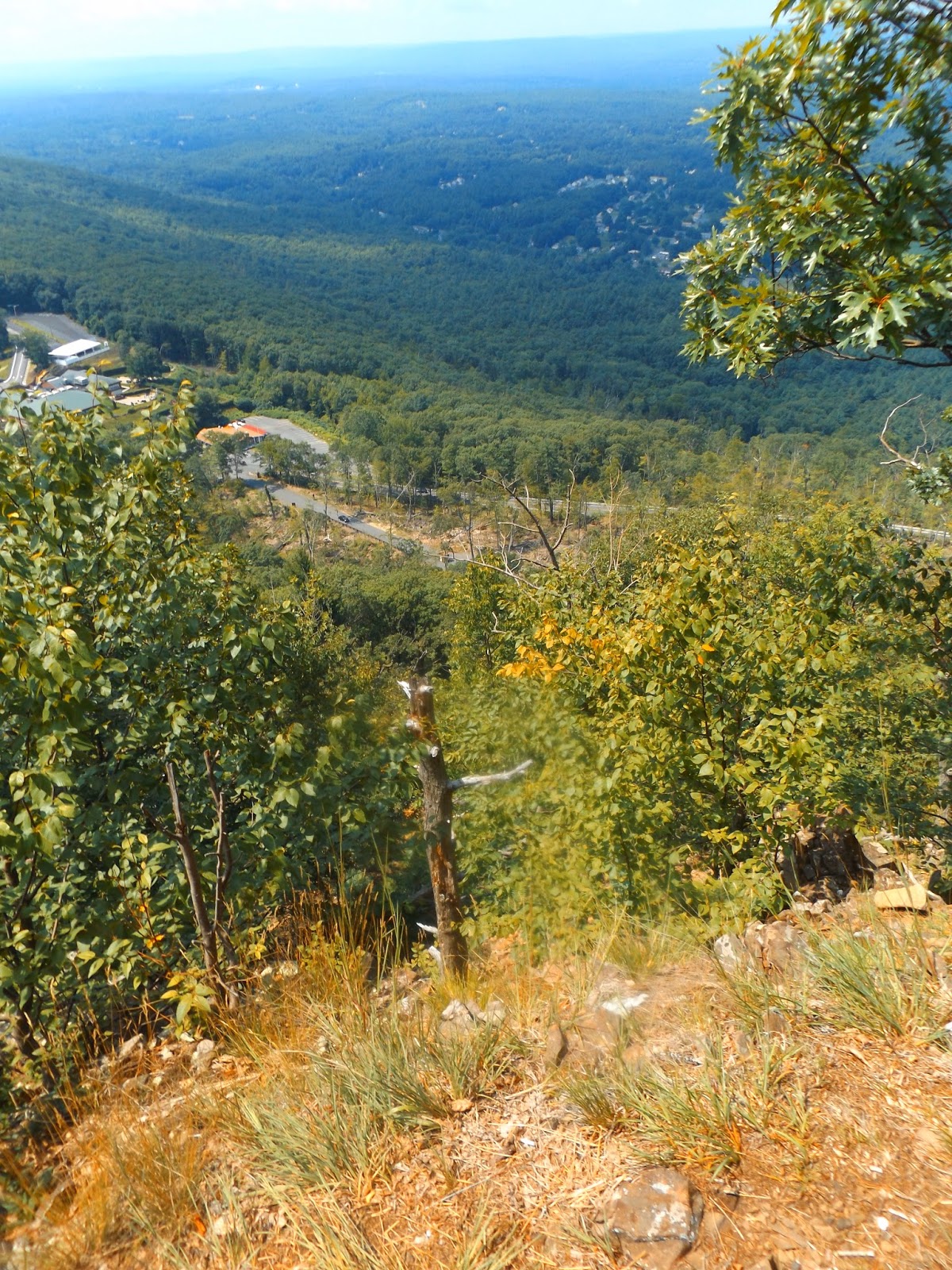
The village of Easthampton and Route 141 can be seen far, far below this rocky perch.
Watch your step.
Steps from the former hotel, which stood at Mount Tom's summit.
An incredible west facing panorama from Mount Tom's 1202 foot summit.
The trail soon drops off the summit, but continues to follow the cliff tops for quite a while.
The views are seemingly endless as the trail heads north.
I hiked about 2.6 miles to Whiting Peak(1,014 feet), where I opted to turn around due to the extreme heat.
Rumbles of thunder and threatening skies loomed to the north, as I retraced my steps back along the cliffs to the car, completing about 5.2 miles RT.
My next stop was the Mount Sugarloaf State Reservation located only about 2 miles east from exit 24 off of I-91 at the intersection of Route 116 and Sugarloaf Street. There is a toll road that vehicles can take to the top of the mountain, or a small parking lot allows hikers to climb the mountain for free. Steps lead away from the parking lot and bring you to a small board with trail maps available. This mountain, while short in stature(652 foot elevation), is big on views.
Although the trail is not very long, it is pretty steep, and with extremely humid conditions, I was working up a good sweat.
Steep climb.
After about half a mile, you arrive at the large open summit of South Sugarloaf. There are good views from the ground, but even better views from a small tower. Here is a view of the route 116 bridge crossing the Connecticut River with the small village of Sunderland along its east banks.
A panorama to the south of the Connecticut River and its valley. Notice the thunderstorms forming to the west.
Hiked about 1 mile RT at Sugarloaf and 6.2 miles total for the day under sweltering heat.


No comments:
Post a Comment