With a perfect summer forecast ahead of us for the day, I drove north to the Adirondack High Peaks to do a hike today, not really sure where I wanted to go. As I got off exit 30 and drove along Route 73, I noticed all of the crowded parking lots along the road and quickly realized that everything was going to be packed today. So I decided to dig into my mind for a place with nice views but small crowds and remembered reading about the Nun-da-ga-o Ridge Loop trail. From Keene, turn north onto County Route 13(Hurricane Road) and continue for 2.2 miles to gravel O'Keefe Road. Follow this to the very end of the road where a designated DEC parking lot is located. This spot is known as Crow's Clearing, and there were only a handful of cars there when I arrived.
After leaving the parking lot, the red marked trail for the Crow Mountains heads north, and begins ascending almost immediately.
After about a half mile, the trail forks. To the left is the official state maintained trail to Big Crow Mountain, and to the right is the Nun-da-ga-o Ridge Loop. I opted to climb the .2 miles to Big Crow's summit first.
Although only .2 miles to the top, this climb is pretty steep.
Approaching Big Crow's 2815 foot summit.
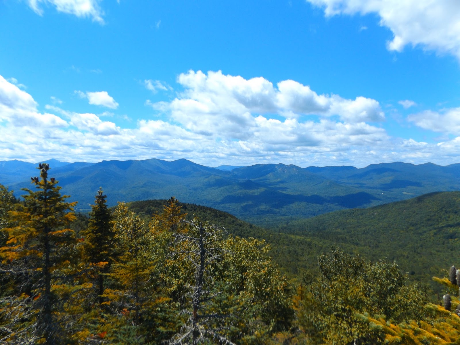
A panorama from Big Crow Mountain's rocky summit area. As many as 28 major peaks are visible from here, as well as many 4,000 footers.
After exploring the open rock areas for a bit, I descended back down the steep slopes.
Arriving back at the trail junction, I turned right this time following the Nun-da-ga-o Ridge trail. This trail is unmarked but fairly easy to follow. The trail travels through deep brush and forest before cresting at many open rock areas along the way.
A view back to the west of Big Crow Mountain from one of the bald clearings.
There is no shortage of views along the hike, so plan to take your time and really enjoy yourself. Here is a section of open rock walking along a ridge line.
This long ridge is often referred to as the Soda Range. There are countless outstanding view points along the way.
A zoomed in view of Whiteface Moutain.
Breathtaking panorama to the south from another clearing.
Much of the unmaintained and unmarked trail is easy to follow, wandering through brushy areas like this.
After about 1.5 miles from the trail head, there is a large rocky cliff that must be climbed.
Ascending the side of the rock cliff.
Once atop the rock cliffs, there are an assortment of different areas to explore, each with a special view of its own.
After leaving that rocky cliff, another steep climb leads to the next.
From this large clearing, there are some of the best views to be had so far. I lingered for a bit here, enjoying the ideal conditions.
The trail leaves the rocky cliffs and re-enters deep woods, basically following the ridge line the entire way. There are several ups and downs along the way, with a couple of fun scrambles.
A great view of Weston Mountain(the next destination) to the southeast from yet another bald clearing.
Coal Dirt Hill's 2927 foot summit sits nearby from here. The trail does not go over the summit however, only skirting a shoulder of the mountain's south side.
The trail drops steeply into a col, before climbing steeply back up towards Weston's summit. The north side of Weston Mountain is very overgrown in spots and is obviously only sparsely used.
A great view of the Soda Range from Weston Mountain's rocky summit. This is the range that I had just hiked along for the past couple hours.
A great view point to the south over Lost Pond from Weston Mountain's 3180 foot summit.
The steep descent off of Weston Mountain.
You will soon pick up yellow discs once arriving at the Biesemeyer Lean To along the north side of Lost Pond. This is the beginning of the DEC maintained trail again. Unfortunately I didn't really check out the Lean To much because it was occupied by a large family.
The trail follows the west side of the pond, with a couple of informal paths leading to the shores. Here is a great view south with Hurricane Mountain rising steeply beyond.
A stunning panorama of Lost Pond.
The trail continues to descend on its way towards Gulf Brook. I passed another Lean To near the brook(offset several hundred feet up in the woods off the trail), but this too was being used already, so I didn't bother them.
Soon the trail levels out and turns west towards O'Keefe Road, eventually completing the loop. About .6 of a mile before the car, I came across this huge split boulder. Thought it was pretty interesting to see and can only imagine how this has happened over time.
Felt absolutely amazing out today, with refreshing temperatures and low humidity. If only all summer was like this! Hiked about 6.6 miles total RT.


No comments:
Post a Comment