Headed down to the Catskills to bushwhack the east ridge up Cornell Mountain that my buddy Jim and I saw last week when we explored the slide on Friday Mountain. It looked like a steep route, but potential for views. We met up with Stash, another friend of ours and started the day from the end of Moon Haw Road. Elevation is under 1200 feet to start, as we followed Wittenburg Brook NW towards the ridge. A well deserved nice fall day was in the forecast for our journey.
Luckily, we found a good woods road that lead right up the lower part of the ridge to over 2000 feet. Just above 2100 feet, we found our first rock ledges to get around.
These were easily negotiated and we continued our ascent.
Once atop the ledges, the ridge continues a long gradual climb, with some incredibly steep ledges to the northeast. From an opening along the ridge, we spotted some nice views across the abyss to Wittenburg's far SE ridge.
Further to the SE, the end of Witt's SE ridge is visible with the Ashokan Reservoir peeking out in the distance.
A zoom view shows Witt's SE ridge enveloped by early morning shadows, with just a hint of the Reservoir beyond. South Mountain and its radio tower can be seen to the right.
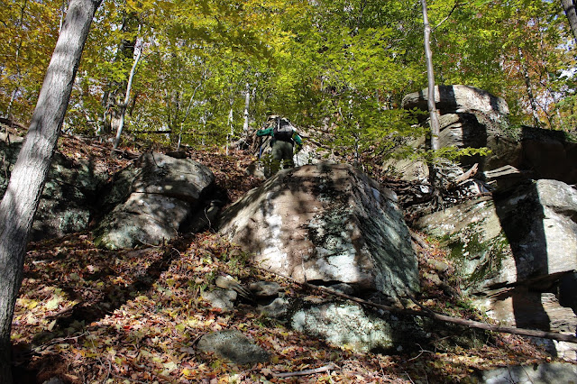
Continuing our march up the ridge, we began to hit some very steep rock ledges that could almost be better defined as 20 to 25 foot walls. We had to carefully choose our routes up and around these huge rock walls.
From atop one of the steep drop offs, at just over 3100 feet, Stash takes a moment to soak in the NE view.
From the ledge, we had a very good view NE to the Devils Path peaks.
Through the trees, we were now high enough to capture much more of the Ashokan Reservoir over Witt's SE ridge.
3780 foot Wittenburg Mountain, standing impressively just to our north.
From the other side of the 3100 foot ledges, we found even more impressive views!
A great view of Balsam Cap and Friday Mountains, with Friday's slide that we were on last week clearly visible about 1000 feet below.
A zoom view of Friday Mountain's slide!
Stash, standing at the edge of the precipice. It's hard for the camera to capture just how ungodly steep this area was.
Balsam Cap and Friday Mountain, both Catskill high peaks, captured from a unique perspective.
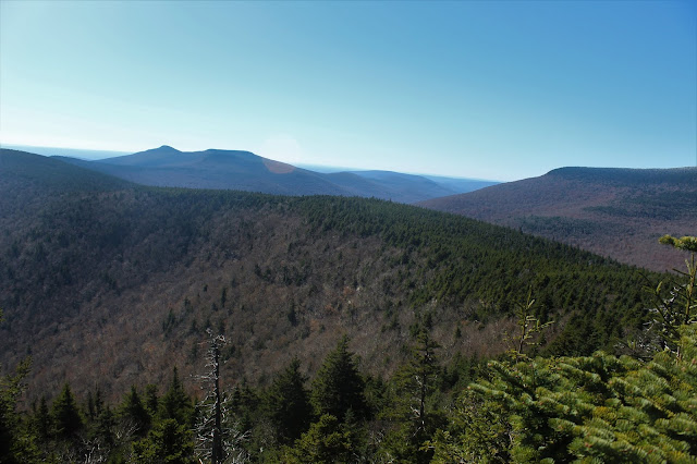
From 3100 feet, the ascent only got steeper. It was a slow go, as we hit rock band after rock band, with some of the walls well over 30 feet high. There were even a couple points that we weren't sure we could make it up. But, luckily our perseverance paid off, and we made it to the summit ridge, where a light dusting of snow and ice glazed everything. A scratchy route through thick spruce brought us to a wide open rock ledge with amazing, sweeping 180 degree views. Ashokan High Point(L) and neighboring Little Rocky to its right in the distance. In front of that our the lower summits of Breath Hill and Hanover Mountain, with Balsam Cap to the far right.
Turning further to the right, and looking more SW, we had an awesome view over the Dink of Peekamoose and Table, with the south ridge of Slide to the right.
From 3800+ feet, this time looking down on Balsam Cap and Friday.
We even managed to spot a clean view of the Ashokan Reservoir to the SE above the tree tops.
After clawing ourselves away from the wide open ledges, we pushed our way through the scratchy spruce to Cornell's 3860 summit. More importantly, we finally hit a trail, which was nice after our exhausting ascent. We made our way on the trail over to the view point of Slide Mountain's snow capped summit to enjoy a well deserved lunch break.
Giant Ledge and Balsam Mountain beyond from the view point. Unfortunately, the winds were quite strong up near the summit, with biting wind chills and icy trails. This made our decision to head back down an easy one.
The bushwhack descent from Cornell can be extremely difficult, but we headed slightly south towards the Dink and made our way slowly down. This route is VERY steep and rock jumbled. This is quite exhausting, especially after our route up.
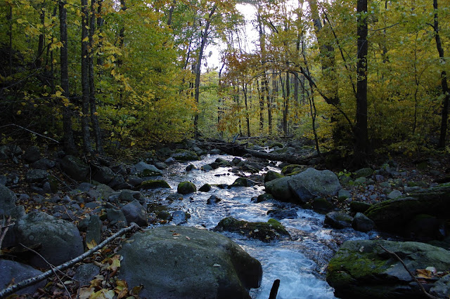
Further down the mountain, we hit one of the tributaries of Wittenburg Brook. Even this was pretty steep.
Once back down below 2000 feet, we were welcomed back into autumn like conditions, with bright sun and surprisingly good color remaining on the trees.
Our golden descent. We eventually found our way back over to the woods road we had taken up, this time battered and beaten, We were all quite tired and happy to see a woods road at this point.
We finally got back to the car, wiped out but all feeling good. A very challenging 8 mile, 3000 foot ascent bushwhack. The numbers don't tell the story of this hike, as the terrain is so difficult to hike. Exhausted is the perfect word for this one.


No comments:
Post a Comment