There are a few different options to hike Park Mountain, but the shortest and most interesting appeared to be a route from the south starting at DEC land on Beaver Pond Road. We started at an elevation of about 975 feet as we headed into the woods on a breezy, cool morning. The woods were very inviting as we headed straight up through open hardwoods.
Park Mountain is actually made up of a few small summit bumps. The approach to the most southern summit was quite fun, as we tried to steer over to a set of south facing ledges.
Jim, stopping to check out the cliffs.
Early morning views SE over the Beaver Pond and a sliver of Brant Lake in the distance. The Three Brothers can be seen in the distance left.
The route from the south is a bit like threading the needle, being sure to stay on DEC land where it connects. The open woods made for easy hiking.
There's something about these blissful fall days...maybe it's the smell in the air, the crunch of the leaves, the crispness in the air...but it's fantastic.From the southern knob, which rises to just over 2000 feet, there are good views south again from a large open area. Unfortunately, the trees below have grown up just enough to slightly obscure the view.
Evidently the only thing that would make this view better would be a bottle of wine...oh wait...somebody left a bottle here. A very strange find.
A zoom view towards the SE(Catamount-left, Sugarloaf-center, Black Mountain-right). In the distance are some of the Greens in Vermont.
Less than 3/10 of a mile away from the southern knob sits the summit as marked by the USGS. From there is a spectacular view west towards Schroon Lake.
Schroon Lake with Ledge Hill impressively above.
A great photo op.
Zoom view to the NW.
Park Mountain's summit.
After enjoying the summit, we retraced our steps back coming back down to the southern cliffs. Prickly Ash Mountain is the small peak to the south.
Beaver Pond sits directly below a set of vertical rock cliffs with Brant Lake again in the distance.A steep drop off nearly 400 feet below to the marsh area just west of Beaver Pond.
From the far west edge of the cliffs, we managed to catch a glimpse towards(left to right)Number 8 Mountain, Little Stevens, and Stevens Mountains.
We circled back over to the SW ridge and made an easy descent back to our cars. A pleasant 5 mile RT with 1600 feet of ascent. The open woods don't get much better than this.
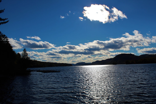
On the way home I stopped by Brant Lake to take in the view to west(Sand Beach Mountain on the right).


I really liked that ledge overlooking Beaver Pond.
ReplyDeleteSweet little hike with open woods and open ledges...doesn't get much better than that.
DeleteWOW that looks awesome; I've been to the Pharaoh Lake Wilderness a few time but I didn't know about this mountain...Thanks!
ReplyDeleteSo many beautiful little peaks in the Pharaoh area that few ever visit..
Delete