Went to check out a rarely visited peak, simply labeled 693 m on topo maps, in the Hoffman Notch Wilderness on Sunday. While there is no given name to this peak, I've heard it referred to as Palmer Pond Mountain or North Squaw Mountain due to its proximity to those features. Regardless of the mountain's name, it is a real hidden gem and almost directly in plain sight, towering above Exit 29 of the Northway. The DEC created a parking area right off Blue Ridge Road just west of the Exit 29 ramp, providing access to Palmer Pond and its southern shores.
Took a few moments to check out Palmer Pond, which sits just a short walk away from the parking area. Elevation to start was down at 876 feet.
Continuing on, a handsomely built bridge provides easy crossing over "The Branch", which is the pond's outlet.
From the bridge, a look back over at the dammed area of "The Branch", which helped create Palmer Pond.
The jeep trail circles around to the south side of the pond for about a hundred yards, before dead ending. That is where I began my bushwhack, and almost immediately I was climbing steeply. I quickly realized that the black flies would be accompanying me for this hike too.
The forest changed between hemlocks and hardwoods and was quite nice to hike through. On my ascent, I began by heading southeast over to the first set of ledges I found at about 1350 feet. These ledges almost literally hang right out over the southbound side of the Northway, and do provide some nice views.
An early view from the low ledges, looking east towards Frontier Town.
South views from the low ledges, with a hint of the Northway peeking out.
A small drop from the first ledges, lead me to another set of impressive cliffs, which I had to find a route up. I circled around to the north side of these cliffs to find an easier way up.
The mountain actually has two peaks, and to climb it from the north you have to go over both summits. Once on the main ridge of the north summit, I found the going to be quite pleasant.
Ledges ring the south side of the ridge, providing some nice views along the way.
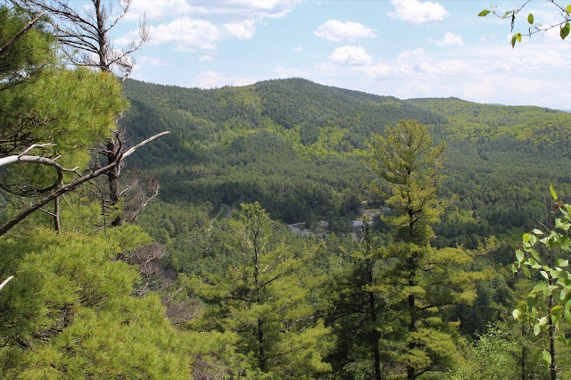
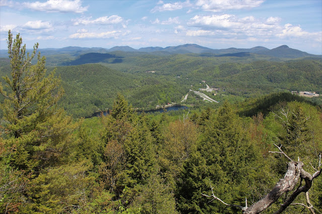
A short distance before the north summit, I managed to find my first clear view NE back down to my starting point along Palmer Pond. Blue Ridge Road, the Northway and Frontier Town are all visible down in the valley, with the peaks of the Hammond Pond Wild Forest beyond.
Just below the north summit, I came across this large vernal pond.
The north summit is wooded, but just a few yards away, I did find one peek a boo view toward the south summit, which was my main goal.
A small drop and re-climb brought be up to the south summit, where I was almost overwhelmed with spectacular views. Although only 2274 feet, this small peak, more than makes up for whatever it lacks in stature with incredible views from the mostly open summit area.
To the south, the Northway can be seen winding along, with a small section of Schroon Lake also visible.
The pine and rock summit area that makes this such an incredible place.
From the summit, you are afforded an up close and personal view of Hoffman Mountain(L) and Blue Ridge Mountain(R), which tower impressively to the SW.
To the north, many of the High Peaks are easily visible.
A look NW towards Blue Ridge Road, with the Adirondack Buffalo Farm in the clearing along the road.
A zoom view south towards I-87 and Schroon Lake.
A zoom view to the west, where Blue Ridge Road snakes its way between the peaks.
After enjoying the summit views, I finally headed back down, heading in a more direct line to the car on the descent. I tried to keep a good move on to avoid the worst of the black flies. Hiked about 5.5 miles total with over 1600 feet of total ascent.


No comments:
Post a Comment