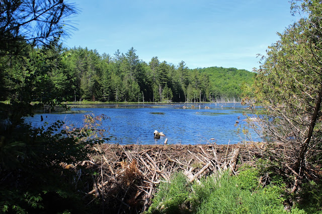
The trail is actually an old road and is in great condition. After roughly half a mile, the trail crosses Rogers Brook on a wide bridge, with views of a large beaver pond to the west.
After crossing the bridge over Rogers Brook, I left the trail and began my bushwhack, heading NE up and over a small knob and then back down towards a stream crossing near the SE end of North Pond. Suddenly, I picked up a flagged route. I followed it for a bit, but it started to climb up the flanks of Hedgehog Hill, so I simply continued my bushwhack north and east, side-hilling above the wetlands down low. Out of nowhere once again I picked up the flagged route heading towards Jones Hill so I followed it.
The flagged trail was very nice and easy to follow as it climbs directly up the SW spine of Jones Hill. The ascend is pretty straightforward and fairly steep in spots.
The approach up the spine was really pretty, and as I approached a false summit, the woods gave way to a wide open SE facing viewpoint.
From the steep, grassy slopes I found this view east towards Pharaoh Mountain.
A closer look at Pharaoh Mountain, with its impressive rock covered slopes.
To the SE, a wonderful view towards Schroon Lake!
After enjoying the south and east facing views, I continued heading up and over another false summit bump with numerous NW views along the way. From a an open area of rock ledges, I enjoyed this view of Hoffman Mountain, Blue Ridge Mountain and the Peaked Hills in the foreground center.
From a steep set of west facing ledges, I found this view north up the Northway corridor.
The most impressive view of all was certainly Hoffman Mountain, with a summit nearly 2000 feet higher than Jones Hill and prominent from many different vantage points.
The long south ridge of Hoffman, with the summit to the far right.
After a short ascent up through a hardwood forest, I could see the final approach to the summit!
From the summit, there are good views south and west. To the west, another view of the conical summit of Hoffman Mountain.
A very good view south back down the ridge at the false summit.
After enjoying the summit and the SW ridge walk back down, I decided to leave the flagged route and bushwhack SW, dropping to a stream crossing.
Once across the damp area near the stream, I kept my feet dry on the lower slopes of an unnamed knob before dropping down to the north shore of North Pond. The deerflies really began to pick up at this point, so I hurried along.
A look at the far NW end of North Pond, where there are many, many fallen trees.
I contoured all the way around the NW end of North Pond before turning west and heading right at Big Pond. Within just a few minutes I hit the blue blazed trail to Big Pond, which I was only on briefly before I followed a herd path down to Big Pond.
Found a nice little fire pit on the north shore of Big Pond, so I decided to stop and have a snack and drink here. A light breeze and the sun splashed waters made for a perfect spot!!!
I seriously could've stayed at this spot all day...the breeze kept the deerflies away too.
After finally leaving Big Pond, it was a nice and easy 1.6 mile trailed hike back to the car. I stopped for just a moment at the unnamed beaver pond on the way back to check out the beaver hut. A pretty little spot just a few feet off trail.
Got back to the car and honestly wished the day wasn't over. A wonderful day in the woods. 9 miles RT, with over 1500 feet of ascent.
Red=Ascent Blue=Descent(return)


Great views! That sweet spot on Big Pond looked pretty awesome too...I love finding a nice spot on the water like that, the only problem is, like you indicated, it's difficult to leave! As always, thanks for the photos.
ReplyDeleteThanks Ned! Appreciate it!
DeleteI'm thinking that flagged route is where the ADK extension of the North Country Scenic Trail will be going through. Per the attached, it looks like it is expected to be opened in 2021. See trail plans under "existing trail segments" link in the attached. https://www.adk.org/protect/volunteer/north-country-national-scenic-trail-adirondack-park-plan/
ReplyDeleteJeff O!, I think you are correct. If so, Jones Hill will not be a well kept secret much longer.
Delete