Threatening skies above kept a little pep in my step as I set out initially on the wide open, mowed yellow blazed Overlook Trail, which leaves the Visitors Center off of Schoharie Street and closely hugs the shore of the Schoharie Creek.
Wildflowers are in bloom and kept it quite fragrant the entire walk. I believe these are Dame's Rocket, which were very abundant along the trail.
The Erie Canalway Trail and Route 5s bridge can be seen just upstream on the Schoharie to the south. It's been a bit dry recently so the water levels are down, hence all the rocks visible.
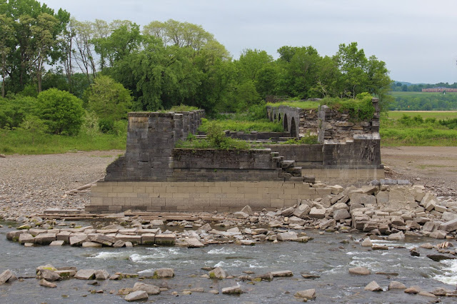
In 1941, one of the piers fell, which lead to the decision to demolish all but 9 of the remaining arches to allow for better stream flow as well as avoid potential further collapse and damage. In the following decades, flood waters have contributed to further collapses, and today only 6 arches remain.
More Dame's Rocket along the trail.
I continued north past the Overlook Trail all the way to where the Schoharie and Mohawk converge. It was a bit of a disappointment, however, as with the Barge Canal not in operation, there was very low water. Here is a look NE towards Lock 12 at Tribes Hill.
Looking back south at a wide, placid area of the Schoharie, just before it meets the Mohawk.
I turned back here, heading back to the Overlook Trail, and then onto the red blazed Towpath Trail. The trail is very pleasant and easy walking, heading NE through a grassy, shaded corridor.
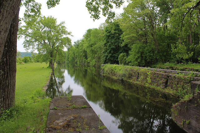
Where the blue blazed trail comes in from the right to meet the red trail, you will find the remains of Empire Lock 29 from the Enlarged Era Erie Canal, which was required to better handle boat traffic . This lock was constructed in the 1840's and is one of the best preserved locks from that enlarged Canal.
Just downstream from Empire Lock 29.
I remained on the red blazed Towpath Trail all the way up to where the Mohawk River becomes visible on the left. Pepper Island is the land mass across the water.
At the end of the Towpath Trail, I came to the "Yankee Hill" Lock No. 28, which was originally completed in 1841 and then enlarged in 1885.
Another angle of Yankee Hill Lock No. 28. There were a ton of geese down in the field so I skipped going any further.
The State has done a great job with informative signage along the way.Right beside "Yankee Hill" Lock No. 28 is the 1856 Putnam's Store, which was operated until 1908.
After enjoying the picnic area around "Yankee Hill" Lock No. 28 and the Mohawk River, I began backtracking towards the car on the pathway.
Once back at Empire Lock 29, I turned onto the blue blazed Woodchuck Walk, which passes besides fertile farmland and "Clinton's Ditch"(the nickname for original Erie Canal-constructed between 1817 and 1825) on its way back to the Visitor Center.
Back near the car, I came to the site of the the first bridge of any consequence over the Schoharie Creek, which was completed at the very end of the 18th century. Unfortunately, the bridge didn't stand very long, as the eastern end of the bridge was paritally destroyed by ice February 23, 1814. A local gentleman named Christian Service, drowned trying to cross the creek that night, unaware that the bridge had been damaged. Today, very little remains of the first bridge.
Walked about 5.5 miles round trip on a very overcast morning. Only saw a couple folks all day.


I never heard that name ... always called it phlox
ReplyDeleteI guess they are a different plant ... phlox has five petals
ReplyDeletegood.according to roofers
ReplyDelete