Took advantage of a beautiful, fall like afternoon by heading up into the hills of Rensselaer County to visit the Rensselaer Plateau Alliance's Grafton Forest at the end of Stuffle Street in the town of Grafton. One bit of caution for anyone attempting to visit here though...the ride in can be a bit of an adventure if you don't have a high clearance vehicle. Luckily my SUV had plenty of clearance, but I definitely took my time driving in. Bright blue skies, a cool breeze and temperatures in the upper 60's were just the recipe for a gorgeous stroll as I set out, elevation to start was just over 1340 feet.
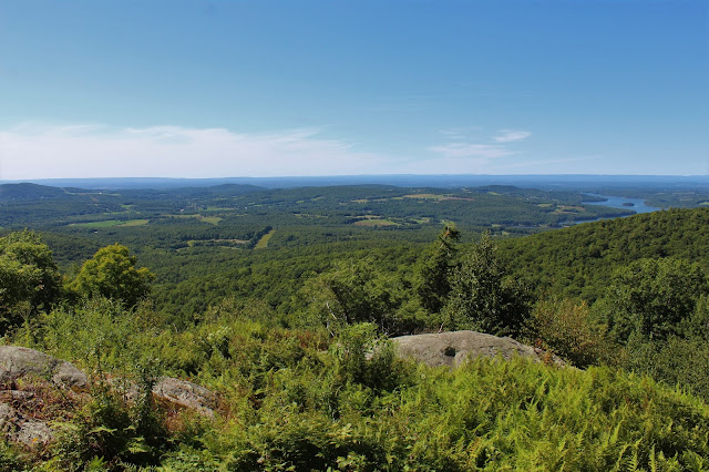
Less than half a mile into the hike and I had this view! Jackpot!
Looking north towards the Tomhannock Reservoir.
From the large clearing at the Valley View, I took in this view NW across northern Rensselaer County.
The foot trail continues past the Valley View, working its way north-northwest crossing a maze of fern filled old woods roads along the way.
After a little bit of ups and downs, I finally came to the spot known as the Vulture View. What a spectacular perch! The view is similar to the Valley View but closer to the Reservoir and gives a slightly different perspective to the surrounding landscape.
To the east of the Reservoir, the rolling farmland and hills of Rensselaer County into Washington County stretch as far as the eye can see.
A closer look provides a glimpse of the farmland on Fords Hill and traffic on nearby Route 7 at the south end of the Reservoir.
After soaking in the vista for several minutes, I continued on, following the orange blazed Vulture View Trail for roughly half a mile back to the white blazed Whoop-de-do Trail, which is really just a rough forest road.
The Whoop-de-do trail makes its way NE passing by a large wetland, which sits just off trail to the right.
A short distance later I came to a handsome little Lean-To sitting unassumingly in an open wooded area.
I stopped to check out the Lean-To, which appears to be newly built and is in pristine condition. The gorgeous day and the quiet setting made for a perfect spot to stop and chill for a bit. I really enjoyed soaking up the serenity here.
Just a few yards in front of the Lean-To is this view, across the large marshy area. The Forest map refers to this marsh as a "Oligotrophic Dimictic Lake". Not entirely sure what that means.
From the Lean To, I picked up the red blazed High Point Trail, which passes through one gorgeous fern glade after another, as it modestly makes its way uphill to the east.
Bear claw marks! Very cool!
Followed the red blazes back to the car for a total of 4.8 miles RT. Elevation gained was around 800 feet on a nearly perfect(in my opinion) late summer afternoon.
Updated trail map of Grafton Forest, as posted inside the Lean-To.


Good to see you back in action
ReplyDeleteThank you! I really appreciate that!
DeleteThank you! This is helpful.
ReplyDelete