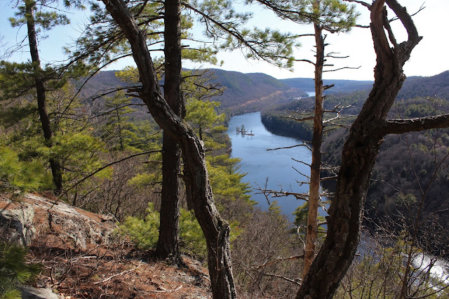
Headed north after work this afternoon to do a short bushwhack hike of 1041 foot Palmertown Mountain, which sits just north of Spier Falls Road near the Sherman Island Boat Launch in the northern section of Moreau Lake State Park. There are no marked trails in this section of the Park, but there looked to be some nice ledges that rise steeply above the Hudson River so I thought I'd give it a look. First took a moment to soak in the tranquility of the Hudson from my starting point at the Sherman Island Boat Launch(elevation 360 feet). A nearly perfect, sunny 50 degree day in early April...hard to ask for more than that.
A bit of a clearing higher up. Other than the steep terrain, there was very little undergrowth to slow me down.
Although the slopes were very steep, there was surprisingly good footing nearly the entire way up, with continuous screened views back down to the river behind me.
A window down to the Hudson River and Sherman Island, near my starting point.
High up on the ridge, I came across this cross, which seemed to be some kind of memorial?
While there are a few okay views along the way, there are two very good ledges at the NW edge of the false summit area.
Open views directly down over the Hudson River looking SW.
West views across the Hudson River into the hills of southern Warren County.
The drop off from here is nearly vertical, but what an awesome little spot!
After enjoying the ledges, I headed generally east towards the summit. Between the summit and false summit, I found this pretty little vernal pond.
A short distance further, just below the true summit, was another vernal pond, still partially frozen in a very thin layer of ice.
One last push brought me up to the wooded 1041 foot summit, marked with pink flagging. No views from here.
The whole summit area is nice and open for exploring, but the public land ends just east of the actual summit, so I dropped south from here, descending rather quickly. Although late winter and early spring have been fairly dry, the small streams and drainages on the peak were flowing quite nicely.
As I got lower, I began noticing pink flagging heading down the mountain. A future trail in the works? Looks quite possible.
Headed south/ southwest down off the mountain and back to the car, where there were a handful of others out enjoying the gorgeous spring weather. A nice and short, but fun 2.5 mile RT with 850 feet of ascent.


Just gorgeous thanks for sharing.
ReplyDelete