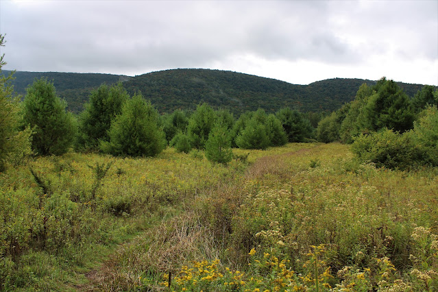
Headed south into the Catskills this morning to do a little exploring up the south slopes of Blackhead Mountain, starting down near Colgate Lake. I had done this part trail/ part bushwhack hike several years ago and wanted to revisit an area of large grassy ledges around 3750 feet. Parked in the second DEC parking lot on the left-past Colgate Lake(Elevation 2130 feet) and set out on the yellow marked trail heading north. The trail passes through expansive meadows with views of many of the surrounding peaks., such as this look south towards West Stoppel Point. Unfortunately, overcast conditions as well as fog and low clouds were holding tight, so I was hoping that they would clear out as the day wore on.
The steep areas were interspersed with flat, grassy areas as is typical with many Catskill peaks. This was a large, grassy clearing at around 3200 feet.
The woods grew a bit tighter and snarled just below the ledges around 3700 feet, with a thick layer of fog hanging tight above.
As I made my way up to the grassy ledges, I found several outstanding vistas-even with the fog not budging much. Here's a nice view SE towards Arizona Mountain, with the Hudson Valley just beyond to the left.
A view SW, with a corner of Colgate Lake visible through the mist.
From the grassy clearing, the view south takes in both Colgate Lake(right) and Lake Capra(left) and the long ridge of West Stoppel Point just above. From this vantage point, I could really see some of the early fall colors popping out.
SE views once again, with Arizona to the left and Stoppel Point to the right, shrouded nearly completely in low clouds.
I hung out in the grassy clearing for nearly an hour, eating lunch and hoping for the clouds to clear out but to no avail. Even with the thick cloud and fog, the views were still quite nice however!
On the descent, I chose a slightly different route down instead of staying right on the ridge and ended up hitting a rough old woods to help ease the way.
A quiet, peaceful descent through mostly open hardwoods finally brought me back down into the Colgate Lake Wild Forest, where, at around 2300 feet, I stumbled back onto the marked DEC trail, which I easily followed back out the car.
A wonderful day in the woods, although I wish the clouds had cleared just a bit. Hiked about 5.4 miles RT, with over 1800 feet of total ascent. Didn't see another person all day.
Map Below. Red P=Parking Red X=Grassy Ledges


.JPG)
.JPG)


No comments:
Post a Comment