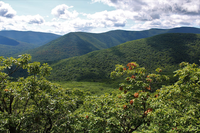
Headed south today to do a bushwhack hike to 2200 foot Little Samuels Point and 2885 foot Samuels Point in the heart of the Catskills. Weather was almost perfect for this hike, which I had done in parts previously, but not altogether. Parked in a small, unmarked parking area beside old stone pillars from a former estate along Route 28A(Elevation 760 feet) and headed west into the woods along the remains of an old road.
The old road peters out a short distance in, so I simply bushwhacked up through open hardwoods. The woods were mostly quite pleasant, save for several large patches of thick mountain laurel. Stumbled upon some kind of large, rocky clearing in a plateau like area. These type of areas seem to be unique to the Catskills.
My ascent was pretty easy, until I hit a large tangle of mountain laurel around 1850 feet, followed by a steep climb up towards Little Samuel Point's ledges.
From the large boulder looking southwest towards(L-R) Ashokan High Point's ridge, Little Rocky, and Hanover Mountain.
Further to the SW, Wittenburg's southeast ridge is in the foreground, while the ridge of Hanocer to Balsam Cap in just beyond and the valley of Moon Haw Road in between.
To the south, South Mountain and Ashokan High Point can be seen through the treetops.
A short ascent from the ledges, brought me up to the 2200 foot summit of Little Samuels Point, which sits in a nice, large clearing. While checking this area out, a large animal went crashing into the woods less than 20 yards away from me, but I didn't see what it was. Startled me to say the least!
From the top of Little Samuels Point, I utilized a herd path that dropped down through a thick area of mountain laurel to the 2175 foot low spot between peaks. From there, the summit of Samuels Point sits less than 4/10 of a mile away, but is over 700 feet up. It was a very steep climb up through several areas of cliff bands and was quite a workout.
Finally arriving at the 2885 foot summit of Samuels Point, which itself sits in a large clearing.
A short distance away from the summit is a fire pit and view point to the north from a steep area of ledges.
From the view spot, looking north towards the Devils Path peaks. Although nice, this view is slightly better in the winter when the leaves are off the trees.
After enjoying the summit, I began my descent, being sure to explore the slopes a bit more in an effort to find some views. I did manage to find this nice framed view of the Ashokan Reservoir just below the summit area.
Further down, I found some additional views on Little Samuels Points north slopes towards nearby Ticetonyk Mountain.
A steep, but pretty straightforward bushwhack down through open woods brought me all the way back to the car for a total of just over 5 miles RT and nearly 2300 feet of total ascent.
Map Below.
P=Parking Blue X=Little Samuels Point Red X=Samuels Point


.JPG)
.JPG)
.JPG)

No comments:
Post a Comment