Took advantage of a beautiful day and headed into the old Dix Mountain Wilderness(now the Eastern High Peaks Wilderness) to visit a trio of unnamed peaks, that are often referred to in the hiking community as The Three Gems. To get started I parked in the unmarked pull off for the South Fork Boquet River "Trail"(Elevation 1160 feet), less than 1/4 of a mile past Malfunction Junction(Route 9 and 73 split). Headed into the woods and easily picked up the trail, which is unmarked but very obvious heading southwest. The trail stays in hardwoods for a while before dropping down beside the South Fork of the Boquet River for a bit.
After about 2 miles on the trail, I began my bushwhack heading east, climbing steadily up to Gem #1. There is quite a bit of open rock to explore here, with pretty solid views to boot.
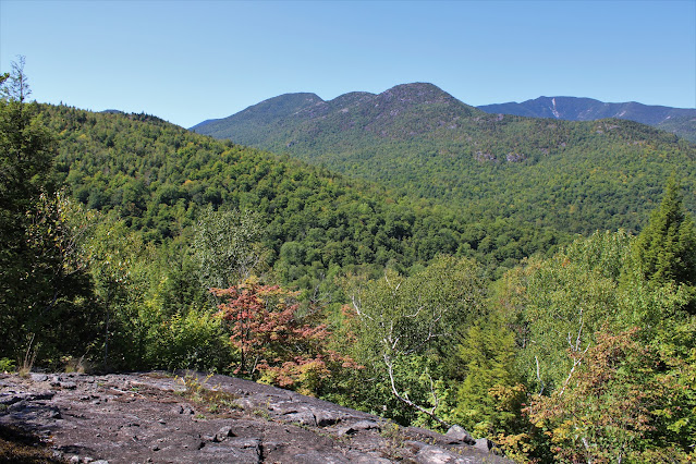
South views from just below the summit area, with a hint of fall color sneaking in.
Looking up at the 1890 foot summit.
After enjoying Gem #1, I dropped down about 350 feet, before a steep 500 foot ascent through open hardwoods to Gem #2. The views aren't nearly as nice here, but they are still okay from several open patches of rock and moss.
View east towards Moss Ponds and the distant peaks of the Hammond Pond Wild Forest.
The open rock atop the 2050 foot summit of Gem #2.
Gem #2 has similar views similar to Gem #1 towards Spotted and E-4. In the foreground is Gem #3 with some open rock near the top clearly visible.
Just before descending Gem #2, I caught this nice glimpse west towards Noonmark Mountain.
An easy bushwhack through more typical hardwoods brought me over to Gem #3, which is also the highest of the three peaks.
There is actually more open rock on Gem #3 than the other two peaks combined, with some really outstanding views as well. Here's a look SW towards(left to right) Wyman Mountain, Grace(East Dix) and Spotted Mountains.
Dropping off the 2250 foot summit, with open rock all around.
South views towards(left to right) Buck, Bear and Wyman Mountains. Camels Hump is in the distance just beyond.
East/ Southeast views.
There are great views north & northwest as well(left to right) featuring Noonmark, Round, Giant and Rocky Peak Ridge.
Just prior to beginning my descent, I caught a neat look back at the open rock on Gem #2.
An easy bushwhack down brought me back to the unmarked trail, which basically follows the east side of South Fork all the way back to the car. Hiked about 6.5 miles RT, with over 1400 feet of total ascent and of course didn't see another soul in the woods.
Map Below. Blue P=Parking Red X's=The 3 Gems


.JPG)


.JPG)

.JPG)
.JPG)
.JPG)
.JPG)

No comments:
Post a Comment