Search This Blog

Thursday, February 10, 2022

The Dome-South Ledges(Green Mountain National Forest-Vermont)

Headed over to the Vermont/ Massachusetts state line after work to do a little exploration in the Green Mountain National Forest on yet another mild winter day.  With limited time, my game plan was to head partway up The Dome from White Oaks Road for about a mile and then bushwhack over to a steep area between the Dome Trail and the Agawon Trail at around 1800 feet.

The trailhead was not plowed but manageable to park in, although I could see it getting tricky with the thawing and melting taking place recently. Elevation at The Dome Trailhead is a just a touch over 1000 feet and I was the only car there to start.


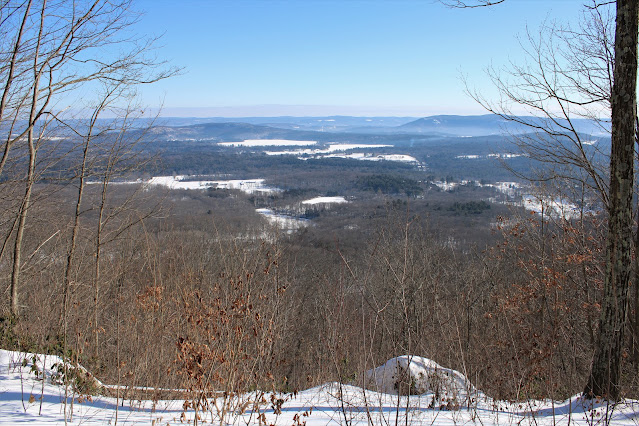
I threw my microspikes on and set out on the hard packed trail, steadily gaining elevation east, then north up to around 1700 feet.  From there, I left the trail and began to contour my way east through several inches of mushy snow.  I was able to locate the steep area of ledges I was looking for just over 2/10 of a mile off trail, with some decent screened views SE towards the north ridge of East Mountain near the state line.
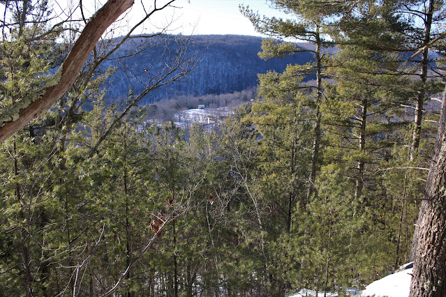
From the same ledges, looking due south into Williamstown. Unfortunately a heavy snow squall was working its way through, hindering what could've been a decent view towards the Greylock Range.
On my return to the trail, the intense, heavy snow squall moved in and dropped visibility down to almost zero.  Thankfully, as quickly as it moved in, it moved right back out, leaving a nice and easy descent back to the car. 

With a little time remaining before the darkness set in, I decided to drive the short distance (less than 1/4 mile south)down White Oaks Road to the Broad Brook Trailhead and do another short walk.  This trail closely hugs the beautiful, babbling Broad Brook, which was especially picturesque in its wintry appearance. 

Hiked about 3 miles total, with just under 900 feet of ascent for the day.


Wednesday, February 9, 2022

Ferncliff Forest(Town of Rhinebeck, Dutchess County)

Took advantage of a sunny and mild winter day by heading down to the 200 acre Ferncliff Forest, located in northern Dutchess County in the town of Rhinebeck.  Parked at the trailhead along Mount Rutsen Road(Elevation 200 feet) and headed out on the yellow blazed Trail, which was well packed down and made for easy walking.  I threw spikes on to be safe, but not sure if they were really needed.

I initially stayed on the yellow trail, which climbs up to the summit of Mount Rutsen, standing at a modest 350 feet.  Although there are no views from the ground, there is an 80 foot steel observation tower at the summit, with very rewarding views at the top.
From the top of the tower, there are great 360 degree views, with the views northwest towards the Hudson River and Catskills being the most stunning! 
South views into Dutchess County.

A closer zoom towards the Kingston-Rhinecliff Bridge and Catskills.

From the tower, I took various trails, which wind their way through the woods, passing by stoic old stone walls along the way.  There are literally a maze of trails throughout these woods, with most being well marked and color coded. 

With temps climbing into the mid 40's, Mount Rutsen Pond is beginning to shows signs of thawing.
Of historical note, there are many old wells and root cellars that remain from a 19th century Church Colony that was located on these grounds. 
Covered many of the trails in the Forest, enjoying the nice weather.  Hiked a nice and easy 2.5 miles total with over 400 feet of combined ascent on a beautiful mid winter day!


Tuesday, February 1, 2022

Lions Head & Mount Riga Shelter(Salisbury, Connecticut-Litchfield Hills)

Took advantage of a sunny and beautiful Tuesday morning by heading down into NW Connecticut to hike Lions Head and a section of the Appalachian Trail.  I would be starting my hike from the trailhead for the Lions Head Connecter Trail on Bunker Hill Road(Elevation 1160 feet), which was plowed, although I was surprisingly the only car there.  Temps were only in the single digits as I set, but quickly warmed up under clear skies and a light south breeze.  The trail was well broken out and compact, making snowshoes more of a hindrance than a benefit through the 6 inches or so of snow.  

The Lions Head connector trail meanders through open meadows and near residential houses, before crossing a private driveway and heading into the woods, where the climbing finally commences. 


The trail climbs steadily west-then north, soon meeting up with the white blazes of the Appalachian Trail after less than one mile and over 300 feet of ascent.  Once on the AT, the trail climbs a bit more steeply north, with one last scramble up to Lions Head summit at 1738 feet.

The views from Lions Head are truly outstanding!  To the southeast, the view takes in the distant Housatonic River Valley, with the Wetauwanchu Ridge in front of that.  The start of the hike down on Bunker Hill Road sits in the foreground, well over 500 feet below. 

 East facing views towards Mount Prospect and Canaan Mountain's long ridge in the distance.

Views to the south, with the Taconic Ridge and Mount Riga to the right. 

After enjoying the summit views, the AT presses on, following the ridge to the north.  Just prior to a descent off the ridge, a nice view opens up to the north, with Bear Mountain and Mount Everett visible.


I followed the Appalachian Trail winding its way north, never dropping below 1550 feet on its way to a spur trail for the Mount Riga Shelter and Campsite.  There are tent platforms, a privy and bear proof containers here, but the Lean To and its views are certainly the highlight!!

East facing views from the Lean To take in a large swath of NW Connecticut.  This must be a truly magical spot to catch the sunrise after a night's sleep in the Lean To.


From the Shelter, I turned back, retracing my steps back over Lions Head and down to the car.  Was quite shocked to not see another person all day on this beautiful mid winter day in the Litchfield Hills!  Hiked 3.5 miles RT, with nearly 1000 feet of combined ascent.

Thursday, January 27, 2022

Mine Mountain Ridge(West Cornwall, Connecticut-Litchfield Hills)

Headed down to the beautiful Litchfield Hills in the NW corner of Connecticut this afternoon to do a little exploring along the north ridge of Mine Mountain.  Mine Mountain is actually a long north-south ridge with multiple summit knobs sitting high above the east banks of the Housatonic River.  To access the mountain, I utilized the Trinity Riverside Trail, which can be found at the very end of Lower River Road, and begins on Trinity Retreat Center Property before entering the Housatonic State Forest.(Elevation at the Trailhead is just a touch over 500 feet).  With the sun shining bright and the trail well used I threw my spikes on and headed south, closely hugging the Housatonic.

(FYI-The public is welcome on Trinity Retreat Center property)

The Housatonic River is just steps away from the trail, which heads south for 1.4 miles.
After about a half mile on the trail, I turned left and began my bushwhack, crossing over the Housatonic Railroad tracks.
The woods are very, very steep but manageable if you pick out a good route.  It was actually quite fun and challenging, gaining over 500 feet in less than a quarter mile. 
The snow actually helped me gain traction in steeper parts, and I was able to enjoy some pretty good views back west on the way up. 
Instead of going straight up, I contoured my way south towards an area of ledges.  From a small perch I was able to enjoy a spectacular view south over the deep River valley, with Mine's true summit(left) as well as Breadloaf Mountain and Silver Mountain in the distance.   To the far right, and almost out of frame is Pine Knob.
After taking in the views, I headed north along the ridge on a blue marked trail, which apparently doesn't see much use, as there were no tracks in the snow at all.
From the very end of the north ridge, and directly above the Trinity Retreat Center, I found amazing NW facing views across the River towards Pine Swamp Hill's multiple summits.
West views with the Housatonic River directly below.
The toughest part of the entire hike was trying to find a route down, as the slopes are quite steep both north and west.  The easiest descent appeared to be on the east slopes, so that is the way I went, carefully weaving my way down.  Once off the steepest slopes, I circled around to the north, leaving the State Forest and heading across Trinity property back to my car.  A fun little adventure on a cool, but pleasant mid winter day.  2.7 miles RT, with 800 feet of climbing.  

 Red P=Parking    Black X=Ledge


Tuesday, January 25, 2022

Palmer Road Preserve(Town of Schodack, Rensselaer County)

Did a short, local walk in Schodack this afternoon at the 57 acre Palmer Road Preserve, which is now owned and managed by the Rensselaer Land Trust.  Parked at the end of Thoroughbred Drive and set out under clearing skies and temps hovering around freezing, with about an inch of crunchy snow on the ground.

Explored various official and unofficial trails through the quiet woods. 

The highlight of the preserve is an unnamed tributary of the Moordener Kill, which flows through the woods here.  With our recent cold snap, it was looking very wintry today.

Walked a nice and easy 1.5 miles total.  Felt good to get out and shake off some cabin fever.


Wednesday, January 19, 2022

Former Beartown Ski Area(Beartown Mountain State Forest-Berkshires)

Decided to take advantage of the last "mild" day for the foreseeable future by checking out an abandoned ski area on the northern slopes of Beartown State Forest in the Berkshires.  Unfortunately, the ski slopes are no longer visible from below but were located on Burgoyne Ridge, which itself is easily visible directly above the Onyx Paper Factory on Route 102 in South Lee. The Ski Area ran from the mid 1930's until the mid 1960's, and was, for a time, one of the largest ski areas in southern New England.  Other regional Ski Resorts, however, began to grow and expand by the 60's, featuring modern lifts and snow guns, which ended up leaving Beartown out in the cold after three decades.

My goal today was to check out some of the remnants of the old Ski Area, so I headed onto the backroads of South Lee, parking at Gate 4 on Beartown Road, just past its intersection with Pine Street and Willow Ave.(Elevation 960 feet)

From the gate I headed west on an unmarked but obvious wide, old woods road. There was only about 3 inches of snow on the ground to start so I decided to carry my snowshoes and wear only if needed up higher.  In less than 3/4 mile of easy hiking, I arrived at Twin Chimneys, which were erected back in 1939 and were part of the CCC Lodge.  

Another angle of the Twin Chimneys, still standing strong after all of these years. 

From the Twin Chimneys, I headed up onto the Polar Trail, which was the main ski slope at Beartown.  Although there are no trail blazes, it is pretty easy to follow the old slopes, as they ascent quite steeply up through open woods.  I turned around several times on my way up, enjoying some very good, filtered views to the north. 

The climb was fairly aggressive, gaining over 650 feet in less than half a mile.  The snow drifted a bit in spots as well, but was never more than 5 or 6 inches at its deepest.

After a good, thigh burning climb, I hit a dark conifer forest and the yellow blazed Ridge Trail, which I briefly followed up to the high spot on Burgoyne Ridge at 1703 feet Elevation. 
After hitting the nondescript high spot, I turned back east, following the Ridge Trail past some more rusted, old, ski resort remnants.
I took the Ridge Trail over to the Kodiak Trail, which was another old ski slope, but even steeper than the Polar Trail.  This trail, at the time of operation, was rated as "Expert" level, and is indeed quite vertical in spots.  I can only imagine how challenging this terrain must have been on a pair of skis.  
A bit lower down on the Kodiak Trail, with the woods seemingly dropping north into the abyss below.
From a small opening in the trees, a look NW towards Yokun Ridge.

I descended steeply back down to the woods road I started on, eventually making my way east back to the car.  Turned out to be a pretty nice day out, with clearing skies and temps in the mid to upper 30's.  Hiked just under 2.5 miles RT, with 800 feet of total ascent for the afternoon. 

For further reading on this and other former Ski Areas in New England, please refer to one of the these amazing sites!

 https://www.nelsap.org/ma/beartown.html

 https://www.newenglandskihistory.com/Massachusetts/beartownmtn.php


Tuesday, January 18, 2022

Cohotate Preserve & Willows at Brandow Point(Greene County-Hudson Valley)

Headed down to the west shores of the Hudson River in Greene County today to do some winter hiking at the Cohotate Preserve as well as neighboring Willows at Brandow Point.  Following yesterday's winter storm, I wasn't sure if the parking lot would be plowed out, but to my luck it was! I was the only car in the lot, and I was also the first to set foot in the fresh blanket of new snow.  There was only about 2 inches of crusty, crunchy snow to walk through so I bare booted it, soon dropping down to the Hudson. A cold wind and temps in the 20's made for brisk conditions, but bluebird skies more than made up for that as I enjoyed an icy view of the Rip Van Winkle Bridge to the south.


A view north up the Hudson River towards Coxsackie.

The trails in the preserve closely follow the Hudson River through the woods, weaving their way through small ravines over several foot bridges along the way.

The Cohotate Preserve is connected to the Willows at Brandow Point by an orange connector trail, which I utiliized to access both trail systems.  Found some informative signage along the way as well.

From Brandow Point, the view south towards the Rip Van Winkle Bridge is similar to the one earlier, although a bit further away.
An old shack near the Point. 
I explored the various trails at both preserves, only seeing a couple other people out all day.  Back near the trailhead at the Cohotate Preserve, I made one side pit stop at a small, frozen over, man made pond.

Hiked about 2.8 miles total altogether with a surprising 500 feet of ascent due to all the small ups and downs along the way.