Search This Blog

Tuesday, October 31, 2023

Mine Mountain(Housatonic State Forest-Connecticut)

Headed over to the NW corner of Connecticut to do a little exploring on a pleasantly cool Halloween.  My first stop would be untrailed Mine Mountain in the Housatonic State Forest starting from Eggleston Road in the town of Sharon, where an unmarked pull off(elevation 900 feet) provides access for 1 or 2 cars.  As I entered the woods, I was immediately greeted with a "Closed Area-No Trespassing" sign, but upon closer inspection it showed that it's only for April 15-October 17th for some reason.  I was safe to proceed.

The climbing is steep right out of the gate but I was able to pick up a good hunters path up to aid the way.  On my climb I passed by an enormous "Aircraft Carrier Rock" akin to the one in the Catskills.

Mine Mountain consists of several small high points and I first hit the SW high spot which had filtered views and a lot of low brush.

From the SW knob, I headed north to the NW summit knob, which was fully wooded.  This is marked as the summit on some maps but is clearly not he high spot.  From this knob, I proceeded east and then up a rocky slope towards the true summit.

The summit ridge was surrounded by mountain laurel, but the 1395 foot true high spot itself sits in a nice clearing.

From the summit, I pushed east through some thick mountain laurel before hitting more wide open hardwoods and many through the trees views.  There is one nice southeast facing view up the Carse Brook valley with Pine Swamp Hill on the left.


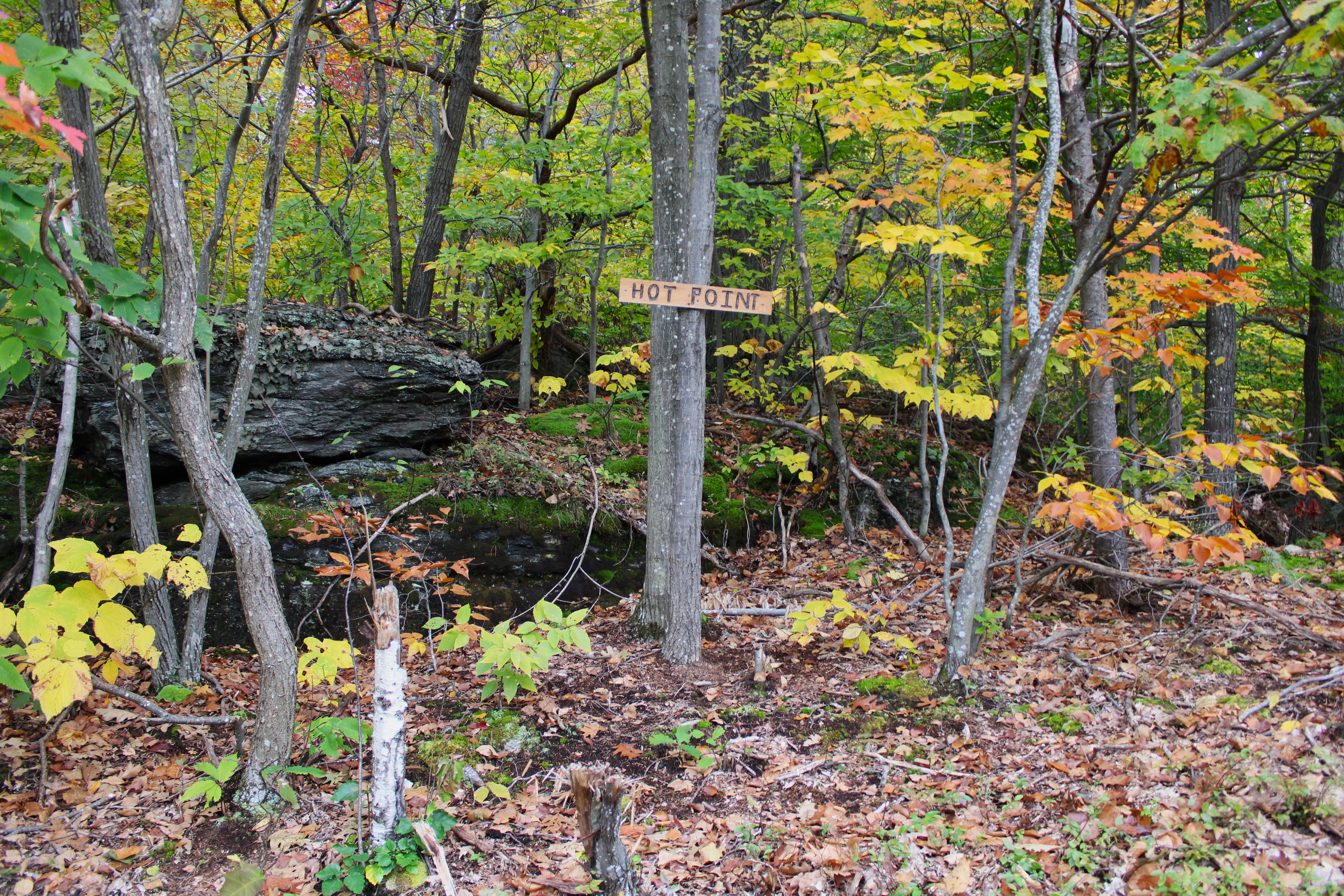
Although fleeting, there was a bit of fall foliage hanging on.  Sometimes, if the conditions are right, the woods themselves can be even prettier than the long distance vistas.

My final "high spot" on the mountain was the SE knob, which sits in a very large, grassy clearing.

The views from this knob are very open and quite nice.  This is the view south.

SE views.

 SW views are a bit obscured, but still okay.

From an even broader and flatter rock slab, just below the other ledges, there are more scenic views to be enjoyed.

After enjoying the views, it was an easy bushwhack back down towards the car on Eggleston Road for a total of 2.2 miles RT and over 500 feet of ascent.  A lot of bang for the buck on this small mountain. 

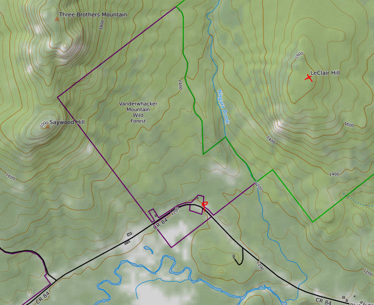
Map below.  Red P=Parking   Red X's=Views


Tuesday, October 24, 2023

Huckleberry Point(Kaaterskill Wild Forest-Catskills)

Ventured down into the Catskills to do a short hike to Huckleberry Point via an unmarked but obvious footpath along the upper rim of Platte Clove.  Being short on time, this was the perfect hike, with a lot of bang for the buck.  Parked in an unmarked pull off along the north shoulder of Platte Clove Road(Elevation 1760 feet) and quickly picked up the "secret" path, heading east.  The tread on path is quite obvious and easy to follow.

Stone wall from an old quarry.

After a short, steep ascent I hit the first view point of the day from a small informal campsite, complete with stone seats and fire pit.  This view takes in a unique view through Platte Clove, with Huckleberry Point on the left.

There are numerous great views along the edge of the Clove, with fleeting fall colors adding to the display.

This unmarked path, while much more scenic than the marked trail, is also not for the faint of heart.

After about one mile, the path meets up with the marked trail at Huckleberry Point.  The views here are nothing short of spectacular, looking south towards Plattekill Mountain and Overlook Mountain just beyond.

Looking SE from Huckleberry Point, across the Hudson Valley, with the lower portion of Platte Clove far below.

I continued along the edge of the escarpment to the east/ northeast, following on again off again herd paths and hit a few more good views and ledges.  This is the view due east with the Hudson River easily visible running north-south.

A bit further north along the escarpment, I came to this grassy ledge. Believe it or not there was a small fire pit on the other side of this boulder, only a couple feet away from the edge.

After taking in the east facing views, I back tracked to the unofficial path and followed it along the edge of the Clove, taking in the breathtaking views and foliage.  This view captures Indian Head, Twin and Sugarloaf Mountains across the Clove.

A nice and easy hike back through the colorful woods got me back to the car in no time.

Covered about 2.2 miles total with 600 feet of ascent.  A much shorter, easier, and better alternative than the marked DEC trail.  Didn't see another person the entire hike.

Map below.  Red P=Parking  Blue=Tracks


Wednesday, October 18, 2023

Hot Point(Florida State Forest-Berkshires)

Headed over to the Berkshires to do a little exploring north of Route 2 along the Hoosac Range to an open ledge known as Hot Point in the little known Florida State Forest.  Utilized an unmarked woods road off of Route 2 to park my car a short distance in. (Elevation 2010 feet).  From there, I continued on foot north along the rough, damp and muddy woods road under cloudy skies.

After about 3/4 of a mile on the woods road, I bushwhacked a short distance east over to a sprawling beaver pond.

There are actually two large beaver ponds here, but the northern one sits on private land, so I crossed the wetlands between the two to stay on state land. 

Continued my bushwhack north for another 3/4 of a mile, criss-crossing more woods roads along the way before beginning my descent west off the steep slopes of the Hoosac Range.  Crossing a small but fast rushing drainage just prior to the big drop.

Due to the odd layout of state land, I was forced to bushwhack back south another 4/10 of a mile, while dropping 300 feet on some very steep slopes.  This was by far the toughest part of the entire hike.

Sitting unassumingly at about 1800 feet of elevation, high above the rugged slopes carved out by Canyon Brook is a wide open rock ledge called Hot Point.  The view west/ southwest towards the Greylock Range is spectacular.

This view looks more southerly with the fall colors clinging to the Hoosac Range, as well as the Greylock Range fighting off some low clouds to the right.  A careful eye can pick out Ragged Mountain's long ridge just in front of Greylock.

The west view from Hot Point, with the Greylock Range(left), North Adams down in the valley and Bald Mountain(Clarksburg State Forest) to the right.  The Taconic Range is in the distant center.

Surprised to find a sign at the point.

After enjoying the views from Hot Point I headed back north, bushwhacking my way up through open hardwoods, and passing by some interesting rock formations.

In a small clearing, back up over 2000 feet, I found some more nice views west over the Clarksburg countryside and into southern Vermont. 

SW views from the clearing, partially blocked by one tree.

Once back over 2200 feet, it was a nice and easy bushwhack east to a series of woods roads that headed south.

A woods road crossing over Canyon Brook.

Autumn splendor deep in the quiet forest.  While tame here, Canyon Brook comes thundering down the Hoosac Range's steep west slopes less than half a mile from here.

Continuing my way south, from the edge of state land, I was able to get a through the trees view towards the fully private, northern beaver pond.

Firmly on state land, I enjoyed exploring the east shoreline of the large, southern beaver pond.

Combined a bushwhack with a myriad of woods roads to make my way back to the car for a total of 4.2 miles RT, and over 800 feet of total ascent.  Unfortunately the clouds never broke up as they were forecast too, but the nice views and remaining fall foliage more than made up for that.

Map below.  Red P=Parking  Red X=Hot Point


Friday, October 13, 2023

LeClaire Hill(Vanderwhacker Mountain Wild Forest/ High Peaks Wilderness(Dix Mtn Tract)-Adirondacks)

My second hike on this beautiful fall day was to 1833 foot LeClaire Hill, another small, obscure peak  south of the High Peaks from Blue Ridge Road.  There is no formal parking to access this peak, so I squeezed my car off of the shoulder of the road and ventured northeast into the woods(Elevation 1210 feet).  After about 1/4 of a mile of bushwhacking I arrived at a crossing of Niagara Brook.  This proved to be a little tricky, but I did manage to make my way across, utilizing a fallen tree to aid the way.

 The woods were very open and inviting, and mostly deciduous. 

The fall foliage, while past peak, was still ablaze in color and quite nice.

I headed basically due NE up to a series of open viewpoints to the south and west.  This is a view SW over the large buffalo farm along Blue Ridge Road, with Blue Ridge Mountain's massive profile looming above.  To the far right are Hornet Cobbles and Washburn Ridge.

A zoom view down to the buffalo farm, with mountains rising high above. 


There are multiple good viewpoints to the west as well, taking in Saywood Hill(left) and Three Brothers Mountain(right), as well as the colorful valley below.

A broader view west with(L-R), Saywood Hill, Three Brothers Mountain, and Clear Pond Mountain peeking out in the distance to the right.

The amazing view SW, with the mountains standing impressively around Blue Ridge Road.

From the open viewpoints, an easy bushwhack north brought me up to the wooded 1833 foot summit of LeClaire Hill.  A small rock cairn marked the high spot.

After hitting the summit, I made my way carefully back down the mountain, leaning a little to the east to avoid the steepest sections of the peak.  Back down at Niagara Brook, with the fallen tree that helped me across.

Covered about 2 miles RT, with 650 feet of elevation gain.

Map below.  Red P=Parking    Red X=Summit