Ventured down into the Catskills to do a short hike to Huckleberry Point via an unmarked but obvious footpath along the upper rim of Platte Clove. Being short on time, this was the perfect hike, with a lot of bang for the buck. Parked in an unmarked pull off along the north shoulder of Platte Clove Road(Elevation 1760 feet) and quickly picked up the "secret" path, heading east. The tread on path is quite obvious and easy to follow.
After a short, steep ascent I hit the first view point of the day from a small informal campsite, complete with stone seats and fire pit. This view takes in a unique view through Platte Clove, with Huckleberry Point on the left.
There are numerous great views along the edge of the Clove, with fleeting fall colors adding to the display.
This unmarked path, while much more scenic than the marked trail, is also not for the faint of heart.
After about one mile, the path meets up with the marked trail at Huckleberry Point. The views here are nothing short of spectacular, looking south towards Plattekill Mountain and Overlook Mountain just beyond.
Looking SE from Huckleberry Point, across the Hudson Valley, with the lower portion of Platte Clove far below.
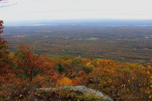
I continued along the edge of the escarpment to the east/ northeast, following on again off again herd paths and hit a few more good views and ledges. This is the view due east with the Hudson River easily visible running north-south.
A bit further north along the escarpment, I came to this grassy ledge. Believe it or not there was a small fire pit on the other side of this boulder, only a couple feet away from the edge.
After taking in the east facing views, I back tracked to the unofficial path and followed it along the edge of the Clove, taking in the breathtaking views and foliage. This view captures Indian Head, Twin and Sugarloaf Mountains across the Clove.
A nice and easy hike back through the colorful woods got me back to the car in no time.
Covered about 2.2 miles total with 600 feet of ascent. A much shorter, easier, and better alternative than the marked DEC trail. Didn't see another person the entire hike.
Map below. Red P=Parking Blue=Tracks


the secret is out ... LOL
ReplyDeleteShhhh...lol
Delete