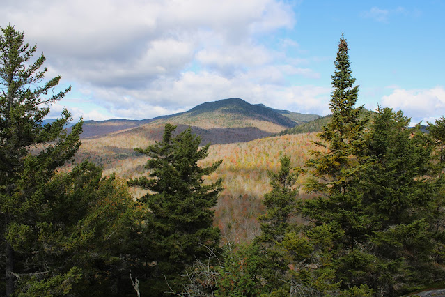
Finally had an open day to hike line up with a nice forecast, so headed north to the Adirondacks to see if I could capture some of the fleeting fall foliage just south of the High Peaks region. My first hike of the day would be to Ragged Mountain's 2325 foot southern, shorter summit-a peak that I had hiked several years ago. My previous visit to this small peak was in the spring, but I had remembered there being several open ledges with great views, so a visit in mid October promised to be really special.
I parked in the first lot along Gulf Brook Road(Elevation 1710 feet) and proceeded to walk the road, heading north for about 4/10 of a mile, enjoying the remaining fall colors.
There are several layers of open rock ledges, with spectacular south and west facing views from each. This is the view west, looking directly up Blue Ridge Road, with Vanderwhacker Mountain way off in the distance.
Washburn Ridge and Sand Pond Mountain stand impressively to the south/ southwest across the Blue Ridge Road.
The view due south takes in (right to left) Hornet Cobbles, Hoffman Notch and Washburn Ridge.
A glimpse NW to nearby Wolf Pond Mountain, an Adk 100 highest peak. Unfortunately this is the only view in this direction that I could find.
Ragged Mountain's 2325 foot south summit sits less than 1/10 of a mile away from the ledges, but is fully wooded.
Exploring the wide open south facing ledges. The foliage was holding on a little better than I had anticipated, and combined with the bright sun made for ideal conditions.
Looking back up at the open rock.
Instead of heading back down the way I came, I decided to simply bushwhack through the open woods more directly back to the car. Covered about 2 miles total, with 650 feet of ascent.
Map below. Red P=Parking Red X=Ragged Mountain South Summit


Those views are awesome (and the other hike too)! I'm loving these lower temps now and the lack of bugs :)
ReplyDelete