My second hike on this beautiful fall day was to 1833 foot LeClaire Hill, another small, obscure peak south of the High Peaks from Blue Ridge Road. There is no formal parking to access this peak, so I squeezed my car off of the shoulder of the road and ventured northeast into the woods(Elevation 1210 feet). After about 1/4 of a mile of bushwhacking I arrived at a crossing of Niagara Brook. This proved to be a little tricky, but I did manage to make my way across, utilizing a fallen tree to aid the way.

The woods were very open and inviting, and mostly deciduous.


I headed basically due NE up to a series of open viewpoints to the south and west. This is a view SW over the large buffalo farm along Blue Ridge Road, with Blue Ridge Mountain's massive profile looming above. To the far right are Hornet Cobbles and Washburn Ridge.

A zoom view down to the buffalo farm, with mountains rising high above.

There are multiple good viewpoints to the west as well, taking in Saywood Hill(left) and Three Brothers Mountain(right), as well as the colorful valley below.

A broader view west with(L-R), Saywood Hill, Three Brothers Mountain, and Clear Pond Mountain peeking out in the distance to the right.

The amazing view SW, with the mountains standing impressively around Blue Ridge Road.

From the open viewpoints, an easy bushwhack north brought me up to the wooded 1833 foot summit of LeClaire Hill. A small rock cairn marked the high spot.

After hitting the summit, I made my way carefully back down the mountain, leaning a little to the east to avoid the steepest sections of the peak. Back down at Niagara Brook, with the fallen tree that helped me across.

Covered about 2 miles RT, with 650 feet of elevation gain.
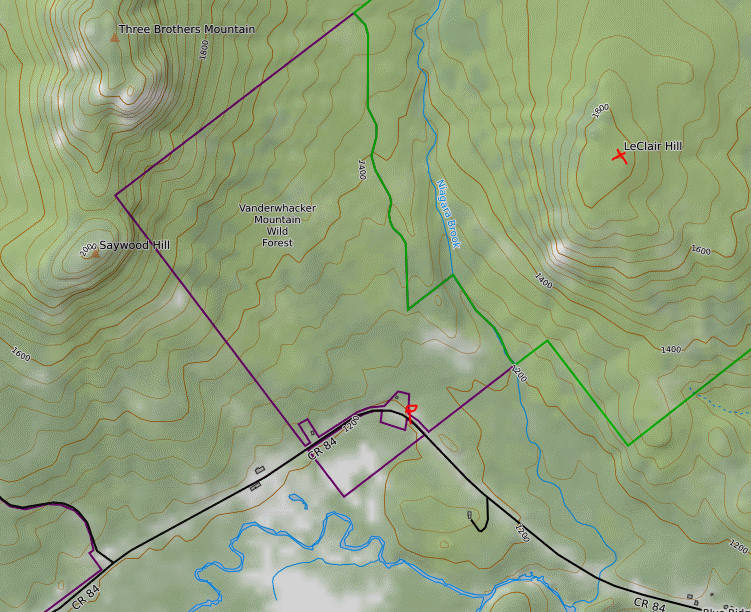
Map below. Red P=Parking Red X=Summit
No comments:
Post a Comment