Met up with a very old friend of mine, Shelby, on a beautiful day for a hike in the Berkshires. Headed over to the Pleasant Valley Wildlife Sanctuary where there are over 7 miles of trails, with many chances to observe wildlife. The main attraction here though, is the climb up to the summit of Lenox Mountain.
A picture perfect June day with sunny skies, low humidity and temps in the 70's made it a great day to be outdoors. A trail map from the park office helps because there is a maze of trails at the Sanctuary, many very pleasant, level walking.
Near Pikes Pond, we observed this bullfrog, who sat still long enough for a picture.
Pikes Pond, teeming with wildlife.
A bit further up the trail, found this little fellow chilling out.
The Ledges Trail is a bit steep and had us huffing and puffing but the it leveled out after a bit and made for a nice walk.
There are a couple of small clearings that offer views down into the east. This one is called Fairviews.
You will know when you've reached the summit because a 70 foot fire tower will greet you.
Although not very tall, the red maples block any view to the east. The views west, however, from the 2126 foot summit, are spectacular and sweeping.
Richmond's rural countryside.
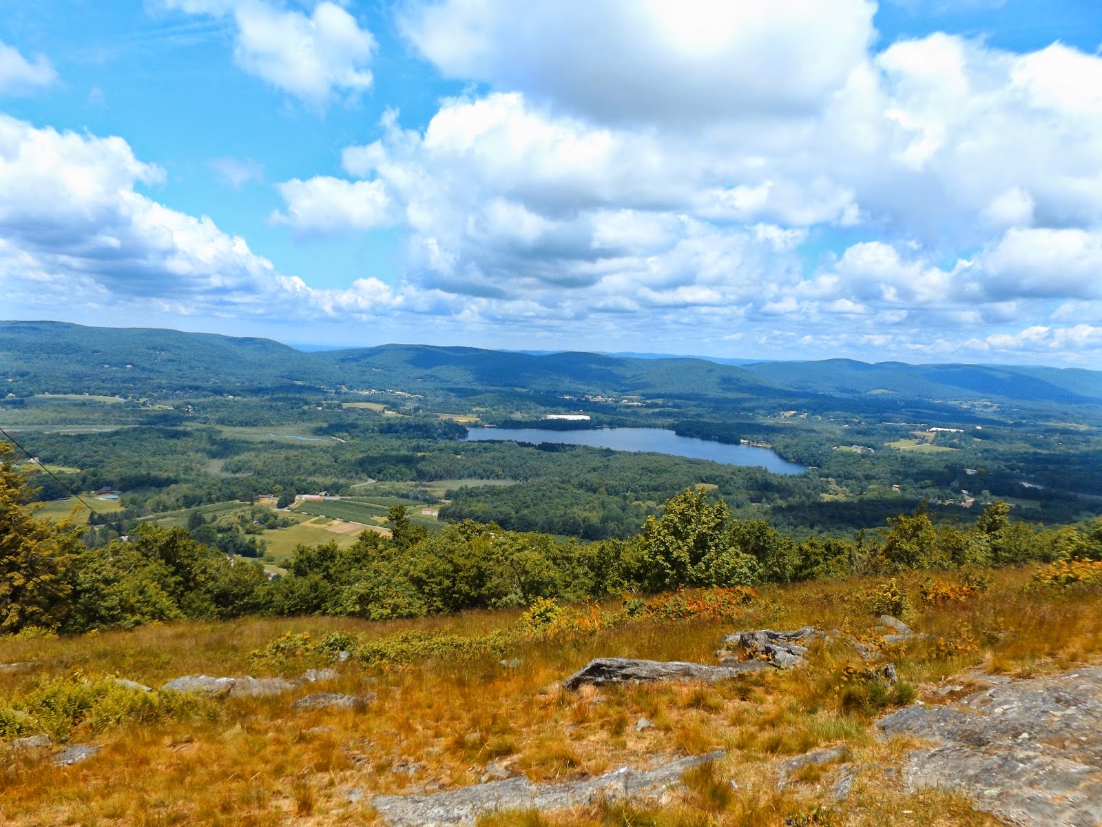
218 acre Richmond Pond sits directly below the mountain.
Bartlett's Orchard far below on Swamp Road. The orchards actually run almost to the foot of the mountain.
Looking west towards Lebanon Mountain. Route 20 can be seen climbing the mountain heading into New York State.
Many people are content turning around here and heading back down the mountain, but we decided to continue on, following the trail along the Yokun Ridge line north. After a little less than a mile along the trail you arrive at a large clearing known as Yokun Seat(Bakers Peak) at an elevation of 2133 feet. From this vantage point, the views to the north are amazing, with westerly views still great as well.
The city of Pittsfield lays below you to the north. Here is a zoomed in look at some of the city streets.
A northwest view shows Mud Pond in the foreground and pristine Onota Lake beyond. The Taconic Mountains can be seen stretching south to north to the horizon. They basically form the state line between New York and Massachusetts.
Secluded Mud Pond as well as some of the runways at Pittsfield's Municipal Airport seen here.
GE Plant in Pittsfield.
Puffy clouds and blue skies, as well as a constant breeze, made this a fantastic place to soak in the views.
Panoramic view from Yokun Seat.
Richmond Pond and the Taconics directly to the west.
We returned via the ridgeline trail, which doesn't see as much foot traffic and hence is more overgrown.
The walk back down the mountain was pleasant, passing by seasonal brooks and Yokun Brook along the way. A small cascade along a babbling brook made a nice spot to stop and relax.
Hiked a little over 4 miles total on a beautiful day!


No comments:
Post a Comment