Following the season's first big snowstorm, my buddy Jim and I were quite anxious to get in some hiking under true winter conditions. We headed south into the Catskills to hike the Lexington Range from Spruceton Road in West Kill. First goal was to head up 3360 foot Evergreen Mountain(which doesn't have enough prominence to count as its own separate peak). This was all a bushwhack hike, meaning we had to be careful to stay off of public property by crossing over to the north side of the West Kill through about a foot of snow on Spruceton Road, elevation of about 1775 feet. From there the climbing began.
The snow depth increased as we gained elevation.
Passing beautiful snow covered stone walls on the way up Evergreen Mountain.
We gained nearly 1600 feet on the way up the mountain. Hit some pockets of some deep, drifted snow making the ascent difficult at times.
Winds were really whipping around, especially at higher elevations, leading to blowing snow and picturesque winter scenes.
Nearing the top of Evergreen Mountain, which was covered in beech.
Approaching the summit cone of Evergreen under clearing, cold skies.
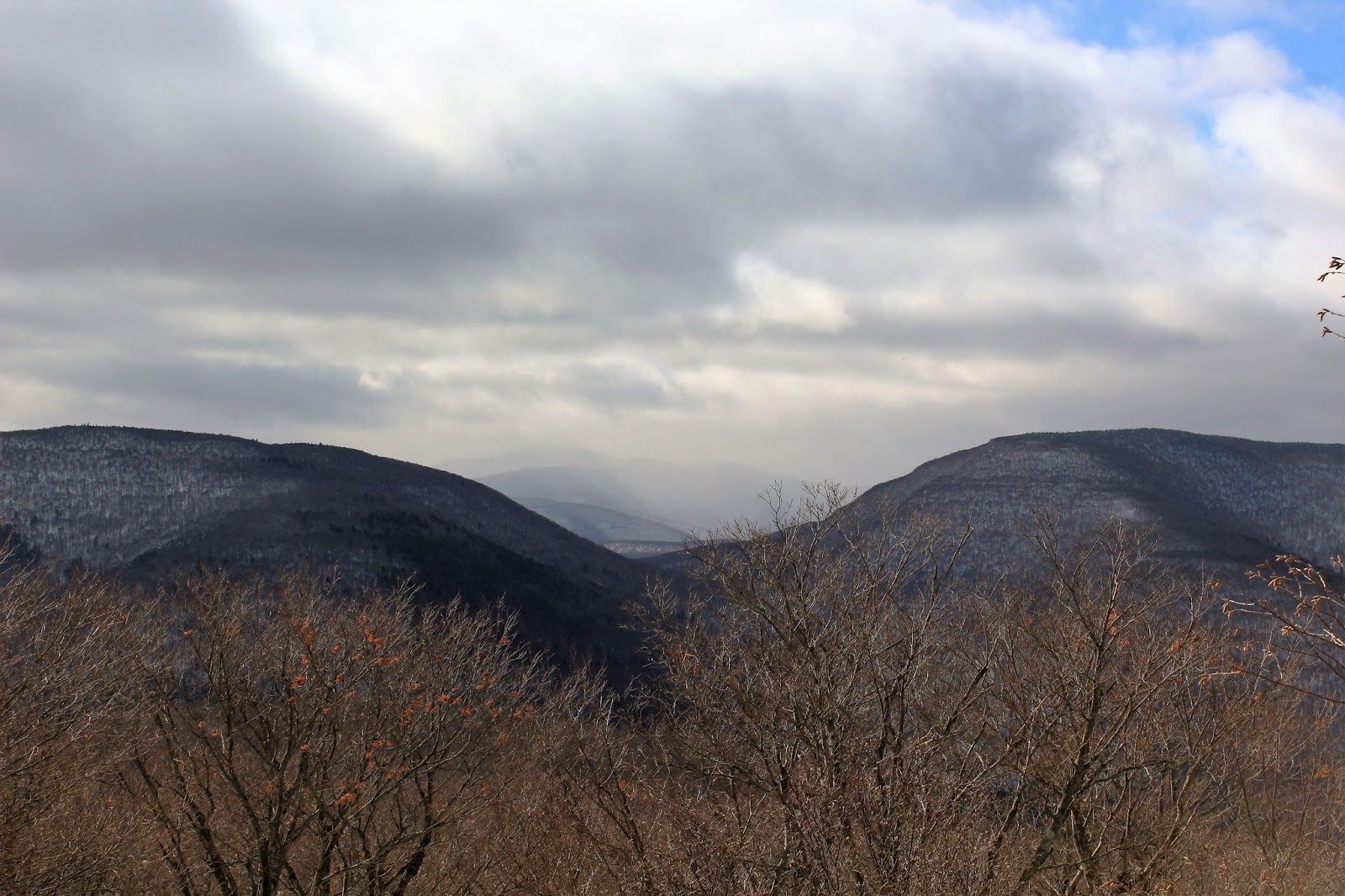
From a small rock ledge near the summit is a nice south view towards North Dome and Mount Sherrill.
Sherrill and Balsalm Mountains towards Deep Notch(L-R).
Looking directly south at a developing snow squall over the Burroughs Range through the deep cut between North Dome and St. Anne's Peak.
Continuing west off Evergreen's peak, we began a steep descent down towards the col between Evergreen and Pine Island Mountain. We managed to stumble upon a small ledge and viewpoint north towards Route 23A and the valley beyond.
A shoulder of Pine Island Mountain directly west above the col.
We dropped down to a touch below 2600 feet in the col and then climbed back up the steep slopes of Pine Island Mountain. We skirted a band of rock ledges just below the summit.
The wooded 3140 foot summit of Pine Island Mountain.
Continuing past the summit with weary legs.
A wintry scene on the west side of the ridge below Pine Island's summit.
A look back at Pine Island Mountain on our ascent of Packsaddle.
Trudging along through the deep snow as we near the summit of Packsaddle Mountain.
At the summit of 3100 foot Packsaddle Mountain. Unfortunately a bit smudged.
We dropped quite steeply off the southwest side of Packsaddle Mountain, eventually reemerging along Spruceton Road. Luckily we found a bridge crossing over the West Kill, helping to keep our feet dry. We were both thankful for that.
We walked along Spruceton Road as the sunset and the temperatures continued to drop. A stiff wind persisted as well making it quite uncomfortable. I paused for a moment to capture this shot of a red barn and Sleeping Lion Mountain rising above.
Hiked about 9 miles with an elevation gain of 2700 feet total over 3 peaks. Two more that count towards my goal of the 102 highest Catskill peaks, making it 56/102 total.


No comments:
Post a Comment