Took advantage of a beautiful spring day by doing a little off trail exploring up 2444 foot South Mountain, an obscure peak in the Vanderwhacker Mountain Wild Forest just west of Route 28 in North Creek and north of Gore Mountain. The hike would actually be part trail/ part bushwhack as I got started from the designated parking area for the Raymond Brook Ski Trail, just off Route 28(Elevation 1047 feet). The Raymond Brook Trail, as expected, was quite wet and muddy in spots, with some lingering ice in the darker shadows and crevices of the woods.
The temperature was climbing through the 50's under bright, sunny April skies...but winter still clings on tight in the Adirondacks. This thick sheet of ice didn't look like it was going to budge any time soon.
At a trail junction, I turned right and headed to a section of trail that has been flooded out by beaver and is being rerouted.
A bit further along, an easy rock hop crossing got me over a tributary stream on the trail.
After a little over 2 miles of trail hiking, I dropped down to a crossing over Raymond Brook and then headed up into the woods to begin my bushwhack on the steep slopes of South Mountain. One of the great parts of bushwhacking in the early spring is the lack of any tree growth, making for very open and inviting hiking.
Although my GPS didn't show the summit being in this small clearing, it seemed to be the obvious high spot.
Just below the summit, a steep area of east/ southeast facing ledges provided some very nice views back towards Little Pete Gay(L) and Pete Gay Mountains(R). Gore Mountain and one of its snowy ski slopes can be seen poking out just beyond.
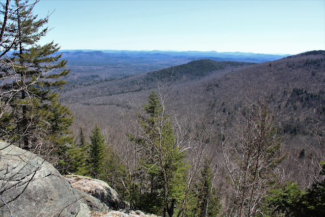
Fantastic east facing views cover a large swath of the east central Adks.
After enjoying the ledge views, I began my descent down the eastern slopes, which were nearly 100% open hardwoods and far less steep than my route up. A bit further down, I followed this small drainage for a short spell towards Raymond Brook.
Once back on the trail it was a nice and easy hike back to the car. A beautiful spring day and didn't see anyone else out in the woods. 6.5 miles RT, with over 1500 feet of ascent total.
Map below. Black P=Parking Red=Trail hike Blue=Bushwhack
 [
[


further north on the hill closest to the Hudson River, there are ledges with nice views to the west
ReplyDeleteA future trip perhaps...
Delete