A blue marked trail begins to climb immediately after leaving the parking lot and follows a woods road for the first .75 mile before turning right onto a foot trail. By the time you have climbed the first .1 of a mile you are already out of the shadows.
I was treated to a sun filled hardwood forest where the fresh air and sounds of song birds made it the perfect place to be.
Fancy woodwork where a fallen tree blocked the trail.
The trail ascends gradually until about 1.5 miles when it begins to climb a bit more steeply.
After a stiff climb you will arrive at Reconnoiter Rock at about 2.2 miles. This large rock appears to be precariously balancing atop two larger boulders. This makes a nice spot to take a quick breather.
The trail continues to climb, at times gradually and others steeply for the next .6 of a mile until you arrive at the 3500 foot elevation sign.
Just a few feet past the 3500 foot sign is an unmarked path that leads to a ledge providing great easterly views. Notice the deep cuts made by the brooks and creeks.
Back on the main trail, after a small ascent you will arrive at a ledge and rewarded with even better views in the same east direction. Here is a panorama from the (L-R)northeast to southeast.
The next nearly half mile follows a long flat section of trail with stunted trees and very little elevation gain or loss.
Soon a steep climb leads to a very short informal path and yet another view.
Ledge views.Continuing on about .1 of a mile and within only about 50 feet from the summit, another unmarked foot path leaves to the right. This path was only recently cut(2009?) and provides easily the best views of the day. Ashokan High Point clearly to the east.
Ashokan Reservoir to the northeast.
Panning out to get a broader view to the north and east.
A great panorama! This is the perfect spot to relax and soak in the views.
There is no view from the actual summit, but this spot is significant because it means you have completed the highest highest elevation gain in all the Catskills. From the trail head to the summit is a 2643 ascent.
Continuing past the summit, the trail soon drops steadily to a saddle between Peekamoose and Table Mountain. Here is a view of the trail in the col.
A flat section of trail is then followed by a climb back up to Table Mountain's long, flat summit area. It may be hard to tell you are at the summit, but a large rock cairn will mark the high point at 3847 feet. This section of trail is much cooler as it travels through a dense conifer forest.
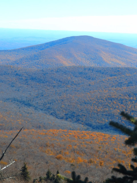
The rock ledge is very small and the drop is very steep so use caution. But the panorama over the East Branch Neversink Valley is beautiful.
I love this picture because if you look carefully, you can see that the south facing slopes are still full of color, while the north facing slopes are nearly completely absent of color.
Turned around after the ledge view and continued past Table's summit and back down to the col. From there the steep ascent back up Peekamoose is basically the last climb of the day.Really enjoyed the hike back off the mountain. Only saw a handful of other people out on this perfect fall day. Everyone seemed to be in such a good mood, and happy to just be out and about.
Another view of Reconnoiter Rock from below.
Fall may be fleeting at the higher elevations, but is alive and well in the lower elevations that receive plenty of sunshine.
Looking back up at a large rock ledge as I continued the descent.
A perfect bluebird fall day.
After arriving back at the car, I headed directly across the road to an added bonus, the Rondout Creek. There are plenty of chances to explore the creek here, including a large swimming hole in the summer time.
A view further upstream on the Rondout. This part of the creek is much, much different than the more well known section further downstream. The creek runs for 63 miles before emptying into the Rondout Reservoir and eventually the Hudson River at Kingston.
Hiked a touch over 9.2 miles RT on what could easily be the best day of the autumn season. Hard to be days like this.


No comments:
Post a Comment