With the day off work today, I decided to hike up to Stoppel Point by accessing a seldom used trail to a well known area. This trail climbs directly up the escarpment from the end of Storks Nest Road in the town of Cairo. From Route 23, turn south onto County Route 31(Hearts Content Rd) for 3.7 miles to an intersection where you will bear right onto Maple Lawn Road. Follow this road for a little over a mile, where you will bear left and then a quick right onto Storks Nest Road. Follow this road until the very end, where a small parking area is found on the left just before a gate and private residence. A DEC trail sign with distances will be found across the road at a stone fence here. Continue past the gate and across the lawn(please be respectful of the private property) where the trail starts just left of the house.
You will gradually ascend for about .3 of a mile, when you arrive at the trail register and foot bridge over a small stream.
The trail begins to climb steadily from here, following a very old road. This road was the East Kill Turnpike or old Colgate Carriage Road and was built in 1836 to help farmers transport goods over the mountains.
Yellow trail discs guide the way, but aren't really necessary much of the way because the washed out old road is very easy to follow.
After about .8 of a mile you will enter state land. The trail before this was on an easement with private property on both sides.
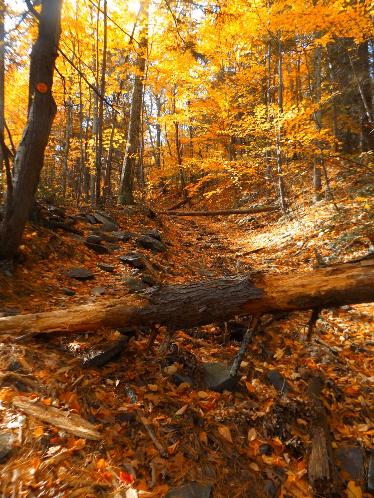
Continuing up the rocky trail, which is covered in leaves.
The trail climbs continuously for nearly 1300 feet in 1.9 miles
The steep rock walls rising above the trail up the escarpment. A reliable spring is found at the base of these rocks at about 1.6 miles in.
Filtered views open up to through the trees as you near Dutcher Notch.
Valley views through a break in the trees.
After 1.9 miles you will arrive at Dutcher Notch, a large clearing and four way trail intersection. This is the view south where the blue marked escarpment trail climbs up towards Stoppel Point.
A few steeper areas are climbed on the escarpment trail, where more Hudson valley views can be seen through the trees.
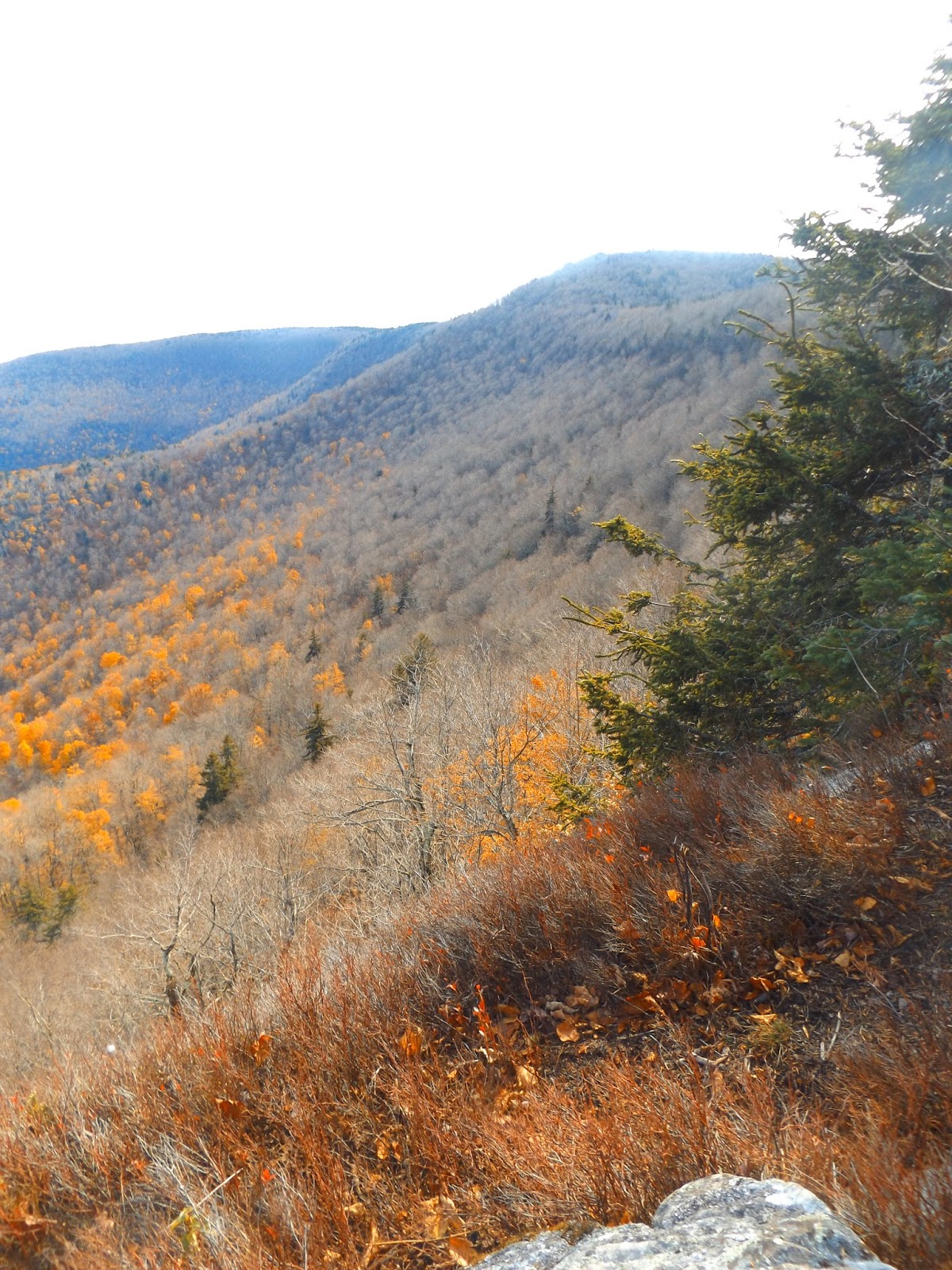
After 1.2 miles on the escarpment trail and 3.1 miles total, you arrive at a gorgeous rock ledge known as Milt's Lookout at an elevation of just over 3100 feet. This is the view south with the eastern flank of North Mountain stretching into the valley.
The north view over rural Greene County and Albany County, which stretches out as far as the eye can see.
Fall colors are still hanging on way down in the valley, and make for a beautiful scene.
Cairo Round Top can be seen directly below. The ledge here is extremely steep, so please use care.
Looking directly south at Stoppel Point, the next stop on the escarpment.
One last shot of the grand view from Milt's Lookout before continuing on my way.
A strange tree growth along the escarpment.
Climbing a steep section just below Stoppel Point.
Near Stoppel Point's large, flat summit area are the remains of an old plane crash from May of 1983, where the pilot died.
The broken wing.
The pilot had a revoked student pilot's license and did not file a flight plan on his intended trip from Poughkeepsie to Watertown. Much of the plane remains to this day and certainly adds a different dimension to this hike.
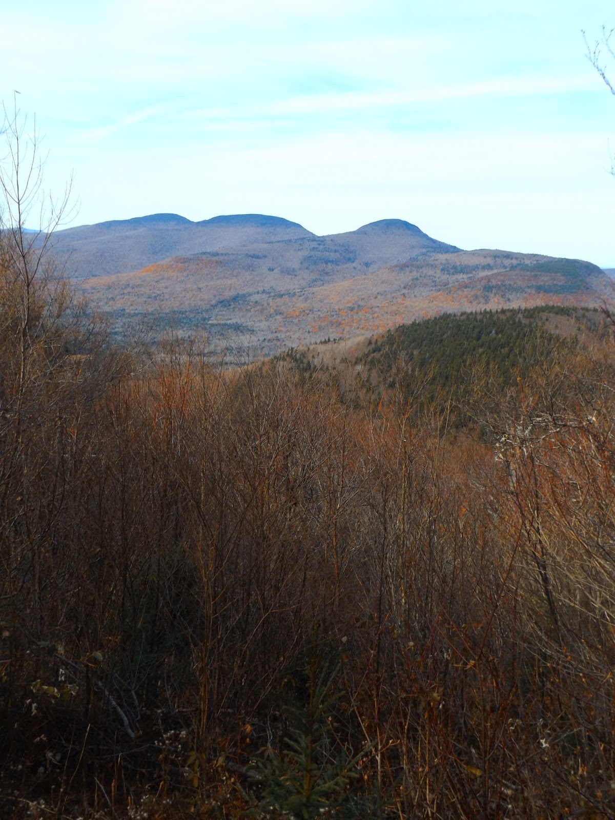
Just past the plane crash at a small lookout is a fantastic north view of the Blackhead Range.
The trail kind of circles the summit area before arriving at 3420 foot Stoppel Point.
A small rock ledge provides outstanding views over much of the Hudson Valley. Little Stoppel Point is seen directly below.
The view north.
After enjoying the sweeping views from Stoppel Point, I turned back and started retracing my steps. About 50 yards away from the east facing rock ledge views, I saw a small view through the trees to the south and west. I had to leave the trail to attain this view.
Continuing on my way back along the summit area of Stoppel Point, where autumn is well past at this elevation.
Descending the steep, rocky trail from Dtucher Notch in the shadow of the mountain.
Hiked about 8.2 miles RT on another nice day. Completed the hike in about 4 hours, slowing down to take pictures and explore.


Thinking about doing this exact route Friday, Is the 4 Hours RT a typo?
ReplyDeleteThis was a few years ago, but I think it took roughly 4 hours.
Delete