Woke up to bitterly cold November like temps this morning, but the sun was shining bright, offering the promise for a beautiful day. Here was the frosty scene near the lake as I loaded the car and hit the road.
Drove down to the Catskills to hike Wittenberg and Cornell Mountains in the Burroughs Range, just west of the Ashokan Reservoir. Parking is in the large DEC designated parking lot on the right side near the end of Woodland Valley Road(just before the Woodland Valley Campground). After parking, the trail head is found by back tracking about 300 feet down the road, where an arrow and red DEC trail markers leave the road to your right and head toward picturesque Woodland Creek.
A well constructed foot bridge crosses the creek and enters the woods here.
A stiff ascent begins immediately after entering the woods. After about a third of a mile, you will arrive at the trail register.
The climb continues steadily until finally leveling off for a short stretch, and at just over one mile in, a very nice view opens up just yards off the trail from a ledge.
Around 2600 feet in elevation, I first encountered some grainy snow on fallen leaves
After 2.6 miles, you arrive at a trail junction. From here it is only 1.3 miles to Wittenberg.
Although cool with temps in the 30's, the bright sun and brisk pace kept me feeling warm.
A large stand of hardwoods on the trail, which make for a very pleasing scene this time of year.
Soon, the trail begins to ascend steadily again.
There are several difficult rock sections to climb.
After ascending the rocky climb in the photo above, you are treated to an outstanding view to the northwest.
This is probably one of the most difficult climbs up Wittenberg. Luckily, there are plenty of rocks and roots to help pull yourself up.
Another steep, rocky section as you near the summit. From here, the trail levels off a bit.
After 3.9 miles, you arrive at the spectacular summit of 3780 foot Wittenberg Mountain. Many people consider this to be "the view" in all of the Catskills. There are unparalleled views to the east over Ashokan Reservoir.
The view is great all the way to north and east too, where the Devils Path can be seen in the distance.
An incredible panorama from the summit.
Fall colors hanging on nicely directly below where Samuels Point can be seen rising above the Ashokan Reservoir.
Two fellow hikers enjoying lunch and the incredible views. This is the view south and east.
A closer look at the Ashokan Reservoir far below.
One last view before I continued to Cornell. It is not unlikely to see a couple dozen people or more up here on the weekend, but today this was a nice place for solitude.
An interesting crack in the trail.
After a short descent, you will soon begin another modest ascent up to Cornell's summit.
This is a very unique and difficult spot known as Cornell Crack. This can be very challenging because there isn't really any good footing and the rocks are much bigger than the photo would suggest. A taller person would certainly have an easier go, but the best route to take is to wedge your foot into the crack and pull yourself up with your upper body.
Immediately after getting through Cornell Crack, a small view point allows a nice look back at Wittenburg.
A short side trail breaks away to the left and leads to the mostly wooded 3860 foot summit of Cornell. A sliver of a view is available to the northeast.
Continuing on about .1 of a mile past Cornell's summit there are great views to the west. Slide Mountain is easily seen almost directly in front of you from this vantage point.
The view stretches far to the north and west, where Giant Ledge and Panther Mountains can also be seen, as well as many other distant peaks.
After the views near Cornell's summit, I turned back, retracing my steps over both summits and back down to the trail junction with Terrace Mountain Lean To. I was feeling pretty good and it was only 2pm, so I opted to continue straight towards the Lean To. This adds an extra 1.8 miles RT to the hike but the elevation gain/ loss isn't significant and it shouldn't take too much time.
Beautiful foliage from the lean to.
There is a fire pit and large area for tents at the lean to. This was an incredibly peaceful place today, where the only sounds I heard were birds in the trees and the leaves rustling in the wind. I lingered here for a few minutes enjoying a nice break before heading back.
By this point in the afternoon, the temperature had warmed up nicely into the 40's and I really enjoyed the hike back, splashing through piles of leaves.
Fall colors from the ledge about 1 mile from the trail head.
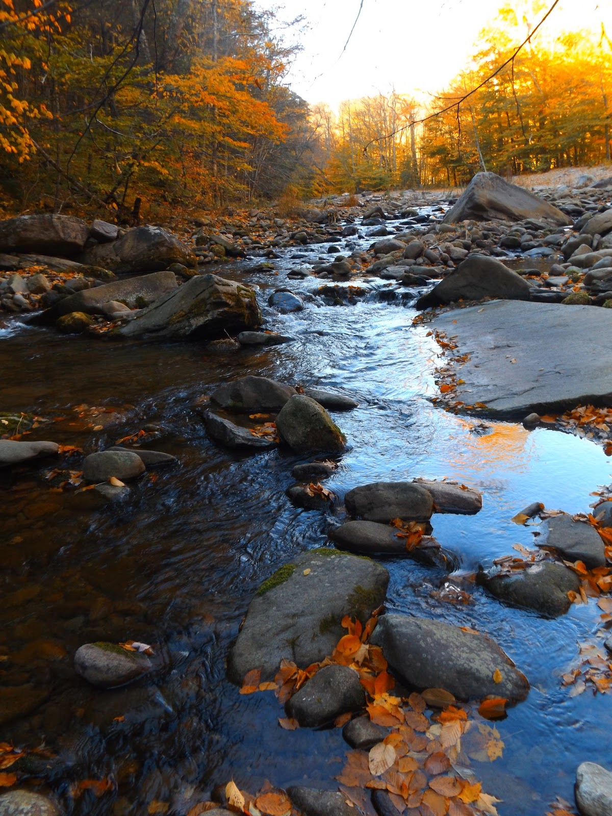
After a steep descent, I arrived back at Woodland Creek.
The ground is completely covered in leaves as I neared to the parking lot.
What a great day!!! Hiked a total of 11.4 miles all together with the extra stops with an elevation gain of over 2700 feet total.


No comments:
Post a Comment