Met up with my buddy Jim to do another Catskill traverse hike today. We spotted a first car at the Devils Path North parking area along Spruceton Road, then drove a second car to the trailhead at the end of Diamond Notch Road(we parked at the bridge crossing). As we left the car, I took a moment to check out Hollow Tree Brook, looking quite nice on a gorgeous spring morning. Elevation to start the day was about 1575 feet.
Started the day hiking north along the Diamond Notch Trail, which is really a continuation of the old road and today looks more like a beautiful country lane.
After hitting state land a short distance in, we left the trail and began the bushwhack through open hardwoods.
To get to the ridge we wanted to get to we had to go up and over the first ridge west, then dropped down steeply down towards a creek crossing.
The unnamed creek descending down the steep slopes of West Kill was running well from recent rains and snowmelt, but thankfully was a fairly easy rock hop across.
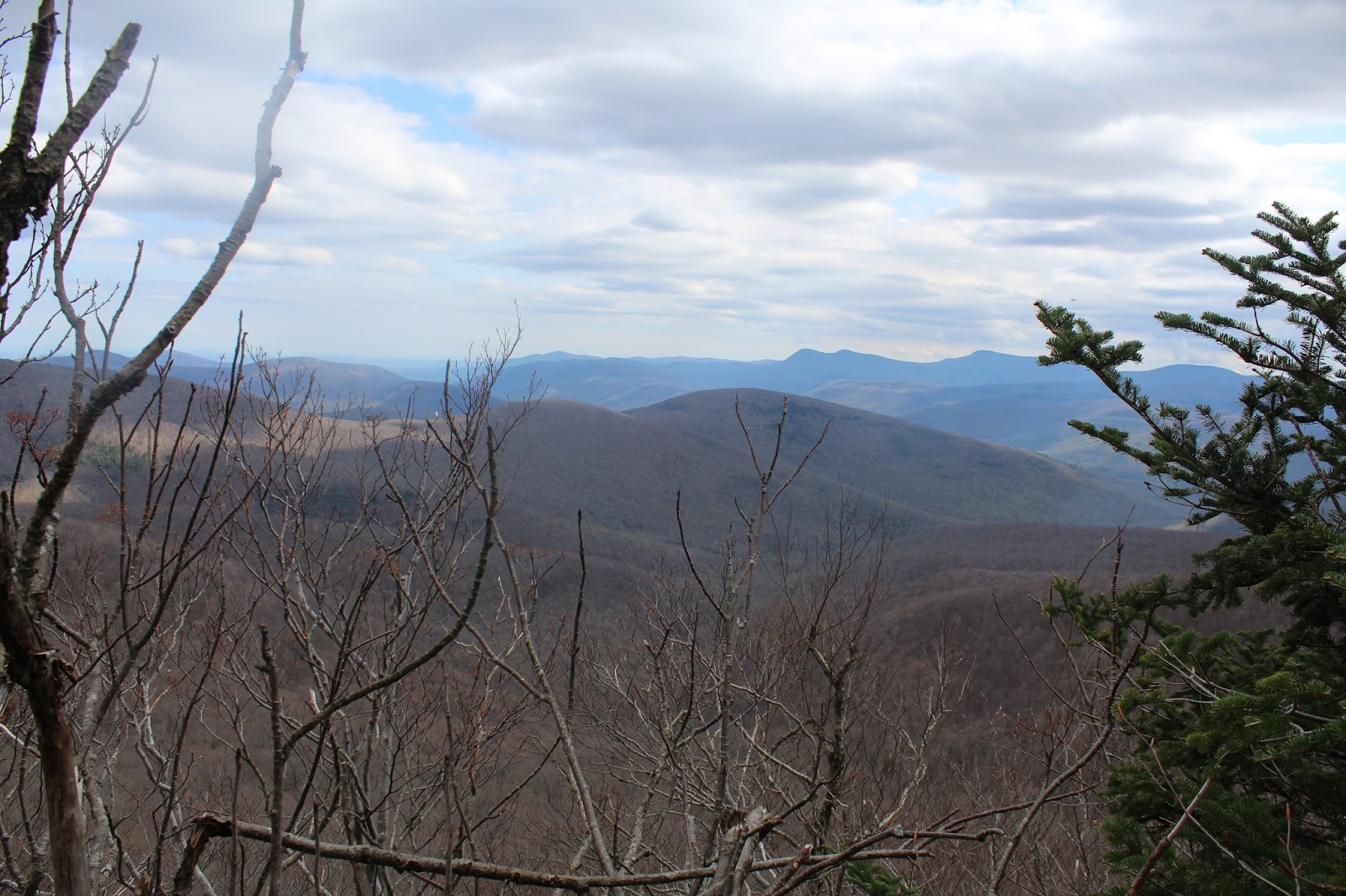
As we gained elevation, we also gained views back east to the first ridge we had to partially climb over. I love the new spring growth on the trees at the lower elevations as well.
Wildlfowers are finally beginning to bloom in the mountains!
The ridge we climbed was pretty straightforward, with several steeper stair steps along the way.
Continuing north, we hit more and more steep rock steps, each with a fun climb up.
We were hoping for views, but were only teased with peek a boo views through the still bare trees. Here's a view southwest with the next ridgeline of West Kill Mountain coming down.
As we gained even more elevation, we headed towards the east side of the ridge in hopes of views, where the drop off was quite significant. This was about the best we could find, however. Nice, but nothing great.
Up over 3000 feet, we left the hardwoods and entered a dark hemlock forest. It was here, where we began to encounter the first signs of snow or ice...mostly small patches in sheltered pockets.
The deep, dark hemlock woods just south of the summit.
After about 3 miles of bushwhacking, we hit the Devils Path, which took us the short .1 of a mile up to the 3880 foot summit.
Just beyond the summit, a short drop leads down to Buck Ridge Lookout. The eastern ridge of West Kill is in the foreground with SW Hunter Mountain's ridge beyond.
The south views from Buck Ridge are well known and for good reason.
The Blackheads rising prominently in the distance beyond the Hunter Ski Slopes from the lookout.

A zoom view down towards Lanesville along Route 214.
Took the short herd path over to the north facing view towards Spruceton Valley from the top of boulder.
After leaving the summit, we followed the Devils Path west over a false summit bump on West Kill, then over to St. Anne's Peak, where we spotted some ledges just off trail. These ledges provided some great views south towards the Broadstreet Peaks(unofficial name) with Wittenburg/ Cornell/ Slide beyond.
The great view back towards West Kill Mountain.
The wooded 3420 foot summit of St. Anne's Peak. My 89th Catskill Hundred Highest.
We wandered southwest off the summit in hopes of finding more views and did manage to find another view towards the Broadstreet Peak's again.
A zoom view...
We finally left the summit area of St. Anne's Peak, soon picking up the Devils Path again, which dropped us steeply back towards our spotted car on Spruceton Road. Once back down into Mink Hollow, spring was back in full force with green being the most prominent color.
The Devils Path closely hugs the picturesque, babbling brook that drops down through the hollow.
Arrived back at the car tired but feeling good. Around 9 miles RT and 2700 feet elevation gain. 89/102 CHH.


No comments:
Post a Comment