Wanted a little bit of a change of a pace, so headed up to the Siamese Ponds Wilderness in the Southern Adirondacks to do a bushwhack traverse with my buddy Jim today. The day started very overcast as we spotted a first car at Griffin along the East Branch of the Sacandaga River, then drove up Route 30 north to our starting point at the old bridge crossing over the Main Branch of the Sacandaga River. The bridge provides access to state land on the east side of the river along Old Route 30. Elevation to start the day was about 1375 feet.
Spring is a great time to get out and see wildflowers, such as this beautiful painted trillium.
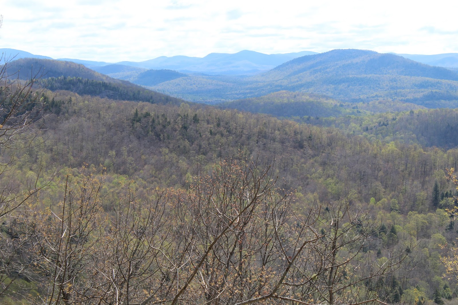
We headed in a general east direction, climbing quickly up and out of the valley. As we gained elevation, screened views behind us towards the peaks west of Route 30 began to unfold.
As we gained the ridge near 2200 feet, we wandered towards the south facing ledges, where we found some nice views under clearing skies.
Route 30 can be seen directly below with a sea of peaks rising above.
Continuing along the ridge, we stumbled across a wide open, extended area of ledges, with outstanding views.
Jim, taking a moment to soak in the views and take some photos.
Route 30 snaking below from this amazing vantage point.
To the east of Route 30, the peaks of the Wilcox Lake Wild Forest can be spotted.
Exploring the wide open, grassy ledges.
The drop off below these ledges was quite steep, but luckily the footing was good.
The south/ east facing views further along the ridge, where I believe we could see Georgia(R) and Moose(L) Mountains.
Jim decided to wander down to the lower ledges, so I decided to take a photo of him down there.
A zoom view down towards Route 30 heading south.
One last view from the grassy, moss covered ledges.
As we continued on, we spotted a 2400 foot south ridge off Macomber.
A look southeast towards the Route 8 corridor peaks.
Zoom view at the Route 8 peaks.
After dropping off the 2200 foot bump, we spotted a view back at the ridge from a small col on our way to the next bump.
After climbing up and over a 2500 foot bump, a bigger drop and ascent finally brought us to the 2850 foot sub summit of Macomber. This was some of our steeper climbing, as well as our first run in with any spruce.
Once we gained the sub summit ridge, we found a grassy clearing that made a perfect lunch spot.
From the sub summit, we found yet another south facing ledge. This view was dominated by the 2400 foot south ridge of Macomber with the Wilcox Lake Wilderness beyond.
A zoom view into the Wilcox Lake Wilderness.
From the edge of the escarpment, we found a small view towards Macomber's summit, less than 3/10 of a mile away.
A short, but steep drop brought us into the col below the summit. We were both quite shocked to find some kind of memorial here.
a straightforward ascent brought us up into a small stand of hemlocks and the 3005 summit of Macomber Mountain.
Just below the summit, where the hardwoods meet the hemlocks, we found a great west facing ledge.
The west facing ledge below the summit.
We stopped near the summit and looked over our maps, trying to pick out our route to "Extract Ridge", the ridge between Extract and Towers brook to our south. It was a pretty steep drop off the summit, as we headed south/ southeast towards the ridge we wanted. At about 2300 feet, we literally stumbled upon an incredible set of rock slabs, with incredible views. Our ridge could be seen over a mile away to the southeast.
A look up at ridges that make up Buckhorn Mountain.
Newly flowering dogwood blossom?
1.4 miles as the crow flies, and nearly 1000 feet below Macomber's summit, found us at the Extract Ridge ledges. These ledges provide phenomenal views towards Macomber's summit, rising beyond the 2400 foot ridge,
A look back at the Extract Ridge ledges at about 2060 feet.
The ledges on Extract Ridge are quite extensive with west facing views being the best.
We enjoyed exploring the west facing ledges, before making our way over the east side of the ridge, really not expecting much. Boy, were we surprised when we spotted open views towards the Buckhorn Cliffs(which we had visited previously a couple of years ago). An amazing shot of the cliffs on the southwest peak of Buckhorn.
A steady drop brought us east down to picturesque Extract Brook, which we stopped to clean up in.
A good herd path(fisherman path) follows Extract Bridge all the way south towards Teachout Road. Unfortunately, the path leads straight to private land, so it takes a short 2/10 of a mile bushwhack to get you to the parking area near Griffin.
What an amazing day in the woods! About 9 miles RT(all bushwhack-except the last one mile on herd path) with 2000 feet elevation gain.


That's a fun area to explore. Think I've been to a couple of those points (Macomber Escarpment and Extract Ridge). Probably an area frequented more by hunters than hikers.
ReplyDeleteThis is a really nice, quiet area to explore with numerous different view points. No trails=few hikers
Delete