While hiking Black Rock in October, a prominent rock ledge on the northeast slopes of Mount Everett in the southern Berkshires, I noticed a spot just south of there called South Pinnacle. South Pinnacle is not a true summit, but a high point along an eastern ridge of Mount Everett. The Berkshire School in the town of Sheffield maintains a trail system along these east slopes and up to South Pinnacle, so today I ventured out to see how it looked.
As I pulled onto the school property off of Route 41, the large ridge that makes up South Pinnacle rises up impressively above the athletic fields.
I parked at the trailhead(elevation 860 feet), which is located at the far northwest end of the school road, where a large trail map is also located. The trail system can be a bit tricky, so I ended up following several different trails, all heading in the same general direction...and up. I passed by this old fireplace and chimney in the middle of the woods. Not really sure of the story behind it, but still pretty interesting.
At one spot, the trail passes a drainage(I think it is referred to as Glen Brook) with pretty cascades coming down a cirque.
Below the cascades, a footbridge and dam have created a tiny but pretty pond.
Fiddleheads everywhere!
Eventually I picked up the red marked South Pinnacle Trail, which climbs steeply southwest.
A steady ascent brought me up to a series of mostly open, east facing rock ledges.
The east views from the mostly open rock is very good and almost directly over the Berkshire School grounds.
A zoom view of Black Rock, which I had previously climbed back in October.
Skies briefly attempted to clear out as i enjoyed the view east/ northeast of the southern Berkshires.
Southeast views towards the Housatonic Valley and Connecticut.
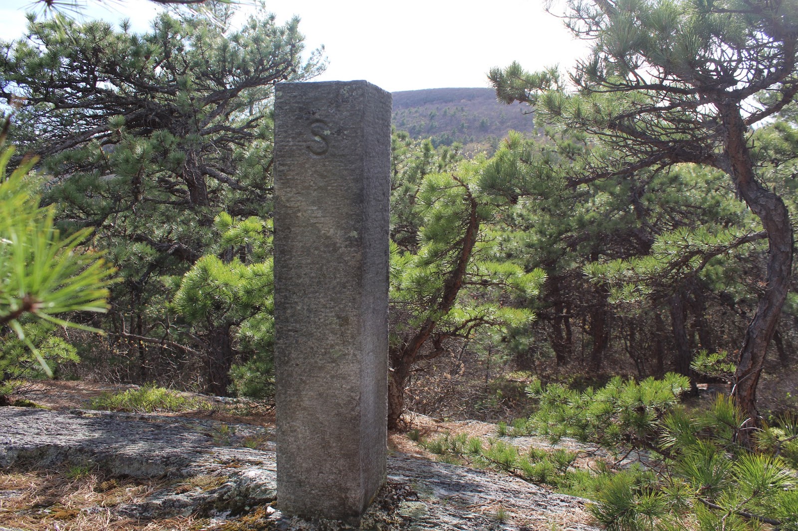
An informal herd path leaves the rock ledges and heads the scant .1 of a mile west to the true high point(elevation 2055). From here, 2624 foot Mount Everett can be seen rising above the trees nearby to west.
The "summit" marker.
I tried my best to capture the high point of South Pinnacle with Mount Everett directly behind it.
After wandering around exploring the summit area for a bit, I finally turned back, descending steeply on slick pine needles. Footing can be a bit tricky on the initial climb off the summit.
As I arrived back at the lower slopes of the mountain, I decided to take different trails back. I ended up following an unmarked herd path along Glen Brook, which offered up several pretty cascades and remnants of the past. A mill site perhaps?
More picturesque cascades higher up the brook.
Eventually I left the herd path and bushwhacked back towards the car. Ended up picking a service road and walked that back the rest of the way. About 4 miles RT with over 1300 feet elevation gain.


No comments:
Post a Comment